Saint-Henri, Chaudière-Appalaches, Quebec
| Saint-Henri | |
|---|---|
| Municipality | |
|
Saint-Henri Church | |
_Quebec_location_diagram.png) Location within Bellechasse RCM. | |
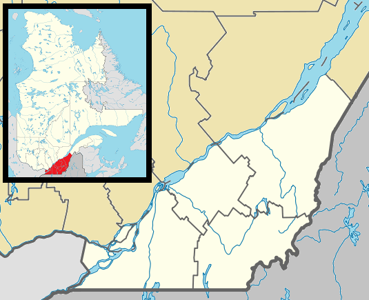 Saint-Henri Location in province of Quebec. | |
| Coordinates: 46°42′N 71°04′W / 46.700°N 71.067°WCoordinates: 46°42′N 71°04′W / 46.700°N 71.067°W[1] | |
| Country |
|
| Province |
|
| Region | Chaudière-Appalaches |
| RCM | Bellechasse |
| Constituted | October 9, 1976 |
| Government[2] | |
| • Mayor | Yvon Bruneau |
| • Federal riding | Bellechasse—Les Etchemins—Lévis |
| • Prov. riding | Bellechasse |
| Area[2][3] | |
| • Total | 124.20 km2 (47.95 sq mi) |
| • Land | 122.29 km2 (47.22 sq mi) |
| Population (2011)[3] | |
| • Total | 5,023 |
| • Density | 41.1/km2 (106/sq mi) |
| • Pop 2006-2011 |
|
| • Dwellings | 2,145 |
| Time zone | EST (UTC−5) |
| • Summer (DST) | EDT (UTC−4) |
| Postal code(s) | G0R 3E0 |
| Area code(s) | 418 and 581 |
| Highways |
|
| Website |
www saint-henri |

Saint-Henri is a municipality of 4,784 people, 20 km south of Lévis, in the Bellechasse Regional County Municipality. It is sometimes known as Saint-Henri-de-Lévis, and was historically known as Saint-Henri-de-Lauzon.
It used to belong to the former Desjardins Regional County Municipality, but decided to join Bellechasse in 2000 when the new city of Lévis was created. Saint-Henri felt it did not belong with a mostly urban RCM, and would fit better with Bellechasse, which has a largely rural base. Now, Saint-Henri is the biggest town in this RCM, followed by Saint-Anselme and Sainte-Claire. The Etchemin River crosses the municipality and one hydroelectric dam is found in Saint-Henri. On November 6, 1775, Benedict Arnold is said to have visited the village on his way to attack Quebec City. The largest local business is Olymel, a meat processing factory.
References
 |
Lévis | | ||
| Saint-Lambert-de-Lauzon | |
Saint-Charles-de-Bellechasse Saint-Gervais | ||
| ||||
| | ||||
| Saint-Isidore | Saint-Anselme |
| Municipalities | |
|---|---|
| Parishes | |
| |