Sado-Yahiko-Yoneyama Quasi-National Park
| Sado-Yahiko-Yoneyama Quasi-National Park | |
|---|---|
| 佐渡弥彦米山国定公園 | |
|
IUCN category V (protected landscape/seascape) | |
|
| |
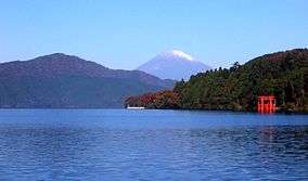
 Sado-Yahiko-Yoneyama Quasi-National Park in Japan | |
| Location | Honshū, Japan |
| Coordinates | 38°15′39″N 138°27′30″E / 38.26083°N 138.45833°ECoordinates: 38°15′39″N 138°27′30″E / 38.26083°N 138.45833°E |
| Area | 294.64 sq.km |
| Established | July 27, 1950 |
| Governing body | Niigata, prefectural governments [1] |

Sado-Yahiko-Yoneyama Quasi-National Park (佐渡弥彦米山国定公園 Sado-Yahiko-Yoneyama Kokutei Kōen) is a Quasi-National Park in Niigata Prefecture, Japan. Designated on 27 July 1950, it has an area of 29,364 ha.[2][3] It is rated a protected landscape (category V) according to the IUCN.[4]
Like all Quasi-National Parks in Japan, the park is managed by the local prefectural governments.[1]
See also
| Wikimedia Commons has media related to Sado-Yahiko-Yoneyama Quasi-National Park. |
References
- Southerland, Mary and Britton, Dorothy. The National Parks of Japan. Kodansha International (1995). ISBN 4-7700-1971-8
Notes
- 1 2 "National Park systems: Definition of National Parks". National Parks of Japan. Ministry of the Environment of the Government of Japan. Retrieved 2008-08-29.
- ↑ "List of Quasi-National Parks". Ministry of the Environment. Retrieved 27 April 2011.
- ↑ "佐渡弥彦米山国定公園". National Parks Association of Japan. Retrieved 27 April 2011.
- ↑ "Sado-Yahiko-Yoneyama". World Database on Protected Areas. United Nations Environment Programme, World Conservation Monitoring Center. Retrieved 2016-07-05.
This article is issued from Wikipedia - version of the 11/19/2016. The text is available under the Creative Commons Attribution/Share Alike but additional terms may apply for the media files.
