Ōnuma Quasi-National Park
| Ōnuma Quasi-National Park | |
|---|---|
| 大沼国定公園 | |
|
IUCN category II (national park) | |
|
Hokkaidō Komagatake, in the center of the park, at dusk. | |
 | |
| Location | Hokkaidō, Japan |
| Nearest city | Nanae |
| Coordinates | 42°00′44″N 140°40′16″E / 42.0121°N 140.671°E[1]Coordinates: 42°00′44″N 140°40′16″E / 42.0121°N 140.671°E[1] |
| Area | 90.83 km2 (35.07 sq mi) |
| Established | July 1, 1958 |

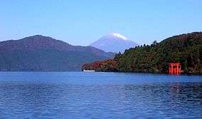
Ōnuma Quasi-National Park (大沼国定公園 Ōnuma Kokutei Kōen) is a 90.83 km2 (35.07 sq mi)[1] quasi-national park on the Oshima Peninsula in southwest Hokkaidō, Japan. The park encompasses the volcanic Hokkaidō Komagatake (北海道駒ケ岳 Hokkaidō Koma-ga-take) as well as the Ōnuma (大沼) and Konuma (小沼) ponds, which abut against the west slope of the mountain. The park, which was designated as quasi-national in 1958, is the smallest major park in Hokkaidō.
Ōnuma and Konuma were created when mudflows due to eruptions of Hokkaidō Koma-ga-take dammed up depressions at the base of the mountain. The ponds, which are dotted with watershields, are surrounded by birch and maple forests.
Related cities, towns and villages
See also
References
- 1 2 3 Onuma Quasi National Park protectedplanet.net
External links
- J-IBIS (Japanese)
This article is issued from Wikipedia - version of the 11/18/2016. The text is available under the Creative Commons Attribution/Share Alike but additional terms may apply for the media files.
