Rzepin
| Rzepin | ||
|---|---|---|
|
Church | ||
| ||
 Rzepin | ||
| Coordinates: 52°21′N 14°50′E / 52.350°N 14.833°E | ||
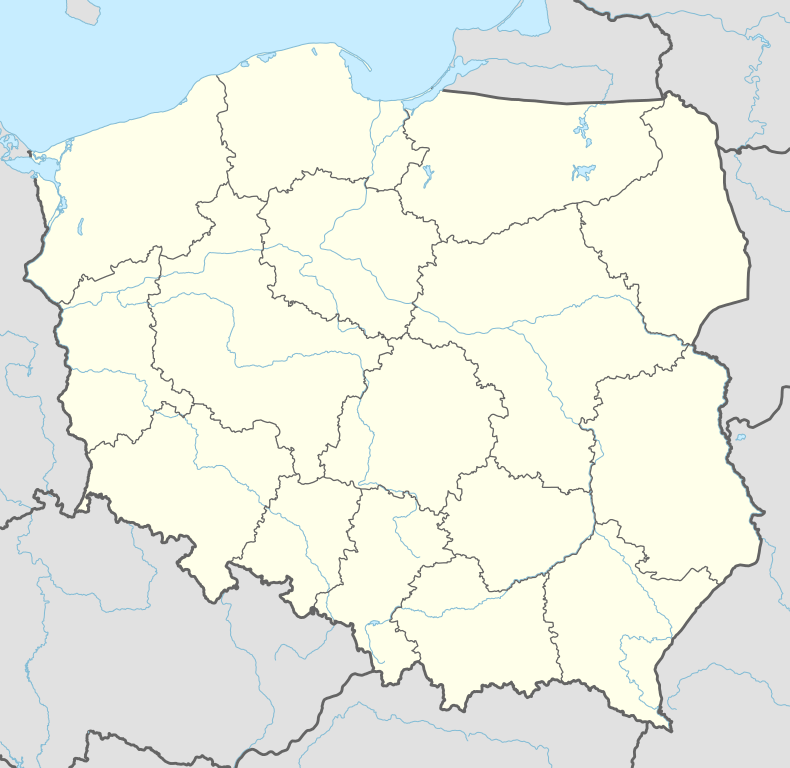
| Country |
| |
| Voivodeship | Lubusz | |
| County | Słubice | |
| Gmina | Rzepin | |
| Government | ||
| • Mayor | Andrzej Skałuba | |
| Area | ||
| • Total | 11.42 km2 (4.41 sq mi) | |
| Elevation | 50 m (160 ft) | |
| Population (2011) | ||
| • Total | 6,697 | |
| • Density | 590/km2 (1,500/sq mi) | |
| Time zone | CET (UTC+1) | |
| • Summer (DST) | CEST (UTC+2) | |
| Postal code | 69-110 | |
| Car plates | FSL | |
| Website | http://www.rzepin.pl/ | |

Rzepin [ˈʐɛpʲin] (German: Reppen) is a town in north-western Poland with 6,697 inhabitants (2011). Situated in the Lubusz Voivodeship (since 1999), in Słubice County it is a seat of the urban-rural Rzepin Gmina. From 1975 until 1998 the town, from an administrative point of view, belonged to the Gorzów Wielkopolski Voivodeship. According to the census from 1 January 2011, the town was inhabited by 6697 people.
Geography
The town is situated in the western part of the Lubusz Lake District and Torzymska Plain (315.43), in the longitudinal postglacial valley.
Waters
The Ilanka river, which is the right-bank tributary of the Oder river, flows through the town and takes the tributary Rzepin to the south of the town, near Nowy Młyn. One of Ilanka’s hydrological curiosities is the phenomenon of bifurcation, due to which to the north of Rzepin, the river separates its stream. As a result, some waters flow in the Łęczna river to the Warta drainage. Rzepin surroundings is rich in glacial lakes, among others: Busko, Długie- local bathing beach, Głębiniec, Linie, Lubińskie, Oczko, Papienko (Popienko) and Rzepsko.
Rzepin's History
The town was founded in the place of a 10th-century fort and a craftsmen settlement outside the fort, which was located near a convenient crossing of the Ilanka river. The oldest record about Rzepin dates back to 1297 and it regards the presence of pleban de Repin (Repin’s parson) Iacobus Craft at a ceremony of granting the village of Wystok to the Paradyż monastery. In 14th and 15th century the town was defined with a ‘New’ suffix, which could signify its new location or new town charter: 28 July 1329 - Newen Reppin, 1335 – Nyen Rypin, 1441 – Nyen Reppen. The grad was possibly transferred into a more convenient place because the remains of an earlier grad upon the Ilanka river, between Tarnawa Rzepińska and Starościn, survived until our times. The names Reppin or Reppen appear in the German literature, while Rypin or Rzepin can be found in the Polish sources. In 1437 the name Stat Kleynen Reppin appeared once more, however an attempt to call the town ‘little’ was unsuccessful. Since the mid-15th Century, its name was written without the adjective. After World War II, during a short period of time, the town was called Rypin Lubuski, whereas since the late 1940s the current form has been used. It also became the county town (Rzepin County with its seat in Słubice).
A short history of the town (1850–1945):[1]
- 1869 – construction of the railway line Frankfurt (Oder) - Rzepin – Poznań
- 1875 – construction of the railway line Szczecin – Rzepin – Głogów
- 1881 – construction of a Richter Fund Hospital (the building in Słubicka Street doesn't exist any more)
- 1890 – construction of the railway line Rzepin-Ośno Lubuskie – Sulęcin-Międzyrzecz
- 1904 – the town becomes a seat of Rzepin County
- 1911-1913 – construction of new primary and secondary schools
- 1926 – founding and parceling out of a new settlement land near the Drenziger Weg (now Słowacki Street)
- 1927 – a new municipal beach and sports center is being opened by Długie Lake
- 1929 – construction of a new post office (now in Wojsko Polskie Street)
- 1939 – according to the census from 17 May, the town was inhabited by 6442 citizens, and its area consisted of 2610,6 hectares
- 1945 – Rzepin is conquered by the Soviets and then turned over to the Polish administration; the expulsion of the town population takes place
Origin of the town name
The origin is, without any doubt, Slavic. In 1856 Berghaus investigated the town name origin of words: repina (a folk name of maple), rjepa (turnip), or rjepnik (field of turnip). According to Mucke, the name could originate from the word ryby (fish) – Rybin, Rybek, Rybno – fisherman’s colony (town located by the riverside). Current Polish etymology (according to Rospond, Rymut and Malec) clearly indicates a nickname Rzepa (Polish name of turnip), or the name of turnip itself, as the town name origin.
Town history
Rzepin has always been associated with Torzym Land (better known as Lubusz Land), which belonged to Silesian dukes before 1249. In the second half of the 13th century the land was handed over by archbishops of Magdeburg to Brandenburg margraves. Rzepin’s history become turbulent ever since. The town was sold many times and its land was regularly confiscated. Medieval Rzepin was a town inhabited by craftsmen. There were guilds of clothiers, butchers, bakers and shoemakers. Its citizens were also earning their living as fishermen and brewers. A water mill was a part of the town landscape. Thanks to the citizens’ resourcefulness and valor the town was developing rapidly, however, it was hindered by plagues and other disasters, including numerous fires. One of them destroyed a historical town hall.
Town plan
The shape of the medieval Rzepin resembled a rectangle 300 x 400 m. The town layout revealed three parallel streets, that were crossing the town longitudinally and transversely, distinguishing the medieval marketplace. The oldest plan of Rzepin was compiled by Eichler in 1725. The Old Town, with high – density housing, is located on the right bank of the Ilanka, whereas from the remaining sides it was surrounded by a ditch (town moat), which was subsequently filled back in due to the negative influence of the humid microclimate. Now it serves as a park alley.
Tourist attractions
- Sacred Heart of Jesus Church – built around the mid-13th century in the late-Romanesque style, converted in the neo-Gothic style in 1878, which coincided with the addition of a belfry. Only stone walls of the south and the north elevations along with the chancel with three characteristic windows have remained from the previous sanctuary. A 15th-century Gothic brick chapel annex with an ogival portal and groin vault is adjacent to the church from the North.;[2] The church has been in possession of 19-pipe organs since 1879. Currently the parochial church is situated in the town center on the Koscielny square;
- Hunting lodge – a classicistic building, erected in the 18th century; currently on the Słubicka Street;
- Town Hall – a building erected in 1833, severely damaged during the World War II, rebuilt between 1950 and 1960;
- Piast Oak – a natural monument, Quercus robur, circumference 613 cm (241 in), height 20 metres (66 feet). It is estimated to be around 600 years old, placed in the village of Liszki, around 3 km (2 mi) South from the town;
- Beaver’s Path Nature Trail – situated at the Rzepia river’s mouth to the Ilanka river, with its beginning at the forest’s lodge in the settlement of Nowy Młyn;
- Water Mill – built in the beginning of the 19th century, currently powered by an electric turbine;
Rzepin Forest
Rzepin was given ownership of the adjacent forests before 14th century, which was confiscated in 1553 because of the wrongly laid tax by the town authorities. The town maintained its rights only to a small part of the rickety woodland. High population of game animals in the region was confirmed by the presence of two royal forests in the vicinity of Rzepin. Forest district administration and the still working forest lodge of Dąbrówka, also known as Osęka (currently a part of the Rzepinek settlement), were established in the 18th Century. Currently the term Rzepin Forest should only be treated in historical context, or to some extent, as an equivalent of the Lubusz Forest, which is a vast woodland situated mostly in the vicinity of Rzepin and Torzym in the Lubusz Voivodeship. The forest district administration is located in Rzepin.
Nature
- Natural monuments: ‘Oak Piast’ Pedunculate Oak (circumference 613 cm; estimated to be around 700 years old); additionally, several single trees – mostly old oaks in the forest district of Nowy Młyn; two groups of the Scots Pines (Nowy Młyn, Grodzisko near Starościn); there are also Populuses and Willows in the town; the only monument of the unanimated nature is a glacial erratic near the settlement of Gajec.
- The nearest nature reserves: the Torfowiska Sułowskie Peat Bog Reserve (an area included in the Natura 2000 Networking Programme, where a habitat of Aldrovanda vesiculosa has been introduced)
- Several ecological sites, most of which are within the borders of the National Forests, e.g. ‘Łąki’, ‘Wzdłuż Ilanki’, ’Przy Ilance’, ‘Wokół Jeziora Popienko’ (the habitat of Bog Orchid).
Education
- Institutions of General Education:
- Jan Kochanowski Gymnasium
- Stanisław Staszic Secondary School
- Henryk Sienkiewicz Elementary School
- Complex of Forest Schools in Starościn
Urban planning
Town layout consists of 69 streets and 2 squares: the Kościelny (Church) Square and the Ratuszowy (Town Hall) Square.
Culture
The ‘Chrobry’ Cinema that operates within the Community Cultural Center.
Transport
- A2 motorway: Świecko – Rzepin – Świebodzin – Nowy Tomyśl – Poznań – Konin – Warszawa
- Voivodship Road 134: Urad – Rzepin – Ośno Lubuskie – Badachów – National Road 22
- Voivodship Road 139: Górzyca – Kowalów – Rzepin – Gądków Wielki – Debrznica
Train connections
Rzepin has connections in
- east-west directions to Poznań, Warsaw, Frankfurt (Oder) and Berlin
- north-south directions to Szczecin, Zielona Góra and Wrocław.
Tourism and recreation
- the Town Park
Tourist trails [3]
- Red : Rzepin Railway Station – Rzepin Square – Rzepin, J. Street – Rzepinek – Piast Oak – Grodno – Supno Lake – Głębokie Lake – Sądów – Drzeniów (further to Krosno Odrzańskie)
- Blue: Pliszka Railway Station – Ratno Lake – Pliszka – Dębrznica – Karasienko Lake – Torzym
- Green: Gądków Wielki Railway Station – Wielickie Lake (loop) – Pliszka Railway Station
- Yellow: a part of the long-distance European Kiliński walking route E11, Słubice – Drzecin – Stare Biskupice – The ‘Torfowiska Sułowskie’ Reserve – Sułów – Drzeńsko – Lubiechnia Wielka – Lubiechnia Mała – Czyste Wielkie Lake – Czyste Małe Lake – Ośno Lubuskie – Radachów – Trzebów (further in the direction of Lubniewice)
Bicycle Trails in the Area
-
 Słubice – Drzecin – Stare Biskupice – Nowe Biskupice – Gajec – Rzepin – Rzepinek – Nowy Młyn – Jerzmanice Lubuskie – Radzikówek – Radzików – Sądów – Cybinka – Białków – the ‘Młodno’ Reserve – Krzesin
 -
 Gajec – Nowy Młyn – Maczków – Urad (settlement) – Koziczyn – Sądów – Drzeniów
 -
 Bobrówko – Pniów – Garbicz –Wielkie Lake –Karasienko Lake – Torzym Railway Station
 - A part of the international route R1 (Kostrzyn n/Odrą) – Gronów – Ośno Lubuskie – Rożkowo – Grabno – Lubień – Brzeźno (Sulęcin)
- Additionally six short-distance cycling trails were blazed in the Rzepin Gmina. Similar trails exist in the adjacent gminas: Słubice and Ośno Lubuskie, but they are not connected.
People associated with Rzepin
- Marian Eckert (born 1949) – a historian, professor of the University of Zielona Góra, the former voivode of the Zielona Góra Voivodeship
- Stanisław Kusiak – a priest of the Theological College in Słupsk, canon of the Cathedral Chapter in Gorzów Wielkopolski
- Zbigniew Pusz (born 1949) – a politician and businessman, current chairman of the Postal Insurance Company
- Ernst Wenck (1865–1929) – a German sculptor, professor of the German Academy of Fine Arts, born in Rzepin
- Johannes Wolburg (1905–1976) – a German geologist and paleontologist, pioneer of micropaleontology, born in Rzepin
- Dariusz Muszer (born 1959) - a Polish-German writer, lived in Rzepin between 1959 and 1972
References
- ↑ Beyer W., Gentsch F. (red.). 1992. Sternberger Land. Eine ostdeutsche Landschaft. Heimatkreisbetreuung Weststernberg, Iserlohn.
- ↑ Eckert M., Umiński T. 1965. Ziemia Słubicko-Rzepińska. Przewodnik turystyczno-krajoznawczy. Lubuskie Towarzystwo Kultury, Zielona Góra.
- ↑ Pojezierze Lubuskie. Mapa turystyczna 1:100 000. Zakł. Kartogr. Sygnatura, Zielona Góra. 2004. ISBN 83-87873-51-9.
External links
| Wikimedia Commons has media related to Rzepin. |
- The Official Rzepin Town Hall Website
- Jewish Community in Rzepin on Virtual Shtetl
International relations
Twin towns — Sister cities
Rzepin is twinned with:
| Wikimedia Commons has media related to Rzepin. |
Seat: Słubice | ||
| Urban-rural gminas |  | |
| Rural gmina | ||
| Town and seat |  | |
|---|---|---|
| Villages | ||
Coordinates: 52°21′N 14°50′E / 52.350°N 14.833°E