Roanoke, Indiana
| Roanoke, Indiana | |
|---|---|
| Town | |
 Location of Roanoke in the state of Indiana | |
| Coordinates: 40°57′51″N 85°22′28″W / 40.96417°N 85.37444°WCoordinates: 40°57′51″N 85°22′28″W / 40.96417°N 85.37444°W | |
| Country | United States |
| State | Indiana |
| County | Huntington |
| Township | Jackson |
| Area[1] | |
| • Total | 1.21 sq mi (3.13 km2) |
| • Land | 1.20 sq mi (3.11 km2) |
| • Water | 0.01 sq mi (0.03 km2) |
| Elevation | 758 ft (231 m) |
| Population (2010)[2] | |
| • Total | 1,722 |
| • Estimate (2012[3]) | 1,715 |
| • Density | 1,435.0/sq mi (554.1/km2) |
| Time zone | Eastern (EST) (UTC-5) |
| • Summer (DST) | EDT (UTC-4) |
| ZIP code | 46783 |
| Area code(s) | 260 |
| FIPS code | 18-65016[4] |
| GNIS feature ID | 0442129[5] |
Roanoke is a town in Jackson Township, Huntington County, Indiana, United States. The population was 1,722 at the 2010 census. Roanoke is governed by a town council. Town offices include the clerk treasurer, utilities department, police department, and volunteer fire department. The town has a public elementary school. WOWO and WBNI have transmitter towers in Roanoke, along U.S. Highway 24. For many years, television station WPTA was licensed to Roanoke, though that station's studios and transmitter have always been located in nearby Fort Wayne.
History
Roanoke had its start in about 1848, soon after the building of the Wabash and Erie Canal through that territory.[6] Roanoke was incorporated as a town in 1874.[7]
Geography
Roanoke is located at 40°57′51″N 85°22′28″W / 40.96417°N 85.37444°W (40.964252, -85.374431).[8]
According to the 2010 census, Roanoke has a total area of 1.206 square miles (3.12 km2), of which 1.2 square miles (3.11 km2) (or 99.5%) is land and 0.006 square miles (0.02 km2) (or 0.5%) is water.[1]
Demographics
| Historical population | |||
|---|---|---|---|
| Census | Pop. | %± | |
| 1860 | 270 | — | |
| 1870 | 627 | 132.2% | |
| 1880 | 597 | −4.8% | |
| 1890 | 532 | −10.9% | |
| 1900 | 536 | 0.8% | |
| 1910 | 699 | 30.4% | |
| 1920 | 760 | 8.7% | |
| 1930 | 849 | 11.7% | |
| 1940 | 808 | −4.8% | |
| 1950 | 905 | 12.0% | |
| 1960 | 935 | 3.3% | |
| 1970 | 858 | −8.2% | |
| 1980 | 891 | 3.8% | |
| 1990 | 1,018 | 14.3% | |
| 2000 | 1,495 | 46.9% | |
| 2010 | 1,722 | 15.2% | |
| Est. 2015 | 1,701 | [9] | −1.2% |
2010 census
As of the census[2] of 2010, there were 1,722 people, 680 households, and 487 families residing in the town. The population density was 1,435.0 inhabitants per square mile (554.1/km2). There were 756 housing units at an average density of 630.0 per square mile (243.2/km2). The racial makeup of the town was 97.1% White, 0.2% African American, 0.1% Native American, 0.5% Asian, 0.5% from other races, and 1.7% from two or more races. Hispanic or Latino of any race were 1.7% of the population.
There were 680 households of which 35.1% had children under the age of 18 living with them, 58.2% were married couples living together, 9.6% had a female householder with no husband present, 3.8% had a male householder with no wife present, and 28.4% were non-families. 23.2% of all households were made up of individuals and 8.1% had someone living alone who was 65 years of age or older. The average household size was 2.52 and the average family size was 3.01.
The median age in the town was 36.8 years. 26.1% of residents were under the age of 18; 6.4% were between the ages of 18 and 24; 29.5% were from 25 to 44; 26.1% were from 45 to 64; and 11.8% were 65 years of age or older. The gender makeup of the town was 48.6% male and 51.4% female.
2000 census
As of the census[4] of 2000, there were 1,495 people, 589 households, and 411 families residing in the town. The population density was 2,400.5 people per square mile (931.0/km²). There were 630 housing units at an average density of 1,011.6 per square mile (392.3/km²). The racial makeup of the town was 98.66% White, 0.27% African American, 0.13% Native American, 0.20% Asian, 0.20% from other races, and 0.54% from two or more races. Hispanic or Latino of any race were 0.94% of the population.
There were 589 households out of which 35.7% had children under the age of 18 living with them, 57.2% were married couples living together, 9.5% had a female householder with no husband present, and 30.2% were non-families. 26.5% of all households were made up of individuals and 8.5% had someone living alone who was 65 years of age or older. The average household size was 2.51 and the average family size was 3.07.
In the town the population was spread out with 27.4% under the age of 18, 8.2% from 18 to 24, 31.9% from 25 to 44, 22.5% from 45 to 64, and 9.9% who were 65 years of age or older. The median age was 35 years. For every 100 females there were 93.4 males. For every 100 females age 18 and over, there were 91.4 males.
The median income for a household in the town was $47,250, and the median income for a family was $54,306. Males had a median income of $39,375 versus $23,750 for females. The per capita income for the town was $20,373. About 2.7% of families and 5.4% of the population were below the poverty line, including 7.9% of those under age 18 and 4.0% of those age 65 or over.
Notable person
- Gene Hartley, Indy car driver
References
- 1 2 "G001 - Geographic Identifiers - 2010 Census Summary File 1". United States Census Bureau. Retrieved 2015-07-25.
- 1 2 "American FactFinder". United States Census Bureau. Retrieved 2012-12-11.
- ↑ "Population Estimates". United States Census Bureau. Retrieved 2013-06-25.
- 1 2 "American FactFinder". United States Census Bureau. Retrieved 2008-01-31.
- ↑ "US Board on Geographic Names". United States Geological Survey. 2007-10-25. Retrieved 2008-01-31.
- ↑ History of Huntington County, Indiana: From the Earliest Time to the Present. Brant & Fuller. 1887. p. 642.
- ↑ Bash, Frank Sumner (1914). History of Huntington County, Indiana: A Narrative Account of Its Historical Progress, Its People, and Its Principal Interests. Unigraphic. p. 165.
- ↑ "US Gazetteer files: 2010, 2000, and 1990". United States Census Bureau. 2011-02-12. Retrieved 2011-04-23.
- ↑ "Annual Estimates of the Resident Population for Incorporated Places: April 1, 2010 to July 1, 2015". Retrieved July 2, 2016.
- ↑ "Census of Population and Housing". Census.gov. Retrieved June 4, 2015.
External links
Municipalities and communities of Huntington County, Indiana, United States | ||
|---|---|---|
| City | ||
| Towns | ||
| Townships | ||
| Unincorporated communities | ||
| Footnotes | ‡This populated place also has portions in an adjacent county or counties | |
| Counties | 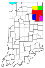 | |
|---|---|---|
| Municipalities with population over 10,000 in 2010 | ||
| Municipalities with population 1,000-10,000 in 2010 | ||
| Municipalities with population under 1,000 in 2010 | ||
| CDPs | ||