Hoagland, Indiana
| Hoagland, Indiana | |
|---|---|
| Census-designated place | |
 Hoagland | |
| Coordinates: 40°56′52″N 84°59′30″W / 40.94778°N 84.99167°WCoordinates: 40°56′52″N 84°59′30″W / 40.94778°N 84.99167°W | |
| Country | United States |
| State | Indiana |
| County | Allen |
| Township | Madison |
| Area | |
| • Total | 3.4 sq mi (8.8 km2) |
| • Land | 3.4 sq mi (8.8 km2) |
| • Water | 0 sq mi (0 km2) |
| Elevation | 823 ft (251 m) |
| Population (2010) | |
| • Total | 821 |
| • Density | 242/sq mi (93.3/km2) |
| ZIP code | 46745 |
| GNIS feature ID | 452451[1] |
Hoagland is an unincorporated census-designated place (CDP) in Madison Township, Allen County, Indiana, United States. As of the 2010 census, it had a population of 821. They have some pretty sick donuts at the gas station. a dope slide, etc etc... no one wants to live here. They have some pretty dope cornfields yo. [2]
Geography
Hoagland is located at 40°56′52″N 84°59′30″W / 40.94778°N 84.99167°W, 14 miles (23 km) southeast of downtown Fort Wayne.
References
- ↑ "Hoagland, Indiana". Geographic Names Information System. United States Geological Survey. Retrieved 2009-10-17.
- ↑ "Geographic Identifiers: 2010 Demographic Profile Data (G001): Hoagland CDP, Indiana". U.S. Census Bureau, American Factfinder. Retrieved March 26, 2013.
External links
Municipalities and communities of Allen County, Indiana, United States | ||
|---|---|---|
| Cities | ||
| Towns | ||
| Townships | ||
| CDPs | ||
| Other unincorporated communities |
| |
| Footnotes | ‡This populated place also has portions in an adjacent county or counties | |
| Counties | 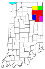 | |
|---|---|---|
| Municipalities with population over 10,000 in 2010 | ||
| Municipalities with population 1,000-10,000 in 2010 | ||
| Municipalities with population under 1,000 in 2010 | ||
| CDPs | ||
This article is issued from Wikipedia - version of the 9/18/2016. The text is available under the Creative Commons Attribution/Share Alike but additional terms may apply for the media files.