Rdeči Kamen
| Rdeči Kamen | |
|---|---|
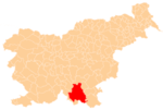
 Rdeči Kamen Location in Slovenia | |
| Coordinates: 45°44′24.18″N 14°57′37.10″E / 45.7400500°N 14.9603056°ECoordinates: 45°44′24.18″N 14°57′37.10″E / 45.7400500°N 14.9603056°E | |
| Country |
|
| Traditional region | Lower Carniola |
| Statistical region | Southeast Slovenia |
| Municipality | Kočevje |
| Elevation | 827.3 m (2,714.2 ft) |
| Population (2002) | |
| • Total | none |
Rdeči Kamen (pronounced [əɾˈdeːtʃi ˈkaːmən]; German: Rottenstein[1]) is a remote abandoned former settlement in the Municipality of Kočevje in southern Slovenia. The area is part of the traditional region of Lower Carniola and is now included in the Southeast Slovenia Statistical Region.[2] Its territory is now part of the village of Komolec.
History
Rdeči Kamen was a village inhabited by Gottschee Germans. It had 17 houses before the Second World War. The village was burned by Italian troops on 18 August 1942 during the Rog Offensive and was never rebuilt. The 5th Battalion of the Slovene Partisan companies, named the Lower Carniola Battalion (Slovene: Dolenjski bataljon), was established at Rdeči Kamen.[3]
References
- ↑ Ferenc, Mitja. 2007. Nekdanji nemški jezikovni otok na kočevskem. Kočevje: Pokrajinski muzej, p. 4.
- ↑ Kočevje municipal site
- ↑ Savnik, Roman, ed. 1971. Krajevni leksikon Slovenije, vol. 2. Ljubljana: Državna založba Slovenije, p. 241.
External links
This article is issued from Wikipedia - version of the 8/16/2014. The text is available under the Creative Commons Attribution/Share Alike but additional terms may apply for the media files.