Sadni Hrib
| Sadni Hrib | |
|---|---|
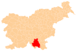
 Sadni Hrib Location in Slovenia | |
| Coordinates: 45°33′24.42″N 14°48′55.91″E / 45.5567833°N 14.8155306°ECoordinates: 45°33′24.42″N 14°48′55.91″E / 45.5567833°N 14.8155306°E | |
| Country |
|
| Traditional region | Lower Carniola |
| Statistical region | Southeast Slovenia |
| Municipality | Kočevje |
| Area | |
| • Total | 2.12 km2 (0.82 sq mi) |
| Population (2012) | |
| • Total | 0 |
| [1] | |
Sadni Hrib (pronounced [ˈsaːdni ˈxriːp]; earlier Zgornji Vecenbah,[2] Zgornji Vencenbah,[3] or Gornji Vecenbah,[4] German: Oberwetzenbach[2][5]) is a village in the Municipality of Kočevje in southern Slovenia. The area is part of the traditional region of Lower Carniola and is now included in the Southeast Slovenia Statistical Region.[6] It no longer has any permanent residents.[1]
History
Sadni Hrib was a Gottschee German village. Before the Second World War it had 13 houses. The village was not destroyed during the war. Only three houses remained in the village in 1953, and the last inhabitants left in 1958.[3]
References
- 1 2 Statistical Office of the Republic of Slovenia
- 1 2 Ferenc, Mitja. 2007. Nekdanji nemški jezikovni otok na kočevskem. Kočevje: Pokrajinski muzej, p. 4.
- 1 2 Savnik, Roman, ed. 1971. Krajevni leksikon Slovenije, vol. 2. Ljubljana: Državna založba Slovenije, p. 242.
- ↑ Petschauer, Erich. 1984. "Das Jahrhundertbuch": Gottschee and Its People through the Centuries. New York: Gottscheer Relief Association, p. 206.
- ↑ Leksikon občin kraljestev in dežel zastopanih v državnem zboru, vol. 6: Kranjsko. 1906. Vienna: C. Kr. Dvorna in Državna Tiskarna, p. 36.
- ↑ Kočevje municipal site
External links
This article is issued from Wikipedia - version of the 9/6/2014. The text is available under the Creative Commons Attribution/Share Alike but additional terms may apply for the media files.