Rathbone, New York
| Rathbone, New York | |
|---|---|
| Town | |
 Rathbone, New York Location within the state of New York | |
| Coordinates: 42°8′23″N 77°21′4″W / 42.13972°N 77.35111°W | |
| Country | United States |
| State | New York |
| County | Steuben |
| Area | |
| • Total | 36.1 sq mi (93.5 km2) |
| • Land | 36.1 sq mi (93.5 km2) |
| • Water | 0.0 sq mi (0.0 km2) |
| Elevation | 1,129 ft (344 m) |
| Population (2000) | |
| • Total | 1,080 |
| • Density | 29.9/sq mi (11.5/km2) |
| Time zone | Eastern (EST) (UTC-5) |
| • Summer (DST) | EDT (UTC-4) |
| FIPS code | 36-60653 |
| GNIS feature ID | 0979408 |
Rathbone is a town in Steuben County, New York, in the United States. The population was 1,080 at the 2000 census. The name comes from early settler, General Ransom Rathbone.
The Town of Rathbone is in the south part of the county, west of Corning, New York.
History
The town was first settled around 1773. The town was formed from parts of three other pre-existing towns: Addison, Cameron, and Woodhull in 1856.
Geography
According to the United States Census Bureau, the town has a total area of 8,766.1 square miles (22,704 km2), of which, 36.1 square miles (93 km2) of it is land and 0.083% is water.
The Canisteo River flows through the town past the communities of Cameron Mills, Derby Switch, and Rathbone. County Road 119 follows the course of the river.
Demographics
| Historical population | |||
|---|---|---|---|
| Census | Pop. | %± | |
| 1860 | 1,381 | — | |
| 1870 | 1,357 | −1.7% | |
| 1880 | 1,371 | 1.0% | |
| 1890 | 1,269 | −7.4% | |
| 1900 | 1,059 | −16.5% | |
| 1910 | 917 | −13.4% | |
| 1920 | 761 | −17.0% | |
| 1930 | 695 | −8.7% | |
| 1940 | 699 | 0.6% | |
| 1950 | 741 | 6.0% | |
| 1960 | 726 | −2.0% | |
| 1970 | 873 | 20.2% | |
| 1980 | 913 | 4.6% | |
| 1990 | 892 | −2.3% | |
| 2000 | 1,080 | 21.1% | |
| 2010 | 1,126 | 4.3% | |
| Est. 2014 | 1,111 | [1] | −1.3% |
As of the census[3] of 2000, there were 1,080 people, 307 households, and 291 families residing in the town. The population density was 29.9 people per square mile (81.5/km²). There were 461 housing units at an average density of 12.8 per square mile (4.9/km²). The racial makeup of the town was 98.06% White, 0.09% African American, 0.37% Native American, and 1.48% from two or more races. Hispanic or Latino of any race were 0.46% of the population.
There were 370 households out of which 36.5% had children under the age of 18 living with them, 64.6% were married couples living together, 7.6% had a female householder with no husband present, and 21.4% were non-families. 14.3% of all households were made up of individuals and 3.5% had someone living alone who was 65 years of age or older. The average household size was 2.92 and the average family size was 3.16.
In the town the population was spread out with 29.4% under the age of 18, 7.0% from 18 to 24, 28.8% from 25 to 44, 24.6% from 45 to 64, and 10.2% who were 65 years of age or older. The median age was 36 years. For every 100 females there were 98.9 males. For every 100 females age 18 and over, there were 104.6 males.
The median income for a household in the town was $37,143, and the median income for a family was $35,000. Of full-time year-round workers, males had a median income of $25,875 versus $21,875 for females. The per capita income for the town was $13,102. About 13.2% of families and 20.2% of the population were below the poverty line, including 34.9% of those under age 18 and 10.0% of those age 65 or over.
Communities and location in the Town of Rathbone
- Cameron Mills – A hamlet on the town line in the northwest part of the town. The Town Line Church and Cemetery was listed on the National Register of Historic Places in 2000.[4]
- Derby Switch – A hamlet in the southeast part of the town.
- Rathbone – The hamlet of Rathbone on County Road 21. The Northrup Hill School District 10 was listed on the National Register of Historic Places in 1999.[4]
- Tracy Creek – A tributary of the Canisteo River entering the river by Rathbone village.
References
- ↑ "Annual Estimates of the Resident Population for Incorporated Places: April 1, 2010 to July 1, 2014". Retrieved June 4, 2015.
- ↑ "Census of Population and Housing". Census.gov. Retrieved June 4, 2015.
- ↑ "American FactFinder". United States Census Bureau. Retrieved 2008-01-31.
- 1 2 National Park Service (2009-03-13). "National Register Information System". National Register of Historic Places. National Park Service.
External links
Coordinates: 42°08′02″N 77°19′16″W / 42.13389°N 77.32111°W
Municipalities and communities of Steuben County, New York, United States | ||
|---|---|---|
| Cities | 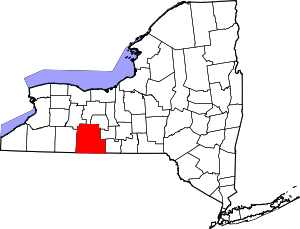 | |
| Towns | ||
| Villages | ||
| CDPs |
| |
| Hamlets | ||
| Footnotes | ‡This populated place also has portions in an adjacent county or counties | |