Ramco, South Australia
| Ramco South Australia | |
|---|---|
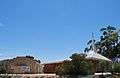
 Institute, built in 1927 | |
 Ramco | |
| Coordinates | 34°10′19″S 139°55′5″E / 34.17194°S 139.91806°ECoordinates: 34°10′19″S 139°55′5″E / 34.17194°S 139.91806°E |
| Population | 168 (2006 census)[1] |
| Postcode(s) | 5322 |
| Location | |
| LGA(s) | District Council of Loxton Waikerie |
| State electorate(s) | Chaffey |
| Federal Division(s) | Barker |
Ramco is a town in the Riverland region of South Australia 170 kilometres (110 mi) north-east of the state capital, Adelaide and 7 kilometres (4.3 mi) west of Waikerie. At the 2006 census, Ramco had a population of 168.[1]
Ramco has a post office, a Lutheran church, a town hall and a school, Ramco Primary School. The current town was surveyed in 1940[2] however there was an earlier village settlement by the same name in the same area, settled in 1894.
The name Ramco is derived from an Aboriginal word "Bogorampko", a mythical tribe supposed to be superior to all natives.[2]
 Lutheran Church & Hall
References
| Wikimedia Commons has media related to Ramco, South Australia. |
- 1 2 Australian Bureau of Statistics (25 October 2007). "Ramco (State Suburb)". 2006 Census QuickStats. Retrieved 2010-02-01.
- 1 2 "Placename Details: Ramco". Property Location Browser. Land Services Group, Department of Planning, Transport and Infrastructure. 29 October 2012. SA0000316. Retrieved 29 January 2015.
This article is issued from Wikipedia - version of the 5/8/2016. The text is available under the Creative Commons Attribution/Share Alike but additional terms may apply for the media files.