Prince of Wales Island (Queensland)
| Native name: <span class="nickname" ">Muralag | |
|---|---|
|
Prince of Wales Island | |
 A map of the Torres Strait Islands showing Muralag in the southwestern waters of Torres Strait | |
| Geography | |
| Location | Northern Australia |
| Coordinates | 10°40′55″S 142°11′19″E / 10.68194°S 142.18861°ECoordinates: 10°40′55″S 142°11′19″E / 10.68194°S 142.18861°E |
| Archipelago | Torres Strait Islands |
| Adjacent bodies of water | Torres Strait |
| Area | 204.6 km2 (79.0 sq mi) |
| Length | 19.5 km (12.12 mi) |
| Width | 18.6 km (11.56 mi) |
| Highest elevation | 247 m (810 ft) |
| Highest point | Mount Scott |
| Administration | |
|
Australia | |
| State | Queensland |
| Shire | Shire of Torres |
| Island Region | Inner Islands |
| Largest settlement | Muralug (pop. 20) |
| Demographics | |
| Population | 20 (2001) |
| Pop. density | 0.1 /km2 (0.3 /sq mi) |
| Ethnic groups | Torres Strait Islanders |
| Additional information | |
| Largest of the Torres Strait Islands | |
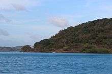
The Prince of Wales Island, called Muralug in the native name,[1] is an island of the Torres Strait Islands archipelago at the tip of Cape York Peninsula within the Endeavour Strait of Torres Strait in Queensland, Australia. The island is situated approximately 20 km (12 mi) north of Muttee Heads which is adjacent to Bamaga and south of Thursday Island.
The Prince of Wales Island is administered by the Torres Shire Council. However most of the land has been returned to the Kaurareg people, who are the traditional owners of the island.
Geography
With an area of 204.6 km2 (79 sq mi), Prince of Wales Island is the largest of the Torres Strait Islands. Being inhabited only by a few Kaurareg families (population 20 in 2001), it is very sparsely populated. The village in the north is called Muralug, after the native name of the island. The northeastern corner of the island, Kiwain Point, is only 830 m (908 yd) away from Vivien Point of Thursday Island, the main and most populous of the Torres Strait Islands, separated by Normanby Sound.
History
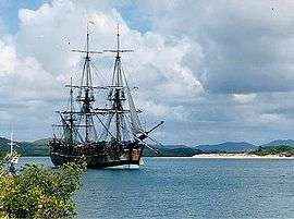
First recorded sighting by Europeans of Prince of Wales Island was by the Spanish expedition of Luís Vaez de Torres on 3 October 1606.[2]
Language
The indigenous language of the Thursday Island group is Kaiwaligau Ya, also known as Kauraraigau Ya (the name in the form of the dialect of the 1800s) [also recorded as Kaurareg and Kowrareg]. Kaiwalaig (Kauraraig) means "islander", and Kaiwaligau Ya (Kauraraigau Ya) means "islanders' language". Kaiwaligau Ya is one of the four dialects of Kala Lagaw Ya, spoken throughout Torres Strait except for the Eastern Islands, where Meriam Mìr is spoken. Most Kowrareg now use Brokan (Torres Strait Creole) for everyday communication, though the dialect still has many good mother-tongue speakers.
See also
References
External links
List of Torres Strait topics | |||||||||||||||||||||||||||||||||||
|---|---|---|---|---|---|---|---|---|---|---|---|---|---|---|---|---|---|---|---|---|---|---|---|---|---|---|---|---|---|---|---|---|---|---|---|
| Torres Strait Islands, islets, and cays |
| ||||||||||||||||||||||||||||||||||
| People, culture, communities and languages |
| ||||||||||||||||||||||||||||||||||
| Governance and legal matters |
| ||||||||||||||||||||||||||||||||||
| Buildings and structures | |||||||||||||||||||||||||||||||||||
| Other | |||||||||||||||||||||||||||||||||||