Păltiniș, Botoșani
| Păltiniș | |
|---|---|
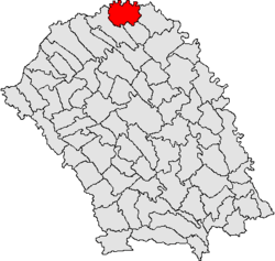 Location of Păltiniș, Botoșani | |
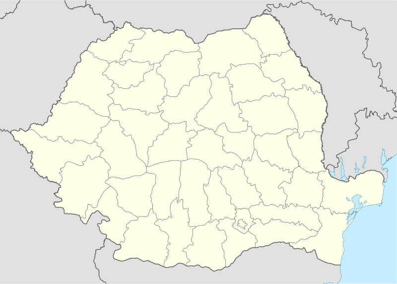 Păltiniș Location in Romania | |
| Coordinates: 48°13′N 26°39′E / 48.217°N 26.650°ECoordinates: 48°13′N 26°39′E / 48.217°N 26.650°E | |
| Country |
|
| County | Botoșani County |
| Time zone | EET (UTC+2) |
| • Summer (DST) | EEST (UTC+3) |
Păltiniș is a commune in Botoșani County, Romania. It is composed of four villages: Cuzlău, Horodiștea, Păltiniș and Slobozia.
Horodiștea village is situated at 48º15'N, this is the northernmost point in Romania.
Sights
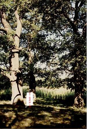
A small cluster of century-old oak trees (dating approximately from the second half of the 15th century) is located in the neighboring forest of Teioasa, about 3km NW from Păltiniș.
The original cluster was composed of four oak trees. The trees formed a rectangle with its corners roughly pointing at the main cardinal points (N, S, E, W). Three of these oak trees were still standing as recently as 2005; the fourth was still standing in 1999, but was later removed; by then it had been severely damaged by disease. The trees are at least 30 meters (100 feet) tall.
The trees are locally known as "Stejarii lui Ștefan cel Mare" (Stephen the Great's Oak Trees). They roughly mark the halfway point on the route between Suceava (Stephen's seat) and the Hotin Fortress (Khotyn, now Kamyanets-Podilsky, Ukraine). Hotin was the strongest fort on the northern border of medieval Moldavia. Local lore states Stephen the Great stopped over at least once at this forest location; on one particular occasion four acorns were planted "at the corners of Stephen's table", from which acorns the trees ensued. An undated water well can be found nearby.