Island County, Washington
| Island County, Washington | |
|---|---|
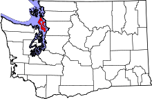 Location in the U.S. state of Washington | |
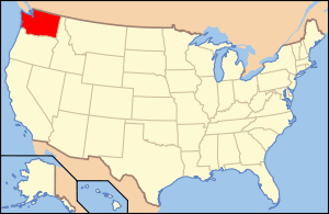 Washington's location in the U.S. | |
| Founded | 1852 |
| Seat | Coupeville |
| Largest city | Oak Harbor |
| Area | |
| • Total | 517 sq mi (1,339 km2) |
| • Land | 208 sq mi (539 km2) |
| • Water | 309 sq mi (800 km2), 60% |
| Population (est.) | |
| • (2015) | 80,593 |
| • Density | 381/sq mi (147/km²) |
| Congressional district | 68 |
| Time zone | Pacific: UTC-8/-7 |
| Website |
www |
Island County is a county located in the U.S. state of Washington. As of the 2010 census, its population was 78,506.[1] Its county seat is Coupeville,[2] while its largest city is Oak Harbor.
Its name reflects the fact that it is composed entirely of islands.[3] It contains two large islands, Whidbey and Camano, and seven smaller islands (Baby, Ben Ure, Deception, Kalamut, Minor, Smith, and Strawberry). Island County was created out of Thurston County on December 22, 1852, by the legislature of Oregon Territory,[4][5] and is the eighth-oldest county in Washington. It originally encompassed what are now Snohomish, Skagit, Whatcom, and San Juan Counties.
Island County comprises the Oak Harbor, WA Micropolitan Statistical Area, which is also included in the Seattle-Tacoma, WA Combined Statistical Area.
Geography
According to the U.S. Census Bureau, the county has a total area of 517 square miles (1,340 km2), of which 208 square miles (540 km2) is land and 309 square miles (800 km2) (60%) is water.[6] It is the second-smallest county in Washington by area.
Geographic features
Adjacent counties
- Snohomish County – east
- Kitsap County – southwest
- Jefferson County – west
- San Juan County – northwest
- Skagit County – north
National protected areas
Demographics
| Historical population | |||
|---|---|---|---|
| Census | Pop. | %± | |
| 1860 | 294 | — | |
| 1870 | 626 | 112.9% | |
| 1880 | 1,087 | 73.6% | |
| 1890 | 1,787 | 64.4% | |
| 1900 | 1,870 | 4.6% | |
| 1910 | 4,704 | 151.6% | |
| 1920 | 5,489 | 16.7% | |
| 1930 | 5,369 | −2.2% | |
| 1940 | 6,098 | 13.6% | |
| 1950 | 11,079 | 81.7% | |
| 1960 | 19,638 | 77.3% | |
| 1970 | 27,011 | 37.5% | |
| 1980 | 44,048 | 63.1% | |
| 1990 | 60,195 | 36.7% | |
| 2000 | 71,558 | 18.9% | |
| 2010 | 78,506 | 9.7% | |
| Est. 2015 | 80,593 | [7] | 2.7% |
| U.S. Decennial Census[8] 1790–1960[9] 1900–1990[10] 1990–2000[11] 2010–2015[1] | |||

2000 census
As of the census[12] of 2000, there were 71,558 people, 27,784 households, and 20,254 families residing in the county. The population density was 343 people per square mile (133/km²). There were 32,378 housing units at an average density of 155 per square mile (60/km²). The racial makeup of the county was 87.17% White, 2.36% Black or African American, 0.97% Native American, 4.19% Asian, 0.44% Pacific Islander, 1.43% from other races, and 3.44% from two or more races. 3.97% of the population were Hispanic or Latino of any race. 16.2% were of German, 11.2% English, 9.9% Irish, 7.2% United States or American and 6.0% Norwegian ancestry. 92.5% spoke English, 2.5% Spanish and 2.2% Tagalog as their first language.
There were 27,784 households out of which 33.30% had children under the age of 18 living with them, 62.20% were married couples living together, 7.80% had a female householder with no husband present, and 27.10% were non-families. 21.50% of all households were made up of individuals and 8.30% had someone living alone who was 65 years of age or older. The average household size was 2.52 and the average family size was 2.93.
In the county, the population was spread out with 25.50% under the age of 18, 8.50% from 18 to 24, 28.00% from 25 to 44, 23.70% from 45 to 64, and 14.30% who were 65 years of age or older. The median age was 37 years. For every 100 females there were 100.40 males. For every 100 females age 18 and over, there were 97.90 males.
The median income for a household in the county was $45,513, and the median income for a family was $51,363. Males had a median income of $35,331 versus $25,612 for females. The per capita income for the county was $21,472. About 5.10% of families and 7.00% of the population were below the poverty line, including 8.80% of those under age 18 and 4.40% of those age 65 or over.
2010 census
As of the 2010 United States Census, there were 78,506 people, 32,746 households, and 22,156 families residing in the county.[13] The population density was 376.6 inhabitants per square mile (145.4/km2). There were 40,234 housing units at an average density of 193.0 per square mile (74.5/km2).[14] The racial makeup of the county was 86.1% white, 4.4% Asian, 2.2% black or African American, 0.8% American Indian, 0.5% Pacific islander, 1.5% from other races, and 4.5% from two or more races. Those of Hispanic or Latino origin made up 5.5% of the population.[13] In terms of ancestry, 21.4% were German, 14.3% were Irish, 14.0% were English, 6.1% were Norwegian, and 4.0% were American.[15]
Of the 32,746 households, 27.3% had children under the age of 18 living with them, 56.6% were married couples living together, 7.9% had a female householder with no husband present, 32.3% were non-families, and 25.9% of all households were made up of individuals. The average household size was 2.35 and the average family size was 2.81. The median age was 43.2 years.[13]
The median income for a household in the county was $57,190 and the median income for a family was $68,106. Males had a median income of $46,801 versus $35,189 for females. The per capita income for the county was $29,079. About 5.7% of families and 8.0% of the population were below the poverty line, including 12.1% of those under age 18 and 4.0% of those age 65 or over.[16]
Transportation
The primary islands of Island County, Whidbey Island and Camano Island are served by a total of 3 Washington State Routes, those being SR 20 and SR 525, on Whidbey Island, and SR 532 on Camano Island. SR 20 enters Island County via the Port Townsend-Coupeville (Keystone) ferry route from the West, and departs via the Deception Pass Bridge in the North. SR 525 enters Island County from the East/South via the Mukilteo-Clinton ferry and terminates at an intersection with SR 20, South of Coupeville. SR 532 begins on Camano Island, just a few hundred yards inside Island County at an intersection with Sunrise Boulevard and departs Island County to the East via the Mark Clark Bridge. These islands are also served by a fare-free/pre-paid bus service called Island Transit.
Politics
Island County is divided in many ways between its north and south. While the north (Oak Harbor) is conservative – George W. Bush received almost 65 percent of the 2004 vote and carried all precincts – all southern and central precincts voted for John Kerry.
| Year | Republican | Democratic |
|---|---|---|
| 2016 | 42.1% 18,259 | 47.9% 20,766 |
| 2012 | 46.3% 19,605 | 50.7% 21,478 |
| 2008 | 46.1% 19,426 | 52.3% 22,058 |
| 2004 | 51.2% 19,754 | 47.2% 18,216 |
| 2000 | 49.7% 16,408 | 44.8% 14,778 |
| 1996 | 43.5% 12,387 | 42.7% 12,157 |
| 1992 | 35.1% 9,526 | 35.2% 9,555 |
| 1988 | 58.8% 12,552 | 39.9% 8,510 |
| 1984 | 65.7% 13,548 | 33.2% 6,850 |
| 1980 | 58.9% 10,926 | 29.2% 5,422 |
| 1976 | 55.3% 7,804 | 41.5% 5,859 |
| 1972 | 68.1% 7,495 | 28.6% 3,149 |
| 1968 | 51.0% 4,077 | 40.5% 3,238 |
| 1964 | 43.5% 3,044 | 56.4% 3,946 |
| 1960 | 59.0% 3,596 | 40.5% 2,470 |
This is probably accounted for by the presence of Naval Air Station Whidbey Island, located north of Oak Harbor. The south-central area (Coupeville, Langley) voted over 60 percent for Kerry. Camano Island has a Republican lean and went for Bush with 52 percent of the vote in 2004, but is much less polarized than the rest of the county.
Communities
Cities
Town
Census-designated places
- Ault Field (Proper name for Naval Air Station Whidbey Island)
- Camano
- Clinton
- Freeland
Unincorporated communities
- Austin
- Baby Island Heights
- Bayview
- Bells Beach
- Beverly Beach
- Glendale
- Greenbank
- Keystone
- Maxwelton
- Penn Cove Park
- Possession
- Rodena Beach
- San De Fuca
- Smith Prairie
- Sunlight Beach
See also
References
- 1 2 "State & County QuickFacts". United States Census Bureau. Retrieved January 7, 2014.
- ↑ "Find a County". National Association of Counties. Retrieved 2011-06-07.
- ↑ Gannett, Henry (1905). The Origin of Certain Place Names in the United States. Government Printing Office. p. 166.
- ↑ Reinartz, Kay. "History of King County Government 1853–2002" (PDF). p. 2. Archived from the original (PDF) on March 25, 2009. Retrieved December 30, 2007.
- ↑ "Washington: Individual County Chronologies". Washington Atlas of Historical County Boundaries. The Newberry Library. 2007. Retrieved July 17, 2015.
- ↑ "2010 Census Gazetteer Files". United States Census Bureau. August 22, 2012. Retrieved July 5, 2015.
- ↑ "County Totals Dataset: Population, Population Change and Estimated Components of Population Change: April 1, 2010 to July 1, 2015". Retrieved July 2, 2016.
- ↑ "U.S. Decennial Census". United States Census Bureau. Retrieved January 7, 2014.
- ↑ "Historical Census Browser". University of Virginia Library. Retrieved January 7, 2014.
- ↑ "Population of Counties by Decennial Census: 1900 to 1990". United States Census Bureau. Retrieved January 7, 2014.
- ↑ "Census 2000 PHC-T-4. Ranking Tables for Counties: 1990 and 2000" (PDF). United States Census Bureau. Retrieved January 7, 2014.
- ↑ "American FactFinder". United States Census Bureau. Retrieved 2011-05-14.
- 1 2 3 "DP-1 Profile of General Population and Housing Characteristics: 2010 Demographic Profile Data". United States Census Bureau. Retrieved 2016-03-06.
- ↑ "Population, Housing Units, Area, and Density: 2010 – County". United States Census Bureau. Retrieved 2016-03-06.
- ↑ "DP02 SELECTED SOCIAL CHARACTERISTICS IN THE UNITED STATES – 2006–2010 American Community Survey 5-Year Estimates". United States Census Bureau. Retrieved 2016-03-06.
- ↑ "DP03 SELECTED ECONOMIC CHARACTERISTICS – 2006–2010 American Community Survey 5-Year Estimates". United States Census Bureau. Retrieved 2016-03-06.
- ↑ http://uselectionatlas.org/RESULTS/
External links
- County Website
- Island Transit (free public transportation in Island County)
- Official Island County Tourism Website (free maps, guides and event calendar. Stories, photos, videos about things to do on Whidbey and Camano Islands, Island County)
 |
San Juan County | Skagit County | | |
| Jefferson County | |
Snohomish County | ||
| ||||
| | ||||
| Kitsap County |
Municipalities and communities of Island County, Washington, United States | ||
|---|---|---|
| Cities | | |
| Town | ||
| CDPs | ||
| Other unincorporated communities | ||
Coordinates: 48°09′N 122°35′W / 48.15°N 122.58°W