Auburn, Washington
| Auburn, Washington | ||
|---|---|---|
| City | ||
 | ||
| ||
| Nickname(s): A-town | ||
| Motto: "More Than You Imagined" | ||
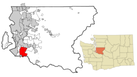 Location of Auburn in King County. | ||
 Auburn, Washington Location in the United States | ||
| Coordinates: 47°18′8″N 122°12′53″W / 47.30222°N 122.21472°WCoordinates: 47°18′8″N 122°12′53″W / 47.30222°N 122.21472°W | ||
| Country | United States | |
| State | Washington | |
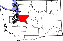
| Counties | King, Pierce | |
| Founded | June 13, 1891 | |
| Government | ||
| • Type | Mayor-Council | |
| • Mayor | Nancy Backus | |
| Area[1] | ||
| • Total | 29.89 sq mi (77.41 km2) | |
| • Land | 29.62 sq mi (76.72 km2) | |
| • Water | 0.27 sq mi (0.70 km2) | |
| Elevation | 82.62 ft (25 m) | |
| Population (2010)[2] | ||
| • Total | 70,180 | |
| • Estimate (2015)[3] | 77,006 | |
| • Rank | US: 441st | |
| • Density | 2,369.3/sq mi (914.8/km2) | |
| [4] | ||
| Time zone | PST (UTC-8) | |
| • Summer (DST) | PDT (UTC-7) | |
| ZIP codes | 98001, 98002, 98092, 98071 | |
| Area code(s) | 253 | |
| FIPS code | 53-03180 | |
| GNIS feature ID | 1511974[5] | |
| Website | www.auburnwa.gov | |
Auburn is a city in King County and additionally Pierce County, Washington, United States; with the majority of spatial land area within King County. The population was 70,180 at the 2010 United States Census.[6] Auburn is a suburb in the Seattle metropolitan area. Auburn is currently ranked the fourteenth largest city in the state of Washington.[7]
Auburn is bordered by the cities of Federal Way, Pacific, and Algona to the west, Sumner to the south, Kent to the north, and unincorporated King County to the east. The Muckleshoot Indian Reservation is in or near the southern city limits.[8]
History
Auburn was originally incorporated as Slaughter, Washington after Lt. William Slaughter, who died in a skirmish fighting Native Americans which are now apart of the modern day Muckleshoot tribe in 1855.[9] At the time, the main hotel in town was called the "Slaughter House." In 1893, a large group of settlers from Auburn, New York, moved to Slaughter, and renamed the town to "Auburn."[10] Due to this history, when Auburn was building its second high school in the mid-1990s, there was a grass-roots effort to name the high school "Slaughter High School," but it was eventually decided that the name would be "Auburn Riverside High School," whose mascots are the Ravens.
There are several locations in and around Auburn on the National and State Registers of Historic Places including the Neely Mansion.

The city of Auburn, located 28 miles (45 km)[11] south of Seattle, Washington, was home to some of the earliest settlers in King County. Nestled in a fertile river valley, Auburn has been both a farm community and a center of business and industry for more than 150 years. Auburn is located near the original confluence of the Green and White rivers, both of which contain runoff water from the Cascade Mountain range. The valley was originally the home of the Skopamish, Smalhkamish, and Stkamish Indian tribes. The first white men in the region were explorers and traders who arrived in the 1830s.
Settlers first came to the valley in the 1850s. In November, a military unit led by Lieutenant William Slaughter camped near what is now present-day Auburn.
A new treaty was written which provided the establishment of the Muckleshoot reservation, which is the only Indian reservation now within the boundaries of King County. The White River tribes collectively became known as the Muckleshoot tribe.
White settlers, the Neely and Ballard families began returning to the area. In 1891, the town of Slaughter incorporated. Although many older citizens considered the town's name as a memorial, many newer residents understandably felt uncomfortable with it. Within two years, the town was renamed Auburn, taken from the first line of Oliver Goldsmith's poem, The Deserted Village: "Sweet Auburn! Loveliest village of the plain."
Auburn had been a bustling center for hop farming until 1890 when the crops were destroyed by aphids. After that, the farms were mostly dairy farms and berry farms. Nevertheless, flooding was still a problem for Auburn farmers up until the Howard A. Hanson Dam was opened in 1962. This dam on the Green River, along with the Mud Mountain Dam on the White River, provided controlled river management, which left the valley nearly flood-free and opened up the rich bottom lands for industrial development.
Another impetus to Auburn's growth was the railroad. The Northern Pacific Railway's subsidiary the Northern Pacific and Puget Sound Shore Railroad opened a line from approximately Puyallup, Washington, through to Seattle, Washington, in 1882. The Seattle-Tacoma Interurban line that allowed easy access to both cities starting in 1902. The railroad, along with better roads, caused many new companies to set up business in Auburn, among them the Borden Condensery (which made Borden's Condensed Milk) and the Northern Clay Company.
Through the twentieth century Auburn grew like many American towns. Many young men went off to fight in the First World War, which was followed by the great influenza epidemic. The 1920s were prosperous for citizens, but the Great Depression of the 1930s left many in need. World War II brought great hardship to many local Japanese-American farmers when they were moved to internment camps and their land taken from them. At the same time, local boys were sent to fight in the Pacific, North Africa, and Europe. Many were wounded and some died in battle.
The post-war era was prosperous to Auburn, bringing more businesses and a community college to the city. In 1963, the Boeing Company built a large facility to mill sheet metal skin for jet airliners. As time went on, many farms disappeared as the land was converted to industrial use. In 1995, The SuperMall of the Great Northwest was built in the valley, bringing in consumers from all over the Puget Sound region.
Much of the city's transition from agricultural small town to industrial and suburban development remains. A monument in the memory of Lieutenant Slaughter, erected in 1918, still stands in a local park. The Neely Mansion, built by the son of a pioneer in 1891, has been refurbished and is listed on the National Register of Historic Places. Auburn's downtown still maintains a "Main Street U.S.A." appearance.
In 2008, Auburn nearly doubled its population by annexing the West Hill and Lea Hill neighborhood of unincorporated King County.
Geography
Auburn is located at 47°18′8″N 122°12′53″W / 47.30222°N 122.21472°W (47.302322, -122.214779).[12]
According to the United States Census Bureau, the city has a total area of 29.89 square miles (77.41 km2), of which, 29.62 square miles (76.72 km2) is land and 0.27 square miles (0.70 km2) is water.[1]
Two rivers, the White River and, to a greater extent, the Green River flow through Auburn.
Historically, the Stuck River ran through the settlement of Stuck, which is now a small pocket of unincorporated King County within southern Auburn. In 1906, the flow of the White River was diverted into the Stuck's channel near today's Game Farm Park.[13] References to the Stuck River still appear in some property legal descriptions and place names, e.g. Stuck River Drive, within Auburn, but today it is essentially indistinguishable from the southern White River.[14]
Geographic location of Auburn
 |
Kent | Kent | Covington | |
| Federal Way | |
Black Diamond | ||
| ||||
| | ||||
| Algona/Pacific | Sumner | Enumclaw |
Parks
Auburn has an extensive system of parks, open space and urban trails consisting of 28 developed parks, over 23 miles of trails (including Auburn's 4.5 mile portion of the Interurban Trail for bikers, walkers, runners and skaters), and almost 247 acres of open space for passive and active recreation.
Environmental Park
The Auburn Environmental Park (AEP) is an innovative project that seeks to create a regionally significant open space in an urbanized area that offers opportunities for wetland ecosystem restoration, fish and wildlife enhancement, water quality improvement, economic development, stormwater detention and flood control, public education, and recreation. The AEP is an approximately 120-acre area that is bounded by 15th Street NW to the north, the Interurban Trail to the east, West Main Street to the south and State Route 167 to the west.
Auburn's records and averages
| Climate data for Auburn, Washington | |||||||||||||
|---|---|---|---|---|---|---|---|---|---|---|---|---|---|
| Month | Jan | Feb | Mar | Apr | May | Jun | Jul | Aug | Sep | Oct | Nov | Dec | Year |
| Record high °F (°C) | 64 (18) |
71 (22) |
81 (27) |
86 (30) |
92 (33) |
100 (38) |
99 (37) |
99 (37) |
96 (36) |
86 (30) |
74 (23) |
69 (21) |
100 (38) |
| Average high °F (°C) | 47 (8) |
51 (11) |
55 (13) |
61 (16) |
67 (19) |
72 (22) |
77 (25) |
78 (26) |
72 (22) |
62 (17) |
52 (11) |
46 (8) |
61.7 (16.5) |
| Average low °F (°C) | 35 (2) |
36 (2) |
39 (4) |
42 (6) |
47 (8) |
52 (11) |
55 (13) |
55 (13) |
51 (11) |
44 (7) |
39 (4) |
35 (2) |
44.2 (6.9) |
| Record low °F (°C) | −10 (−23) |
−5 (−21) |
10 (−12) |
25 (−4) |
27 (−3) |
33 (1) |
38 (3) |
34 (1) |
28 (−2) |
24 (−4) |
−1 (−18) |
3 (−16) |
−10 (−23) |
| Average precipitation inches (mm) | 5.3 (135) |
4.5 (114) |
4.1 (104) |
2.9 (74) |
2.1 (53) |
1.7 (43) |
0.9 (23) |
1.2 (30) |
1.8 (46) |
3.4 (86) |
6.1 (155) |
5.8 (147) |
37.1 (942) |
| Source: Weather.com[15] | |||||||||||||
Transportation

Auburn has many large roads nearby and within city limits, including Washington State Route 167 commonly referred as the "Valley Freeway," and Washington State Route 18. Auburn also has its own Transit Center, Auburn (Sounder station) in downtown, making it a central gateway key to access with Sound Transit to the entire Puget Sound area. Sound Transit buses connect the Auburn Transit Center directly to the Federal Way, Sumner, & Kent Transit Centers, while King County Metro buses connect the Transit Center to Green River Community College, the Super Mall, and Auburn Way.
Sounder Transit Rail allows the commuter to get to Downtown Seattle in 25 minutes or less, and to Hwy 512 S. of Tacoma in less than 35 minutes, bypassing the rush hour gridlock of the area's streets and highways.
Until 1987 Auburn was also the home for a steam locomotive roundhouse and diesel engine house of the Northern Pacific Railway, the BNSF Railway of today. BNSF maintains a rail yard and small car repair facility, along with maintenance-of-way facilities at the former NP yard.[16] In addition, the Auburn Municipal Airport serves the general aviation community.[17]
Demographics
| Historical population | |||
|---|---|---|---|
| Census | Pop. | %± | |
| 1890 | 740 | — | |
| 1900 | 489 | −33.9% | |
| 1910 | 957 | 95.7% | |
| 1920 | 3,163 | 230.5% | |
| 1930 | 3,906 | 23.5% | |
| 1940 | 4,211 | 7.8% | |
| 1950 | 6,497 | 54.3% | |
| 1960 | 11,933 | 83.7% | |
| 1970 | 21,653 | 81.5% | |
| 1980 | 26,417 | 22.0% | |
| 1990 | 33,102 | 25.3% | |
| 2000 | 40,314 | 21.8% | |
| 2010 | 70,180 | 74.1% | |
| Est. 2015 | 77,006 | [18] | 9.7% |
| U.S. Decennial Census[19] 2015 estimate[3] | |||
2010 census
As of the census[2] of 2010, there were 70,180 people, 26,058 households, and 17,114 families residing in the city. The population density was 2,369.3 inhabitants per square mile (914.8/km2). There were 27,834 housing units at an average density of 939.7 per square mile (362.8/km2). The racial makeup of the city was 70.5% White, 4.9% African American, 2.3% Native American, 8.9% Asian, 1.6% Pacific Islander, 6.3% from other races, and 5.4% from two or more races. Hispanic or Latino of any race were 12.9% of the population.
There were 26,058 households of which 36.2% had children under the age of 18 living with them, 46.7% were married couples living together, 13.0% had a female householder with no husband present, 5.9% had a male householder with no wife present, and 34.3% were non-families. 25.6% of all households were made up of individuals and 7.9% had someone living alone who was 65 years of age or older. The average household size was 2.67 and the average family size was 3.22.
The median age in the city was 34.4 years. 25.9% of residents were under the age of 18; 10.5% were between the ages of 18 and 24; 27.9% were from 25 to 44; 25.5% were from 45 to 64; and 10.2% were 65 years of age or older. The gender makeup of the city was 49.4% male and 50.6% female.
2000 census
As of the census of 2000, there were 40,314 people, 16,108 households, and 10,051 families residing in the city. The population density was 1,895.9 per square mile (732.1/km²). There were 16,767 housing units at an average density of 788.5 per square mile (304.5/km²). The racial makeup of the city was 82.80 percent White, 2.42 percent African American, 2.54 percent Native American, 3.50 percent Asian, 0.51 percent Pacific Islander, 3.66 percent from other races, and 4.56 percent from two or more races. Hispanic or Latino of any race were 7.49 percent of the population.
There were 16,108 households out of which 32.8 percent had children under the age of eighteen living with them, 43.7 percent were married couples living together, 13.4 percent had a female householder with no husband present, and 37.6 percent were non-families. 29.1 percent of all households were made up of individuals and 9.1 percent had someone living alone who was 65 years of age or older. The average household size was 2.47 and the average family size was 3.05.
In the city the population was spread out with 26.6 percent under the age of eighteen, 9.5 percent from eighteen to 24, 31.6 percent from 25 to 44, 20.7 percent from 45 to 64, and 11.6 percent who were 65 years of age or older. The median age was 34 years. For every 100 females there were 98.5 males. For every 100 females age 18 and over, there were 95.5 males.
The median income for a household in the city was $39,208, and the median income for a family was $45,426. Males had a median income of $36,977 versus $27,476 for females. The per capita income for the city was $19,630. About 10.2 percent of families and 12.8 percent of the population were below the poverty line, including 15.3 percent of those under age 18 and 8.8 percent of those age 65 or over.
Neighborhoods

- Downtown—Historic buildings with a Main Street USA appearance, also many Craftsman-style houses from the 1920s.
- North Auburn—A mix of commercial and single-family housing separated by Auburn Way North.
- River's Bend—A small residential neighborhood nestled along the Green River, located at the bottom of Lea Hill in North Auburn.
- Christopher/Thomas—An area in North Auburn roughly bordered by the Valley Drive Inn and 227th Street. Both are former farming towns annexed into the city in the 1960s.
- Lea Hill, Washington—A mainly residential neighborhood east of the valley, annexed into the city in 2007. Green River Community College is located here.
- Hazelwood—The area on Lea Hill between Green River Community College, and Auburn Mountainview High School. Once a town in the late nineteenth century.
- West Valley—A commercial and industrial area on the west side of SR 167, located on the bottom of West Hill.
- West Hill—Located on the West Hill, bordered by the city of Federal Way to the west.
- South Auburn—A general area located south of downtown, once a low-income area but becoming a commercial zone.
- Terminal Park—An area of middle class housing near the end of the rail yard named for the railroad workers who lived there.
- Forest Villa—Mainly residential area located in the Game Farm Park area.
- Lakeland Hills—A master-planned community sprawling on a large hillside at the southern end of the city on both sides of King and Pierce counties.
- Hidden Valley—A planned development located East of Lakeland Hills overlooking North Lake Tapps.
- Muckleshoot Area—The general area of the Muckleshoot Indian Reservation.
Government
The city of Auburn is a mayor-council form of government meaning the mayor is a full-time, separately elected position. The current Mayor is Nancy Backus, who was elected in 2013 and is the first female to serve in the office since Auburn was incorporated in 1891. Backus served on the Auburn City Council since 2003 and spent the last two years as deputy mayor. In her most recent assignments as a councilmember, she served as Chair of Planning and Community Development, Council Operations, Committee of the Whole, and was Chair of the Finance Committee for nine years. She has spent the last 24 years at the Boeing Company in finance and accounting roles and left her role of Financial Operations Manager for the company's Commercial Airplane Group to take the office of mayor.
Auburn Council members
- Largo Wales, Deputy Mayor
- Bob Baggett
- Claude DaCorsi
- John Holman
- Bill Peloza
- Yolanda Trout
- Rich Wagner
Auburn is the site for the Northwest headquarters of United States General Services Administration.
Auburn is home to one of the largest Veterans Day events of its kind. Auburn, Washington is designated by the Veterans Day National Committee and the US Department of Veterans Affairs as a Regional Site for celebration of Veterans Day.
Auburn Police Department
See Auburn Police Department (Washington)
Annexation
Using King County's Annexation Initiative, Auburn annexed Lea Hill and West Hill in 2008. With the annexation, the city grew in population from 40,314 to 68,000 and increased its land area from 21.26 to 29.89 sq mi.[21][22]
Boeing
The Auburn Boeing Plant, opened in 1966, is the largest airplane parts plant in the world with 2,100,000 square feet (200,000 m2) and 1,265,000 parts being manufactured each year.[23] With over 5,000 employees, the Boeing plant is the third major employer in Auburn.
Crime
According to the Uniform Crime Report statistics compiled by the Federal Bureau of Investigation (FBI) in 2012, there were 248 violent crimes and 3,985 property crimes per 100,000 residents. Of these, the violent crimes consisted of six murders, 23 forcible rapes, 110 robberies and 109 aggravated assaults, while 984 burglaries, 2,415 larceny-thefts, 586 motor vehicle thefts and 18 arson defined the property offenses.[24]
Economy
Top employers
According to Auburn's 2011 Comprehensive Annual Financial Report,[25] the top employers in the city are:
| # | Employer | # of Employees |
|---|---|---|
| 1 | Boeing | 5,179 |
| 2 | Muckleshoot Tribal Enterprises | 2,500 |
| 3 | Auburn School District | 1,800 |
| 4 | The Outlet Collection Seattle | 1,700 |
| 5 | Green River Community College | 1,600 |
| 6 | Auburn Medical Center | 805 |
| 7 | Emerald Downs | 678 |
| 8 | Safeway | 650 |
| 9 | Social Security Administration | 600 |
| 10 | Federal Aviation Administration | 500 |
| 10 | General Services Administration | 500 |
| 10 | Zones, Inc. | 500 |
Recreation and entertainment
The Outlet Collection Seattle
The Outlet Collection Seattle, formerly SuperMall of the Great Northwest, is an outlet mall which opened in 1995.
Muckleshoot Casino & Bingo
Muckleshoot Casino & Bingo, commonly known for its slogan, "The Biggest and Best in the Northwest!" is a Native American-run casino, located on the Muckleshoot Reservation.[26] In addition to being one of the largest casinos in the Pacific Northwest, it is one of the few left in the state that allows smoking. All money made in the casino directly benefits the Muckleshoot Tribal Community, providing education and low-cost health care for tribal residents and the Auburn Community and others through charitable donations.
Emerald Downs Racetrack
Washington’s only Class One thoroughbred racetrack. A 167-acre (0.68 km2) facility. Emerald Downs' six-level stadium is focused on the finish line.[27] The racetrack is professionally operated on land purchased by the Muckleshoot in 2002.
White River Valley Museum
The White River Valley Museum’s exhibits feature Auburn, from Native American history to the 1920s. They focus on the Muckleshoot Indian Tribe, pioneer life, immigration from Europe and Japan, truck farming, railroading and the building of towns throughout the area. Visitors can visit a recreation of a pioneer cabin, climb aboard a Northern Pacific Railway caboose, and investigate a recreation of the shops in 1924 downtown Auburn.[28]
White River Amphitheater
The White River Amphitheater is a 20,000-seat venue, located about 3 miles east of the city limits
Auburn Parks, Arts & Recreation
Auburn has an extensive system of parks, open space and urban trails: 28 developed parks, over 23 miles of trails (including Auburn's 4.5 mile portion of the Inter-urban Trail for bikers, walkers, runners and skaters), and almost 247 acres of open space for passive and active recreation. The City of Auburn also offers a variety of cultural arts programming for performing arts, visual arts, public art, special events and more! And the City's recreation division provides opportunities for the public to participate in diverse recreational programs and activities. These programs include preschool, youth, teen, and adult leisure programs; youth, teen, and adult athletics; fitness and wellness programs; programs designed to provide social and recreational opportunities to senior citizens and those with special needs, and a host of special events suitable for the entire family and community at large. The recreation division also offers a gymnasium for open gym and organized activities, and several options for facility rentals, including buildings, picnic shelters, and fields.
Famous past/present residents
- Christine Gregoire grew up in Auburn, she attended both Cascade Middle School, and Auburn Senior High School. Gregoire is the former Governor of Washington.
- Dave Reichert is former King County Sheriff and a current representative from Washington's 8th congressional district. Reichert was in charge of the task force responsible for the search and capture of the Green River Killer.
- Greg Haugen was born and raised in Auburn, and grew up to become a professional boxer. He gained four championship belts and holds record for highest number in attendance for a single fight against Julio César Chávez.
- Commander Dick Scobee, attended school and briefly lived in Auburn, where his father Frank was a road foreman of engines for the Northern Pacific Railway. Dick attended Washington Elementary in Auburn. North Auburn Elementary was the school chosen to be named after him after the Space Shuttle Challenger accident.
- Blair Rasmussen, a professional basketball player, who was selected in the first round (fifteenth overall) in the 1985 NBA Draft by the Denver Nuggets.
- Minoru Yamasaki, designer of the World Trade Center, destroyed on September 11, 2001. Minoru also designed the Pacific Science Center Pavilion during the 1962 World's Fair in Seattle.
- Danny Shelton, professional American football player with the Cleveland Browns. He was drafted in the first round (12th overall) in the 2015 NFL Draft. He attended and played for Auburn Senior High School and the University of Washington.
- D. C. Simpson, a comic artist who created the Ozy and Millie online comics.
- Sir Mix-A-Lot, a pioneering hip hop artist made famous with the track Baby Got Back.
- Cam Gigandet, an actor best known from the movie Never Back Down as Ryan, as well as a vital role in the movie Twilight.
- Misty Upham, a Native American actress best known from the movie Frozen River, was raised in Auburn.
Education


In addition to the Auburn School District, Green River Community College also resides in Auburn, atop Lea Hill. Currently the Auburn School District has fourteen elementary schools, four middle schools and three high schools, making twenty-two schools in all. The district's newest school is Auburn High School. The district is larger than the city itself, serving the neighboring towns of Algona and Pacific, as well as some unincorporated areas around Auburn and Kent.
High schools
ASD has 3 primary High Schools[29]
School Location Mascot Colors Approx.
StudentsAuburn High School Auburn Trojans Green/Gold 1,476 Auburn Riverside High School Auburn Ravens Navy/Teal/Silver 1,579 Auburn Mountainview High School Auburn Lions Blue/Orange 1,472
Private, and alternative High Schools
School Location Mascot Colors Approx.
StudentsWest Auburn Secondary High School Auburn Wolves Silver/Black 275 Auburn Adventist Academy Auburn Falcons Blue/Gold 310 Rainier Christian High School Auburn Lions Blue/Orange 130
Middle schools 6-8
- Cascade MS
- Cascade Middle School is located in North Auburn, and has a student population of 750. Cascade's mission statement is "Spartan Excellence: Everyone, Everyday, Everywhere." Their mascots are the Spartans.
- Mt. Baker MS
- Mt. Baker Middle School is located in the Southwest Region of Auburn. It has about 900 students.
- Olympic MS
- Olympic Middle School is located in South Auburn and has about 700 students.
- Rainier MS
- Rainier Middle School is situated on Lea Hill and has about 900 students. Their mascot is the panther.
Elementary schools K-5
- Alpac ES, Located in Pacific, Washington - Opened in 1973 and named for the cities of Algona and Pacific. Originally an open classroom concept school, but converted to standard classroom ideals in 1983.
- Chinook ES - Opened in 1963 and named for the nearby White River Fish Hatchery. Located on the Muckleshoot Indian Reservation.
- Dick Scobee ES - Dick Scobee Elementary opened in 1959 as North Auburn Elementary and was renamed for the famed astronaut and Auburn High School graduate who died as commander of the Space Shuttle Challenger.
- Evergreen Heights ES - Opened in 1970, located on the West Hill of Auburn.
- Gildo Rey ES - Opened in 1969, under the name of South Auburn Elementary and was renamed in 1976 in honor of a longtime faculty member, Gildo Rey.
- Rainier Christian Schools- Kent View , Located in Auburn, Washington - Opened on September 1, 2005 after buying the property from Thomas Academy. Rainier Christian Schools Kentview campus K-12 also houses Little People Pre-School.
- Hazelwood ES - Opened 1990, on Auburn's Lea Hill.
- Ilalko ES- Opened 1992. Named after a Native American village, the word "Ilalko" means "Striped Water."
- Lakeland Hills ES - Auburn's largest Elementary school, opened in the Lakeland Hills community 2006.
- Lake View ES- Opened in 1980.
- Lea Hill ES - Opened in 1965 as one of only 11 schools in the United States designated as a National Educational landmark by the National Park Service.
- Pioneer ES- Opened in 1950.
- Terminal Park ES - opened in 1945 and it was named for the terminal end of the railroad and the neighborhood where the rail workers lived, Terminal Park.
- Washington ES - The oldest Elementary school in Auburn, located next to Auburn High School, originally opened in 1920, was demolished and re-built in 1970.
- Arthur Jacobsen ES - Opened in 2007, on the former Jacobsen Tree farm and on the lower portion of Auburn Mountainview's campus. "AJ" is currently the youngest school in the Auburn School District.
Events
- Auburn Good Ol' Days
- Veterans Day Parade and Observance
- Clean Sweep
- KidsDay
- 4th of July Festival
- Petpalooza
- S'more Than You Imagined
- Santa Parade
City landmarks
The City of Auburn has designated the following landmarks:
| Landmark | Built | Listed | Address | Photo |
|---|---|---|---|---|
| Auburn Masonic Temple,[30] | 1923-24 | 2002 | 302-310 E. Main Street |  |
| Auburn Post Office[30] | 1937 | 2000 | 20 Auburn Avenue NE |  |
| Auburn Public Library[30] | 1914 | 1995 | 306 Auburn Avenue NE |  |
| Olson Farm[30] | 1897–1902 | 1995, 2000 | 28728 Green River Road S |
Image gallery
-

A Union Pacific train passing downtown.
-

Emerald Downs seating.
-

The old JC Penney's building, downtown.
-

A view from Centennial Viewpoint Park, looking towards Mt. Rainier and the Valley floor.
-

Masonic Temple in Auburn.
-

Former Auburn Post Office.
-

Lifegate Auburn Foursquare Church.
-

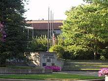
Auburn Justice Center.
Sister cities
Auburn has five sister cities -- Kent, Washington, neighboring them to the north, and Tamba, a city in the Hyōgo prefecture of Japan. The three cities participate in an annual student exchange program, as well as a summer Youth Ambassador program, and "official governmental, people-to-people, recreational, cultural, and business exchanges." The Other cities are Pyeongchang, Korea, which Auburn has a friendship exchange agreement with, and Guanghan, China, Sichuan Province in which Auburn also has a friendship exchange. In 2012 the city of Auburn established a formal sister cities agreement with Mola di Bari, Italy[31]
References
- 1 2 "US Gazetteer files 2010". United States Census Bureau. Archived from the original on January 24, 2012. Retrieved 2012-12-19.
- 1 2 "American FactFinder". United States Census Bureau. Retrieved 2012-12-19.
- 1 2 "Population Estimates". United States Census Bureau. Retrieved June 15, 2016.
- ↑ "2010 Census Redistricting Data (Public Law 94-171) Summary File". American FactFinder. United States Census Bureau. Archived from the original on July 21, 2011. Retrieved 2013-02-24.
- ↑ "Auburn". Geographic Names Information System. United States Geological Survey.
- ↑ "ANNEXATION". Archived from the original on 2008-10-09. Retrieved 2013-02-24.
- ↑ "Office of Financial Management" (PDF). Ofm.wa.gov. Archived (PDF) from the original on 30 April 2010. Retrieved 2010-05-02.
- ↑ "Muckleshoot Area Vicinity Map". muckleshoot.nsn. Muckleshoot Tribe. Retrieved 6 January 2015.
- ↑ Wilma, David (1999-10-17). "the Free Online Encyclopedia of Washington State History". HistoryLink.org. Retrieved 2013-02-24.
- ↑ "Auburn Real Estate". Archived from the original on 2008-05-16. Retrieved 2013-02-24.
- ↑ http://goo.gl/maps/LzrOL
- ↑ "US Gazetteer files: 2010, 2000, and 1990". United States Census Bureau. 2011-02-12. Retrieved 2011-04-23.
- ↑ "White River Valley Museum". Wrvmuseum.org. Retrieved 2010-05-02.
- ↑ http://www5.metrokc.gov/reports/property_report.asp?PIN=6655000025[]
- ↑ "Monthly Averages for Seattle, WA". The Weather Channel. Archived from the original on 6 November 2007. Retrieved 2007-09-28.
- ↑ "Northern Santa Fe central roundhouse". Content-dev.lib.washington.edu. Retrieved 2010-05-02.
- ↑ "Welcome to S50 Auburn Municipal Airport near Seattle and Tacoma Washington (WA)". S50wa.com. Retrieved 2010-05-02.
- ↑ "Annual Estimates of the Resident Population for Incorporated Places: April 1, 2010 to July 1, 2015". Retrieved July 2, 2016.
- ↑ "U.S. Decennial Census". Census.gov. Archived from the original on May 11, 2015. Retrieved May 24, 2014.
- ↑ "City Councilmembers". www.auburnwa.gov. City of Auburn. Retrieved 29 July 2015.
- ↑ "King County Annexation Initiative Auburn Lea Hill and Auburn West Hill". Retrieved 2013-02-24.
- ↑ "Community Profile". Archived from the original on 2012-07-11. Retrieved 2013-02-24.
- ↑ "Boeing Frontiers Online Source". Retrieved 2013-02-24.
- ↑ "Washington – Offenses Known to Law Enforcement by State by City, 2012". Federal Bureau of Investigation. 2012. Retrieved May 24, 2014.
- ↑ City of Auburn CAFR
- ↑ "Washington Casinos, Seattle Area Casinos - Muckleshoot Casino". Retrieved 2013-02-24.
- ↑ "Emerald Downs". Retrieved 2013-02-24.
- ↑ "White River Valley Museum website". Wrvmuseum.org. Retrieved 2010-05-02.
- ↑ "About Us". Auburn School District. Retrieved 4 January 2015.
- 1 2 3 4 "King County and Local Landmarks List". 2015-12-29.
- ↑ "Sister City Program". auburnwa.gov. City of Auburn. Retrieved 28 July 2015.
External links
| Wikimedia Commons has media related to Auburn, Washington. |
- City of Auburn Government - City of Auburn Government Portal
- White River Valley Museum - White River Valley Museum
- Auburn Tourism Site - Auburn Tourism Site
Municipalities and communities of King County, Washington, United States | ||
|---|---|---|
| Cities |
|  |
| Towns | ||
| CDPs |
| |
| Unincorporated communities | ||
| Indian reservation | ||
| Ghost towns | ||
| Footnotes | ‡This populated place also has portions in an adjacent county or counties | |
Municipalities and communities of Pierce County, Washington, United States | ||
|---|---|---|
| Cities | 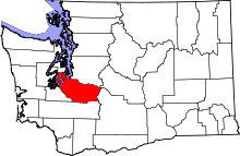 | |
| Towns | ||
| CDPs |
| |
| Other unincorporated communities | ||
| Indian reservation | ||
| Military bases | ||
| Ghost towns | ||
| Footnotes | ‡This populated place also has portions in an adjacent county or counties | |