Norwood, Pennsylvania
| Norwood, Pennsylvania | |
| Borough | |
 Corner of Winona and Chester | |
| Country | United States |
|---|---|
| State | Pennsylvania |
| County | Delaware |
| Elevation | 82 ft (25.0 m) |
| Coordinates | 39°53′18″N 75°17′50″W / 39.88833°N 75.29722°WCoordinates: 39°53′18″N 75°17′50″W / 39.88833°N 75.29722°W |
| Area | 0.8 sq mi (2.1 km2) |
| - land | 0.8 sq mi (2 km2) |
| - water | 0.04 sq mi (0 km2), 5% |
| Population | 5,890 (2010) |
| Density | 7,579.0/sq mi (2,926.3/km2) |
| Timezone | EST (UTC-5) |
| - summer (DST) | EDT (UTC-4) |
| ZIP code | 19074 |
| Area code | 610 and 484 |
| FIPS code | 42-55664 |
| GNIS feature ID | 1182691 |
 Location of Norwood in Delaware County | |
 Location of Norwood in Pennsylvania | |
 Location of Pennsylvania in the United States | |
| Website: www | |
Norwood is a borough in Delaware County, Pennsylvania, United States. The population was 5,890 at the 2010 census.[1]
History
The Morton Morton House was listed on the National Register of Historic Places in 2000.[2]
 Morton Morton House
Geography
Norwood is located in southeastern Delaware County at 39°53′18″N 75°17′50″W / 39.88833°N 75.29722°W (39.888312, -75.297178).[3] It is bordered to the northeast by Glenolden, to the east by Folcroft, to the south by Tinicum Township, to the west by Prospect Park, and to the west and north by Ridley Township. U.S. Route 13 (Chester Pike) is the main road through the borough, leading northeast 10 miles (16 km) to Center City Philadelphia and southwest 4.5 miles (7.2 km) to Chester.
According to the United States Census Bureau, Norwood has a total area of 0.81 square miles (2.1 km2), of which 0.77 square miles (2.0 km2) is land and 0.04 square miles (0.1 km2), or 4.54%, is water.[1]
Demographics
| Historical population | |||
|---|---|---|---|
| Census | Pop. | %± | |
| 1880 | 194 | — | |
| 1900 | 1,286 | — | |
| 1910 | 1,668 | 29.7% | |
| 1920 | 2,353 | 41.1% | |
| 1930 | 3,878 | 64.8% | |
| 1940 | 3,921 | 1.1% | |
| 1950 | 5,246 | 33.8% | |
| 1960 | 6,729 | 28.3% | |
| 1970 | 7,229 | 7.4% | |
| 1980 | 6,647 | −8.1% | |
| 1990 | 6,162 | −7.3% | |
| 2000 | 5,985 | −2.9% | |
| 2010 | 5,890 | −1.6% | |
| Est. 2015 | 5,898 | [4] | 0.1% |
| Sources:[5][6][7] | |||
As of the census[6] of 2000, there were 5,985 people, 2,286 households, and 1,536 families residing in the borough. The population density was 7,484.3 people per square mile (2,888.5/km²). There were 2,363 housing units at an average density of 2,955.0 per square mile (1,140.4/km²). The racial makeup of the borough was 97.56% White, 1.10% African American, 0.05% Native American, 0.70% Asian, 0.18% from other races, and 0.40% from two or more races. Hispanic or Latino of any race were 0.74% of the population.
There were 2,286 households, out of which 33.2% had children under the age of 18 living with them, 51.3% were married couples living together, 12.4% had a female householder with no husband present, and 32.8% were non-families. 28.3% of all households were made up of individuals, and 9.9% had someone living alone who was 65 years of age or older. The average household size was 2.62 and the average family size was 3.26.
In the borough the population was spread out, with 26.3% under the age of 18, 7.7% from 18 to 24, 32.5% from 25 to 44, 21.5% from 45 to 64, and 12.0% who were 65 years of age or older. The median age was 36 years. For every 100 females there were 94.0 males. For every 100 females age 18 and over, there were 90.8 males.
The median income for a household in the borough was $47,043, and the median income for a family was $54,983. Males had a median income of $41,667 versus $28,315 for females. The per capita income for the borough was $20,513. About 4.6% of families and 7.6% of the population were below the poverty line, including 8.5% of those under age 18 and 10.4% of those age 65 or over.
Notable people
- Bill Foster, former Duke basketball coach; Lawrence Griffin Platt great grandson of Medal of Honor recipient, George C. Platt and award winning writer of The Secret from the Heart.
References
- 1 2 "Geographic Identifiers: 2010 Demographic Profile Data (G001): Norwood borough, Pennsylvania". U.S. Census Bureau, American Factfinder. Retrieved December 28, 2015.
- ↑ National Park Service (2010-07-09). "National Register Information System". National Register of Historic Places. National Park Service.
- ↑ "US Gazetteer files: 2010, 2000, and 1990". United States Census Bureau. 2011-02-12. Retrieved 2011-04-23.
- ↑ "Annual Estimates of the Resident Population for Incorporated Places: April 1, 2010 to July 1, 2015". Retrieved July 2, 2016.
- ↑ "Census of Population and Housing". U.S. Census Bureau. Retrieved 11 December 2013.
- 1 2 "American FactFinder". United States Census Bureau. Retrieved 2008-01-31.
- ↑ "Incorporated Places and Minor Civil Divisions Datasets: Subcounty Resident Population Estimates: April 1, 2010 to July 1, 2012". Population Estimates. U.S. Census Bureau. Retrieved 11 December 2013.
External links
Municipalities and communities of Delaware County, Pennsylvania, United States | ||
|---|---|---|
| City | 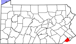 | |
| Boroughs | ||
| Townships | ||
| CDPs | ||
| Unincorporated communities |
| |
| Footnotes | ‡This populated place also has portions in an adjacent county or counties | |