Media, Pennsylvania
| Media, Pennsylvania | ||
| Borough | ||
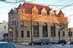 Bank building on State Street | ||
|
||
| Nickname: Everybody's Hometown | ||
| Country | United States | |
|---|---|---|
| State | Pennsylvania | |
| County | Delaware | |
| Elevation | 299 ft (91.1 m) | |
| Coordinates | 39°55′08″N 75°23′17″W / 39.91889°N 75.38806°WCoordinates: 39°55′08″N 75°23′17″W / 39.91889°N 75.38806°W | |
| Area | 0.8 sq mi (2.1 km2) | |
| - land | 0.8 sq mi (2 km2) | |
| - water | 0.0 sq mi (0 km2) | |
| Population | 5,327 (2010) | |
| Density | 7,016.3/sq mi (2,709.0/km2) | |
| Incorporated | 1850 | |
| Mayor | Robert A. McMahon | |
| Timezone | EST (UTC-5) | |
| - summer (DST) | EDT (UTC-4) | |
| ZIP codes | 19063, 19065, 19091 | |
| Area code | 610 and 484 | |
| FIPS code | 42-48480 | |
| GNIS feature ID | 1180858 | |
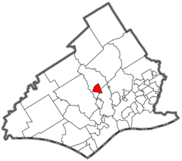 Location of Media in Delaware County
| ||
 Location of Media in Pennsylvania
| ||
| Website: www | ||


The borough of Media is the county seat of Delaware County, Pennsylvania[1] and is located 13 miles (21 km) west of Philadelphia. Media was incorporated in 1850 at the same time that it was named the county seat.[2] The population was 5,327 at the 2010 census,[3] down from 5,533 at the 2000 census. Its school district is the Rose Tree Media School District with Penncrest High School and Springton Lake Middle School. In June 2006, it became the first fair trade town in America.[4]
The history of the area goes back to William Penn, but the area remained predominantly rural until the twentieth century.[5] The Delaware County Institute of Science was founded in Media in 1833, while the Pennsylvania Institute of Technology, a two-year technical college; Williamson College of the Trades , a three-year technical college; and Delaware County Community College, a two-year liberal arts college, are located nearby. Media promotes itself as "Everybody's Hometown".
History
Land in the area was sold and settled soon after William Penn was named proprietor of the colony of Pennsylvania in 1681 by King Charles II of England. Peter and William Taylor bought the land where Media is now located, directly from Penn.[6] At the time, the land was located in Chester County. Providence Township was organized in 1684, and later divided into Upper Providence and Nether Providence townships by 1690, even though they only had 40 taxable properties at the time.[7][8] The current borough, formed in 1850, sits between the two townships.
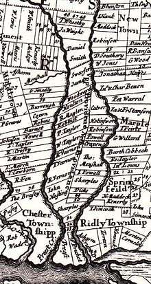
In 1683, the Court of Chester County approved the construction of "Providence Great Road" (now Pennsylvania Route 252). The road, which runs north from Chester to within a few blocks of today's downtown, is shown on a 1687 map along with the names of local landowners.[9] It forms the eastern border of the borough.
Thomas Minshall, a Quaker, was an early Media resident, settling just outside the small village then known as "Providence", along the Providence Great Road. The village then included a tailor shop, blacksmith shop, wheelwright shop, barn and other buildings.[10]
Minshall bought 625 acres (253 ha) from William Penn and arrived in 1682. The Providence Friends Meeting was established at his house in February 1688, and a meetinghouse was later built on land he donated for the purpose. The original meetinghouse was built out of logs in 1699 or 1700, and the current building dates to 1814. A house on Minshall's property, built c. 1750, still stands and was given to the citizens of the borough in 1975.[11]
Chester County, Pennsylvania was divided in 1789, the eastern portion becoming Delaware County, Pennsylvania. The area in the center of the new county remained rural through 1850. On March 11, 1850, the Commonwealth of Pennsylvania by Special Act of Assembly incorporated the Borough of Media, and made the sale of malt and spirituous liquors unlawful within its borders. At the same time, the county seat of Delaware County was moved to Media from Chester. The borough was formed from four farms purchased by the county, totaling only 480 acres (190 ha). The borders of the borough have not changed since that time.[12]
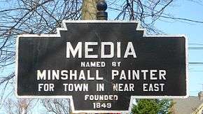
Streets were plotted in a rectangular grid around the location of the new courthouse, lots were sold at public auctions, and the construction of houses began. Sources agree that Minshall Painter, a descendant of Thomas Minshall, suggested the name "Media", but do not agree on the reason. The name most likely comes from the borough's central location in Delaware County.[13]
The John J. Tyler Arboretum occupies part of Thomas Minshall's original 625 acres (253 ha). This farm was used by the Underground Railroad.[14] The land was donated to a public trust in 1944 by an eighth-generation descendant. The arboretum was started as a private collection by brothers Jacob and Minshall Painter. In 1825, they began systematically planting over 1,000 varieties of trees and shrubs. Over 20 of their original trees survive, including a giant sequoia.[15]

Minshall Painter was also a leader of the Delaware County Institute of Science, which was formed on September 21, 1833, with just four other members: George Miller, John Miller, George Smith, M.D., and John Cassin. The institute was incorporated in 1836. About 1850, Painter gave the institute the land where its building currently stands at 11 Veterans Square, and the building was constructed in 1867.[16]
In the second half of the 19th century, Media was a summer resort for well-to-do Philadelphians. The borough's large vacation hotels included the Idlewild Hotel (1871) on Lincoln Street at Gayley Terrace, Chestnut Grove House or "The Colonial" (1860) on Orange Street, and Brooke Hall on Lemon Street and Washington Avenue (now Baltimore Avenue). The Chestnut Grove was used for a year by nearby Swarthmore College due to a fire on its campus.[17]
The West Chester and Philadelphia Railroad was built through Media on October 19, 1854. Electrified service was opened on December 2, 1928. Up to 50 trains passed through each day. The railroad became part of the Philadelphia, Wilmington and Baltimore Railroad and eventually the Penn Central. SEPTA took over operations in 1983. Woodrow Wilson spoke at the Media Station in 1912 during his first election campaign. Trolley transportation lines spread to and through Media in the 1890s and early 1900s.[18][19]

The Media Theatre opened as a vaudeville house in 1927.[20] The first 'talkie' film, The Jazz Singer, was shown there. It remained a popular cinema through the 1970s and 1980s. In 1994, the theater underwent a $1 million restoration by Walter Strine Sr. and re-opened as the 'Media Theatre for the Performing Arts'.[21] Shows produced there have included The Full Monty, Carousel and Miss Saigon.
On March 8, 1971, the Citizens' Commission to Investigate the FBI raided an FBI "resident agency" in Media. They later released thousands of documents to major newspapers around the country. These documents revealed FBI tactics, like the recruitment of Boy Scouts as informants, and confirmed for the first time the existence of COINTELPRO, an FBI program to "expose, disrupt, misdirect, discredit, or otherwise neutralize" dissident groups in the United States.[22]
In June 2006, Media became the first town in the United States to follow over 300 towns in Europe in attaining fair trade certification. To meet the criteria for certification, Media passed a council resolution in support of fair trade, served fair-trade coffee and tea in local government meetings and offices, ensured that a range of fair-trade products were available in local restaurants and businesses, raised popular support and provided media coverage for the fair-trade campaign, and convened a fair-trade steering committee to ensure continued commitment.[23]
 | |
|
| |
|
|
Local historic districts
Three locally recognized historic districts were designated by the borough in 1975.[24] These districts are
- Courthouse Square, from Olive to Orange Streets between 2nd and Jasper Streets.
- Lemon Street, from Baker to Front Streets.
- Providence Friends' Meeting House District, from Front to 2nd including the meetinghouse to Haldeman.[24][25]
Landmarks

- Minshall House (c.1750) on Route 252
- Media Presbyterian Church (1855) on Baltimore Ave. designed by John McArthur, Jr., architect of Philadelphia City Hall.[26]
- Brooke Hall Female Seminary (1856) Finishing school at Lemon St. and Baltimore Ave, attended by future first lady, Ida (Sexton) McKinley. (demolished in 1959) [27]
- Delaware County Institute of Science (1867) on Veterans Square (Google Street View)
- Cooper House (before 1870) on State Street
- Delaware County Courthouse (1871) on Front Street (Google Street View)

- Media Monthly Meeting of the Religious Society of Friends (1875) and Media-Providence Friends School (1876), both located at 125 W. 3rd Street
- Dr. Samuel D. Risley House (1877), 430 N. Monroe Street
- Hillhurst (1890) on Orange Street, designed by Addison Hutton and owned by John Biddle as a summer home.
- The Brick Church (1862) Nativity BVM's original church. Used as a school (1882-c.1950) after the main church was built. Currently used as a hall.
- Provident National Bank (1900) on State Street at Veterans Square, designed by Albert Dilks (Google Street View)
- Media Armory (1908) on State St, designed by Will Price and M H. McClanahan. Now home to the PA Veterans Museum and Trader Joe's grocery store.[28]
- Nativity BVM Church (1882) 30 E. Franklin St. Designed by Philadelphia ecclesiastical architect, Edwin Durang.
- Media Theatre (1927, restored 1994) on State St., designed by Louis Magaziner as a Beaux-Arts movie palace with Art Deco design elements.[29]
- Jaisohn House (1925), 100 East Lincoln Street (Google Street View)
- Old Rose Tree Tavern (1809), listed on the National Register of Historic Places in 1971[30]
- Gayley House (1855) 301 Gayley St., originally the Media Classical Institute,[31] a Presbyterian academy founded by Rev. Samuel Maxwell Gayley.[32][33] In 1923, the building became a convent for Nativity BVM Catholic Church until 2005. It currently serves as Nativity's parish center.
There are several parks located within the borough of Media and shared with surrounding communities.[34]
- Rose Tree Park
- Barrall Park (aka Barrall Field)
- Glen Providence Park [35]
- Houtman Park
- Philip Green Park
- Muriel Jaisohn Memorial Park and Nature Sanctuary
- Cherry Street Park
- Milton Park
- Scott Park
Sky line
The sky line of Media is visible best while traveling west on Baltimore Pike from Manchester Avenue. It consists mainly of a condo building on Jefferson Street, the former Nativity BVM Catholic school on Franklin Street, the steeple of Nativity BVM Roman Catholic Church, and the gold-domed steeple of Media Presbyterian Church.
Surrounding area
The borough of Media covers only 0.8 sq mi (2.1 km2) and less than 6,000 residents, but the Media ZIP code 19063 covers 23.08 sq mi (59.8 km2) and a population of 35,704.[36] The term "Media" is often used to include not only the borough of Media, but other municipalities but that share the ZIP code.
According to the United States Postal Service, the following addresses are acceptable for use within the 19063 ZIP code: Elwyn, Garden City, Glen Riddle, and Rose Valley.[37] Other areas at least partially within the zip code include Upper Providence Township; Nether Providence Township, the neighborhoods of South Media, Bowling Green, Pine Ridge and Ridgewood; and most of Middletown Township, including, Bortondale, Riddlewood, and Lima.[38]
Geography and climate
| Media, Pennsylvania | ||||||||||||||||||||||||||||||||||||||||||||||||||||||||||||
|---|---|---|---|---|---|---|---|---|---|---|---|---|---|---|---|---|---|---|---|---|---|---|---|---|---|---|---|---|---|---|---|---|---|---|---|---|---|---|---|---|---|---|---|---|---|---|---|---|---|---|---|---|---|---|---|---|---|---|---|---|
| Climate chart (explanation) | ||||||||||||||||||||||||||||||||||||||||||||||||||||||||||||
| ||||||||||||||||||||||||||||||||||||||||||||||||||||||||||||
| ||||||||||||||||||||||||||||||||||||||||||||||||||||||||||||
Media is located in central Delaware County at 39°55′8″N 75°23′17″W / 39.91889°N 75.38806°W (39.918761, -75.388127).[40]
According to the United States Census Bureau, the borough has a total area of 0.77 square miles (2.0 km2), of which 0.004 square miles (0.01 km2), or 0.42%, is water.[3] Media is situated on high ground (250 to 350 feet (76 to 107 m) above sea level) draining west to Ridley Creek, a south-flowing tributary of the Delaware River.
Demographics
| Historical population | |||
|---|---|---|---|
| Census | Pop. | %± | |
| 1850 | 285 | — | |
| 1860 | 2,397 | 741.1% | |
| 1870 | 1,045 | −56.4% | |
| 1880 | 1,919 | 83.6% | |
| 1890 | 2,736 | 42.6% | |
| 1900 | 3,075 | 12.4% | |
| 1910 | 3,562 | 15.8% | |
| 1920 | 4,109 | 15.4% | |
| 1930 | 5,372 | 30.7% | |
| 1940 | 5,351 | −0.4% | |
| 1950 | 5,726 | 7.0% | |
| 1960 | 5,803 | 1.3% | |
| 1970 | 6,444 | 11.0% | |
| 1980 | 6,119 | −5.0% | |
| 1990 | 5,957 | −2.6% | |
| 2000 | 5,533 | −7.1% | |
| 2010 | 5,327 | −3.7% | |
| Est. 2015 | 5,363 | [41] | 0.7% |
| Sources:[42][43][44] | |||
As of the census[43] of 2000, there were 5,533 people, 2,782 households, and 1,112 families residing in the borough. The population density was 7,399.0 people per square mile (2,848.4/km²). There were 2,966 housing units at an average density of 3,966.3 per square mile (1,526.9/km²). The racial makeup of the borough was 81.02% White, 14.22% African American, 0.14% Native American, 2.01% Asian, 0.02% Pacific Islander, 0.65% from other races, and 1.93% from two or more races. Hispanic or Latino of any race were 1.88% of the population.
There were 2,782 households, out of which 14.9% had children under the age of 18 living with them, 27.2% were married couples living together, 9.5% had a female householder with no husband present, and 60.0% were non-families. 49.2% of all households were made up of individuals, and 11.7% had someone living alone who was 65 years of age or older. The average household size was 1.85 and the average family size was 2.73.
In the borough the population was spread out, with 13.7% under the age of 18, 8.3% from 18 to 24, 34.3% from 25 to 44, 23.0% from 45 to 64, and 20.6% who were 65 years of age or older. The median age was 41 years. For every 100 females there were 83.9 males. For every 100 females age 18 and over, there were 81.9 males.
The median income for a household in the borough was $42,703, and the median income for a family was $58,065. Males had a median income of $42,121 versus $31,904 for females. The per capita income for the borough was $28,188. About 6.1% of families and 7.9% of the population were below the poverty line, including 9.7% of those under age 18 and 11.2% of those age 65 or over.
The population in 1900 consisted of 3,075 people, whose numbers grew to 3,562 in 1910, and to 5,351 in 1940.
Government
The borough of Media is run by a mayor and an elected borough council. Their main responsibility is to ensure the safety and livelihood of the residents of Media. Mayor Bob McMahon was first elected in 1992; Brian C. Hall serves as President and Paul Robinson is Media's Vice-President.[45]
Current Borough Council members are Kevin Boyer, Kent Davidson, Sayre Dixon, Amy Johnson and Lisa Johnson.[45]
Religion
Media is home to many churches, including Cambell A.M.E, Christ Church (Episcopalian), First Baptist, First United Methodist, Media Presbyterian, Nativity B.V.M. (Roman Catholic), St. George (Greek Orthodox), the Unitarian Universalist Church of Delaware County, and two Quaker meetinghouses, Media Friends Meeting and Providence Friends Meeting.[46] Congregation Beth Israel, a Reconstructionist synagogue formed in 1925, is west of town in Middletown Township and is the oldest Re-constructionist congregation in the Delaware Valley.[47]
Transportation
Media is connected to Upper Darby Township by the 101 trolley. The trolley terminates just after the Delaware County Courthouse, at a station known as Orange Street. Media also has a stop on the Media/Elwyn Regional Rail Line at the corner of Orange Street and Station Road.
U.S. 1 formerly ran through the borough until the "Media bypass" was completed in 1960.[48] The bypass has an unusual "volleyball" or three-level diamond interchange with Interstate 476. The former Route 1 through the center of Media is known by its older name, Baltimore Avenue, changing to "Baltimore Pike" outside the borough limits.[49]
Philadelphia International Airport (PHL), the 11th busiest airport in the world in 2007, is 11 miles (18 km) driving distance (about 15 minutes) from downtown Media, following Baltimore Pike east, then Interstate 476 south and Interstate 95 northeast.[50][51]
Media train station
Notable People
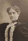
- Muriel Armstrong, niece of president James Buchanan and wife of Philip Jaisohn
- John Beatty, Owner and proprietor of State Street's first building, a dry goods store on the corner of South Ave.[52]
- John Biddle, grandson of William P. Biddle, lived at Hillhurst, designed by Addison Hutton
- Jonathan Bixby, costume designer
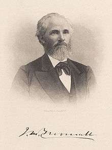
- John Martin Broomall, congressman
- Jim Croce, singer and songwriter[53]
- Ann Crumb, Broadway actress
- Edward Darlington, congressman
- Paul DiMeo, actor, Extreme Makeover: Home Edition[54]
- Frank Furness, renowned Philadelphia architect
- Charles Lewis Fussell, 19th century American landscape painter [55][56]
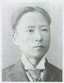
- Philip Jaisohn, a Korean nationalist, lived in Media from 1925 to 1951
- Harry Kalas, broadcaster for the Philadelphia Phillies
- Lew Krausse, Sr., pitcher for the Philadelphia Athletics
- Lew Krausse, Jr., pitcher for the Kansas City/Oakland Athletics, and other teams
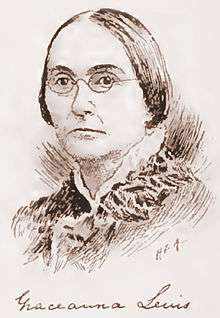
- Graceanna Lewis, ornithologist, abolitionist & suffragist
- Phil Martelli, head basketball coach, Saint Joseph's University
- Tug McGraw, pitcher for the New York Mets and Philadelphia Phillies[57]
- Ida Saxton McKinley, First Lady
- Dave Miller, record producer for Bill Haley's early recordings[29]
- Joan Mondale, wife of Vice President Walter Mondale
- Michael A. O'Donnell, author, researcher, international lecturer, and Episcopal priest
- Mildred Scott Olmsted, Peace activist and suffragist[58]
- Samuel D. Riddle, textile mill owner and race horse owner
- John Buchanan Robinson, editor and congressman
- Todd Robinson Screenwriter, direction, Emmy winner
- Dean Sabatino, drummer for The Dead Milkmen
- Dr. Anna Howard Shaw physician and suffragist
- Wanda Sykes, actress and comedian
.jpg) The Route 101 trolley on State Street
The Route 101 trolley on State Street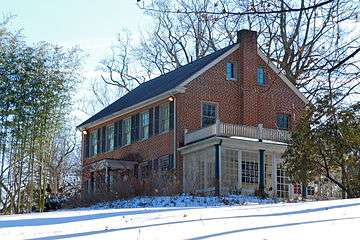 House of Philip Jaisohn - (Seo Jae-pil) a founding father of (South) Korea, located in Media PA where he worked for many years. A PHMC historical marker marks the site.
 The former Friends Select School on Gayley Street, was also home to the Congregation Beth Israel
References
- ↑ "Find a County". National Association of Counties. Retrieved 2011-06-07.
- ↑ Ashmead, Henry Graham (1884). History of Delaware County, Pennsylvania. Philadelphia: L. H. Everts & Co. Chapters XVI and XLVI. Retrieved 2007-09-30.
- 1 2 "Geographic Identifiers: 2010 Demographic Profile Data (G001): Media borough, Pennsylvania". U.S. Census Bureau, American Factfinder. Retrieved December 28, 2015.
- ↑ First Free Trade Town
- ↑ "A Brief History of Media: 1900 to 1950". Community. Borough of Media. Retrieved February 10, 2014.
- ↑ Media: A Walking Tour, published by the Borough of Media, 1990
- ↑ History of Delaware County
- ↑ Nether Providence Through the Years (Delaware County Historical Society)
- ↑ The City of Philadelphia Two Miles in Length and One in Breadth (Lower Merion Historical Society)
- ↑ "History". Media Historical Society. Retrieved 20 March 2016.
- ↑ Minshall House
- ↑ Mayberry, Jodine. "Media, Pennsylvania". Encyclopedia of Greater Philadelphia. Rutgers University. Retrieved 20 March 2016.
- ↑ Gannett, Henry (1905). The Origin of Certain Place Names in the United States. U.S. Government Printing Office. p. 204.
- ↑ Loretta Rodgers, "The Trackless Train: Tracking Delco's Role in the Underground Railroad" (Feb. 27, 1989), Delaware County Daily Times
- ↑ Tyler Arboretum History
- ↑ "History". Delaware County Institute of Science. Retrieved 20 March 2016.
- ↑ "1881 Parrish Hall Burns". Swarthmore Sesquicentennial. Swarthmore College. Retrieved 20 March 2016.
- ↑ "A Brief History of Media: 1850 to 1900". Media Borough. Retrieved 20 March 2016.
- ↑ "A Brief History of Media: 1900 to 1950". Media Borough. Retrieved 20 March 2016.
- ↑ The Media Theatre for the Performing Arts - History
- ↑ "Restoration of an important landmark". www.mediaborough.com. Media Borough. 2016.
- ↑ Medsger, Betty (January 2014). The Burglary: The Discovery of J. Edgar Hoover's Secret FBI. Random House. p. 592. ISBN 9780307962966.
- ↑ "How does a town become Fair Trade?". Media Fair Trade. Retrieved 20 March 2016.
- 1 2 "Code - Historic Districts". Borough of Media, PA. Retrieved July 27, 2016.
- ↑ Lefevre, Michel (2007). "Historic District Designation in Pennsylvania" (PDF). Pennsylvania Historical and Museum Commission. Harrisburg, PA: Commonwealth of Pennsylvania. p. 30. Retrieved July 27, 2016.
- ↑ "Media Presbyterian Church History". www.mediapresbyterian.org. 2010. Retrieved June 16, 2016.
- ↑ Lockhart, Keith (2016). "An Early View of Brooke Hall in the Borough of Media". www.delcohistory.com. Delaware County Historical Society. Retrieved March 1, 2016.
- ↑ Pennsylvania Veteran's Museum accessed October 28, 2009
- 1 2 Media History accessed May 10, 2007
- ↑ National Park Service (2010-07-09). "National Register Information System". National Register of Historic Places. National Park Service.
- ↑ Glasgow, William Melancthon (1888). History of the Reformed Presbyterian Church in America. Baltimore, MD: Hill & Harvey. pp. 512–513 – via the New York Public Library.
Rev Samuel Maxwell Gayley
- ↑ "Bible Encyclopedias - Cyclopedia of Biblical, Theological and Ecclesiastical Literature - Gayley Samuel Maxwell,". www.studylight.org. 2016. Retrieved October 27, 2016.
- ↑ Wilson, 1864, Joseph M. (1864). The Presbyterian Historical Almanac and Annual Remembrancer of the Church, Volume 6. Philadelphia, PA: Presbyterian Church. pp. 150–158 – via New York City Library.
- ↑ "Parks in Upper Providence Township". Upper Providence Township. 2016. Retrieved February 29, 2016.
- ↑ "Friends of Glen Providence Park". www.glenprovidencepark.org. 2016. Retrieved February 29, 2016.
- ↑ "American Fact Finder, 19063". U.S. Census Bureau. Retrieved August 1, 2016.
- ↑ "USPS.com". Look up a ZIP code. United States Postal Service. Retrieved August 1, 2016.
- ↑ "19063". United States Zip Codes. Retrieved August 1, 2016. Note that this is not an official USPS website, but it includes a map.
- ↑ "Monthly Averages for Media, Pennsylvania". The Weather Channel. Retrieved 2011-02-15.
- ↑ "US Gazetteer files: 2010, 2000, and 1990". United States Census Bureau. 2011-02-12. Retrieved 2011-04-23.
- ↑ "Annual Estimates of the Resident Population for Incorporated Places: April 1, 2010 to July 1, 2015". Retrieved July 2, 2016.
- ↑ "Census of Population and Housing". U.S. Census Bureau. Retrieved 11 December 2013.
- 1 2 "American FactFinder". United States Census Bureau. Retrieved 2008-01-31.
- ↑ "Incorporated Places and Minor Civil Divisions Datasets: Subcounty Resident Population Estimates: April 1, 2010 to July 1, 2012". Population Estimates. U.S. Census Bureau. Retrieved 11 December 2013.
- 1 2 Media Borough Council Members
- ↑ "Religious Organizations in Media". Welcome to Media Borough. Borough of Media, Pennsylvania. Retrieved April 9, 2009.
- ↑ History, Synagogue website. Accessed July 23, 2008.
- ↑ US Expressway 1 South of Philadelphia - Historic Overview
- ↑ Google (December 31, 2011). "overview of Baltimore Pike in Pennsylvania" (Map). Google Maps. Google. Retrieved December 31, 2011.
- ↑ Statistics: Top 30 World Airports
- ↑ Google Map directions
- ↑ John W. Jordan, LL. D. (1914). "History of Borough of Media, Pa. (From: A History of Delaware County, Pennsylvania)". www.history.rays-place.com. Lewis Historical Publishing Company, New York. Retrieved June 16, 2016.
- ↑ I Got a Name: The Jim Croce Story. Da Capo Press, 2012
- ↑ Bio: Carpenter Paul Dimeo of ABC's Extreme Makeover: Home Edition
- ↑ "Wikimedia Commons: Category:Charles Lewis Fussell". www.commons.wikimedia.org. Retrieved March 1, 2016.
- ↑ "Schwarz Gallery : Charles Lewis Fussell". www.schwarzgallery.com. 2016. Retrieved March 1, 2016.
- ↑ "Dave Anderson, "SPORTS OF THE TIMES; Tug McGraw Changes Lanes", The New York Times, Feb 19, 1985."
- ↑ Neborak, Anne. "Marker celebrates Peace Activist Mildred Olmsted's life". October 02, 2015. Retrieved June 5, 2016 – via www.delconewsnetwork.com.
External links
| Wikimedia Commons has media related to Media, Pennsylvania. |
| Wikivoyage has a travel guide for Media, Pennsylvania. |
- Borough of Media official website
- Visit Media PA
- Historical Photographs
- Media Arts Council
- Media Borough at DelawareCountyPA.com
- Media's Fair Trade Town Committee
- Nether Providence History
- Media, PA News
- Transition Town Media
- All Things Media, PA
- Semi-centennial of the Borough of Media, Penna., May 19, 1900. Media, PA: T.V. Cooper. 1900. p. 112.
- Lenny Campello (November 27, 2007). Sunday Evening Stroll through Media, PA. Media, PA.
- Mayberry, Jodine. "Media, Pennsylvania". The Encyclopedia of Greater Philadelphia.
Municipalities and communities of Delaware County, Pennsylvania, United States | ||
|---|---|---|
| City | 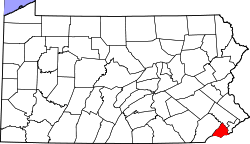 | |
| Boroughs | ||
| Townships | ||
| CDPs | ||
| Unincorporated communities |
| |
| Footnotes | ‡This populated place also has portions in an adjacent county or counties | |