Niles, New York
| Niles, New York | |
|---|---|
| Town | |
 Location within Cayuga County and New York | |
 Niles Location within the state of New York | |
| Coordinates: 42°48′57″N 76°24′53″W / 42.81583°N 76.41472°W | |
| Country | United States |
| State | New York |
| County | Cayuga |
| Government | |
| • Type | Town Council |
| • Town Supervisor | Rickey L. Slagle (R) |
| • Town Council |
Members' List
|
| Area | |
| • Total | 43.4 sq mi (112.3 km2) |
| • Land | 39.0 sq mi (100.9 km2) |
| • Water | 4.4 sq mi (11.3 km2) |
| Elevation | 1,358 ft (414 m) |
| Population (2010) | |
| • Total | 1,194 |
| • Density | 31/sq mi (11.8/km2) |
| Time zone | Eastern (EST) (UTC-5) |
| • Summer (DST) | EDT (UTC-4) |
| FIPS code | 36-51198 |
| GNIS feature ID | 0979278 |
| Website |
www |
Niles is a town in Cayuga County, New York, United States. The population was 1,194 at the 2010 census.[1] Niles lies in the eastern part of the county southeast of Auburn.
History
Niles was in the Central New York Military Tract, land reserved for veterans. The area that would become the town was first settled around 1792. The town of Niles was created in 1833 by division of the town of Sempronius.
Geography
According to the United States Census Bureau, the town has a total area of 43.4 square miles (112.3 km2), of which 39.0 square miles (100.9 km2) is land and 4.4 square miles (11.3 km2), or 11.83%, is water.[1]
Niles is between Owasco Lake and Skaneateles Lake, two of the Finger Lakes. The east town line and part of the north town line are the border of Onondaga County.
New York State Route 38A intersects New York State Route 41A in the northwest part of the town.
Demographics
| Historical population | |||
|---|---|---|---|
| Census | Pop. | %± | |
| 1840 | 2,234 | — | |
| 1850 | 2,053 | −8.1% | |
| 1860 | 2,013 | −1.9% | |
| 1870 | 1,912 | −5.0% | |
| 1880 | 1,875 | −1.9% | |
| 1890 | 1,579 | −15.8% | |
| 1900 | 1,402 | −11.2% | |
| 1910 | 1,209 | −13.8% | |
| 1920 | 1,076 | −11.0% | |
| 1930 | 903 | −16.1% | |
| 1940 | 834 | −7.6% | |
| 1950 | 941 | 12.8% | |
| 1960 | 943 | 0.2% | |
| 1970 | 965 | 2.3% | |
| 1980 | 1,115 | 15.5% | |
| 1990 | 1,194 | 7.1% | |
| 2000 | 1,208 | 1.2% | |
| 2010 | 1,194 | −1.2% | |
| Est. 2014 | 1,180 | [2] | −1.2% |

At the 2000 census,[4] there were 1,208 people, 476 households and 348 families residing in the town. The population density was 30.9 per square mile (11.9/km²). There were 824 housing units at an average density of 21.1 per square mile (8.1/km²). The racial makeup of the town was 99.09% White, 0.33% African American, 0.08% Native American, 0.08% Asian, and 0.41% from two or more races. Hispanic or Latino of any race were 0.08% of the population.
There were 476 households of which 32.1% had children under the age of 18 living with them, 61.3% were married couples living together, 6.1% had a female householder with no husband present, and 26.7% were non-families. 20.4% of all households were made up of individuals and 8.4% had someone living alone who was 65 years of age or older. The average household size was 2.54 and the average family size was 2.91.
24.0% of the population were under the age of 18, 6.7% from 18 to 24, 26.2% from 25 to 44, 31.1% from 45 to 64, and 12.0% who were 65 years of age or older. The median age was 41 years. For every 100 females there were 110.5 males. For every 100 females age 18 and over, there were 103.1 males.
The median household income was $42,167 and the median family incomewas $47,188. Males had a median income of $33,250 versus $26,250 for females. The per capita income for the town was $20,791. About 5.4% of families and 7.5% of the population were below the poverty line, including 7.6% of those under age 18 and 8.1% of those age 65 or over.
Communities and locations in Niles
- Adams Point – a projection into Owasco Lake.
- Austin – a hamlet in the western part of the town.
- Carpenter Point – a projection into Skaneateles Lake.
- Conklin Cove – a hamlet on Owasco Lake near the north town line.
- Globe Hotel Corners – a hamlet on NY Route 38A near the south town line.
- Gregory Landing – a hamlet on the shore of Skaneateles Lake in the southwest of Niles.
- Kelloggsville – a hamlet near the south town line.
- Koenigs Point – a location at the northwest corner of the town.
- New Hope – a hamlet in the southeast part of the town on NY Route 41A. The New Hope Mills Complex was listed on the National Register of Historic Places in 2005.[5]
- Niles – the hamlet of Niles is near the north town line on NY-38A.
- Omro – a hamlet in the southwest part of the town near the town line.
- Partello Corners – a hamlet in the southeast part of the town on NY-38A.
- Rice Point a location on the shore of Owasco Lake by the south town line.
- Seward Point – a projection into Owasco Lake.
- Twelve Corners – a location in the central part of the town south of Niles village.
References
- 1 2 "Geographic Identifiers: 2010 Demographic Profile Data (G001): Niles town, Cayuga County, New York". U.S. Census Bureau, American Factfinder. Retrieved November 13, 2014.
- ↑ "Annual Estimates of the Resident Population for Incorporated Places: April 1, 2010 to July 1, 2014". Retrieved June 4, 2015.
- ↑ "Census of Population and Housing". Census.gov. Retrieved June 4, 2015.
- ↑ "American FactFinder". United States Census Bureau. Retrieved 2008-01-31.
- ↑ National Park Service (2009-03-13). "National Register Information System". National Register of Historic Places. National Park Service.
External links
Coordinates: 42°50′15″N 76°24′49″W / 42.83750°N 76.41361°W
Municipalities and communities of Cayuga County, New York, United States | ||
|---|---|---|
| City | 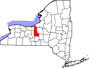 | |
| Towns | ||
| Villages | ||
| CDP | ||
| Other hamlets | ||
| Footnotes | ‡This populated place also has portions in an adjacent county or counties | |