Netawaka Township, Jackson County, Kansas
| Netawaka Township | |
|---|---|
| Township | |
 Location in Jackson County | |
| Coordinates: 39°36′25″N 95°43′01″W / 39.60694°N 95.71694°WCoordinates: 39°36′25″N 95°43′01″W / 39.60694°N 95.71694°W | |
| Country | United States |
| State | Kansas |
| County | Jackson |
| Area | |
| • Total | 36.09 sq mi (93.48 km2) |
| • Land | 36.04 sq mi (93.35 km2) |
| • Water | 0.05 sq mi (0.12 km2) 0.13% |
| Elevation | 1,132 ft (345 m) |
| Population (2000) | |
| • Total | 361 |
| • Density | 10/sq mi (3.9/km2) |
| GNIS feature ID | 0473236 |
Netawaka Township is a township in Jackson County, Kansas, USA. As of the 2000 census, its population was 361.
History
Netawaka Township was formerly occupied by the Kickapoo Tribe in Kansas, until they were removed to a reservation in Brown County. It was bought by the Union Pacific Railroad in 1870 and opened for settlement.[1] Netawaka Township was formed in 1871.[2] Netawaka is a Native American name meaning "fair view".[3]
Geography
Netawaka Township covers an area of 36.09 square miles (93.48 square kilometers); of this, 0.05 square miles (0.12 square kilometers) or 0.13 percent is water. The streams of Mosquito Creek and Wolfley Creek run through this township.
Cities and towns
Adjacent townships
- Powhattan Township, Brown County (north)
- Whiting Township (east)
- Straight Creek Township (southeast)
- Liberty Township (south)
- Jefferson Township (southwest)
- Wetmore Township, Nemaha County (west)
- Granada Township, Nemaha County (northwest)
Major highways
References
- ↑ Barr, Elizabeth N. (1907). Business directory and history of Jackson County. p. 33.
- ↑ Barr, Elizabeth N. (1907). Business directory and history of Jackson County. p. 13.
- ↑ Blackmar, Frank Wilson (1912). Kansas: A Cyclopedia of State History, Volume 2. Standard Publishing Company. p. 354.
External links
Municipalities and communities of Jackson County, Kansas, United States | ||
|---|---|---|
| Cities | 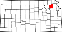 | |
| Unincorporated communities | ||
| Indian reservations | ||
| Townships | ||
| Footnotes | ‡This populated place also has portions in an adjacent county or counties | |
This article is issued from Wikipedia - version of the 10/25/2016. The text is available under the Creative Commons Attribution/Share Alike but additional terms may apply for the media files.