Na-Au-Say Township, Kendall County, Illinois
| Na-Au-Say Township | |
|---|---|
| Township | |
 Location in Kendall County | |
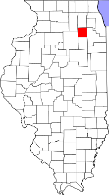 Kendall County's location in Illinois | |
| Coordinates: 41°35′25″N 088°18′45″W / 41.59028°N 88.31250°WCoordinates: 41°35′25″N 088°18′45″W / 41.59028°N 88.31250°W | |
| Country | United States |
| State | Illinois |
| County | Kendall |
| Area | |
| • Total | 34.22 sq mi (88.6 km2) |
| • Land | 34.22 sq mi (88.6 km2) |
| • Water | 0 sq mi (0 km2) 0% |
| Elevation[1] | 610 ft (186 m) |
| Population (2010) | |
| • Total | 8,145 |
| • Density | 238/sq mi (92/km2) |
| FIPS code | 17-51531[2] |
| GNIS feature ID | 0429416 |
Na-Au-Say Township occupies the 6 mile square on the eastern edge of Kendall County, Illinois. As of the 2010 census, its population was 8,145 and it contained 2,534 housing units.[3]
History
The township's name was chosen by popular vote and came from the Native American village on the Aux Sable Creek (a branch of which flows through the township), which was named for a Potawatomi leader.[4]
Geography
According to the 2010 census, the township has a total area of 34.22 square miles (88.6 km2), all land.[3]
Government
The township is governed by an elected Town Board of a Supervisor and four Trustees. The Township also has an elected Assessor, Clerk, and Highway Commissioner and Supervisor.
References
- "Na-Au-Say Township, Kendall County, Illinois". Geographic Names Information System. United States Geological Survey. Retrieved 2010-02-20.
- ↑ "US Board on Geographic Names". United States Geological Survey. 2007-10-25. Retrieved 2008-01-31.
- ↑ "American FactFinder". United States Census Bureau. Retrieved 2008-01-31.
- 1 2 "Population, Housing Units, Area, and Density: 2010 - County -- County Subdivision and Place -- 2010 Census Summary File 1". United States Census. Retrieved 2013-05-28.
- ↑ Callary, Edward (2009). Place Names of Illinois. Urbana and Chicago: University of Illinois Press. p. 243.
Municipalities and communities of Kendall County, Illinois, United States | ||
|---|---|---|
| Cities | ||
| Villages | ||
| Townships | ||
| CDP | ||
| Other unincorporated communities |
| |
| Footnotes | ‡This populated place also has portions in an adjacent county or counties | |
| Major city |  | |
|---|---|---|
| Cities (over 30,000 in 2010) | ||
| Towns and villages (over 30,000 in 2010) |
| |
| Counties | ||
| Regions | ||
| Sub-regions | ||
This article is issued from Wikipedia - version of the 9/4/2016. The text is available under the Creative Commons Attribution/Share Alike but additional terms may apply for the media files.