Mosquito Township, Christian County, Illinois
| Mosquito Township | |
|---|---|
| Township | |
 Location in Christian County | |
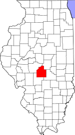 Christian County's location in Illinois | |
| Coordinates: 39°45′20″N 89°11′45″W / 39.75556°N 89.19583°WCoordinates: 39°45′20″N 89°11′45″W / 39.75556°N 89.19583°W | |
| Country |
|
| State |
|
| County | Christian |
| Established | November 7, 1865 |
| Area | |
| • Total | 46.66 sq mi (120.8 km2) |
| • Land | 46.65 sq mi (120.8 km2) |
| • Water | 0 sq mi (0 km2) 0% |
| Elevation | 594 ft (181 m) |
| Population (2010) | |
| • Total | 390 |
| • Density | 8.4/sq mi (3.2/km2) |
| Time zone | CST (UTC-6) |
| • Summer (DST) | CDT (UTC-5) |
| ZIP codes | 62513, 62547 |
| GNIS feature ID | 0429397 |
Mosquito Township is one of seventeen townships in Christian County, Illinois, USA. As of the 2010 census, its population was 390 and it contained 162 housing units.[1]
Geography
According to the 2010 census, the township has a total area of 46.66 square miles (120.8 km2), all land.[1]
Unincorporated towns
Cemeteries
The township contains these four cemeteries: Berea Christian, Darmer, Hunter and Stafford.
Airports and landing strips
- McCoy Airport
- Noland RLA Airport
School districts
- Meridian Community Unit School District 15
- Sangamon Valley Community Unit School District 9
- Taylorville Community Unit School District 3
Political districts
- State House District 87
- State Senate District 44
References
- "Mosquito Township, Christian County, Illinois". Geographic Names Information System. United States Geological Survey. Retrieved 2010-01-04.
- United States Census Bureau 2009 TIGER/Line Shapefiles
- United States National Atlas
- 1 2 "Population, Housing Units, Area, and Density: 2010 - County -- County Subdivision and Place -- 2010 Census Summary File 1". United States Census. Retrieved 2013-05-28.
External links

Municipalities and communities of Christian County, Illinois, United States | ||
|---|---|---|
| Cities | ||
| Villages | ||
| Townships | ||
| CDP | ||
| Other unincorporated communities | ||
| Footnotes | ‡This populated place also has portions in an adjacent county or counties | |
This article is issued from Wikipedia - version of the 12/5/2013. The text is available under the Creative Commons Attribution/Share Alike but additional terms may apply for the media files.