Mockingbird Valley, Kentucky
| Mockingbird Valley, Kentucky | |
|---|---|
| City | |
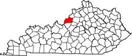
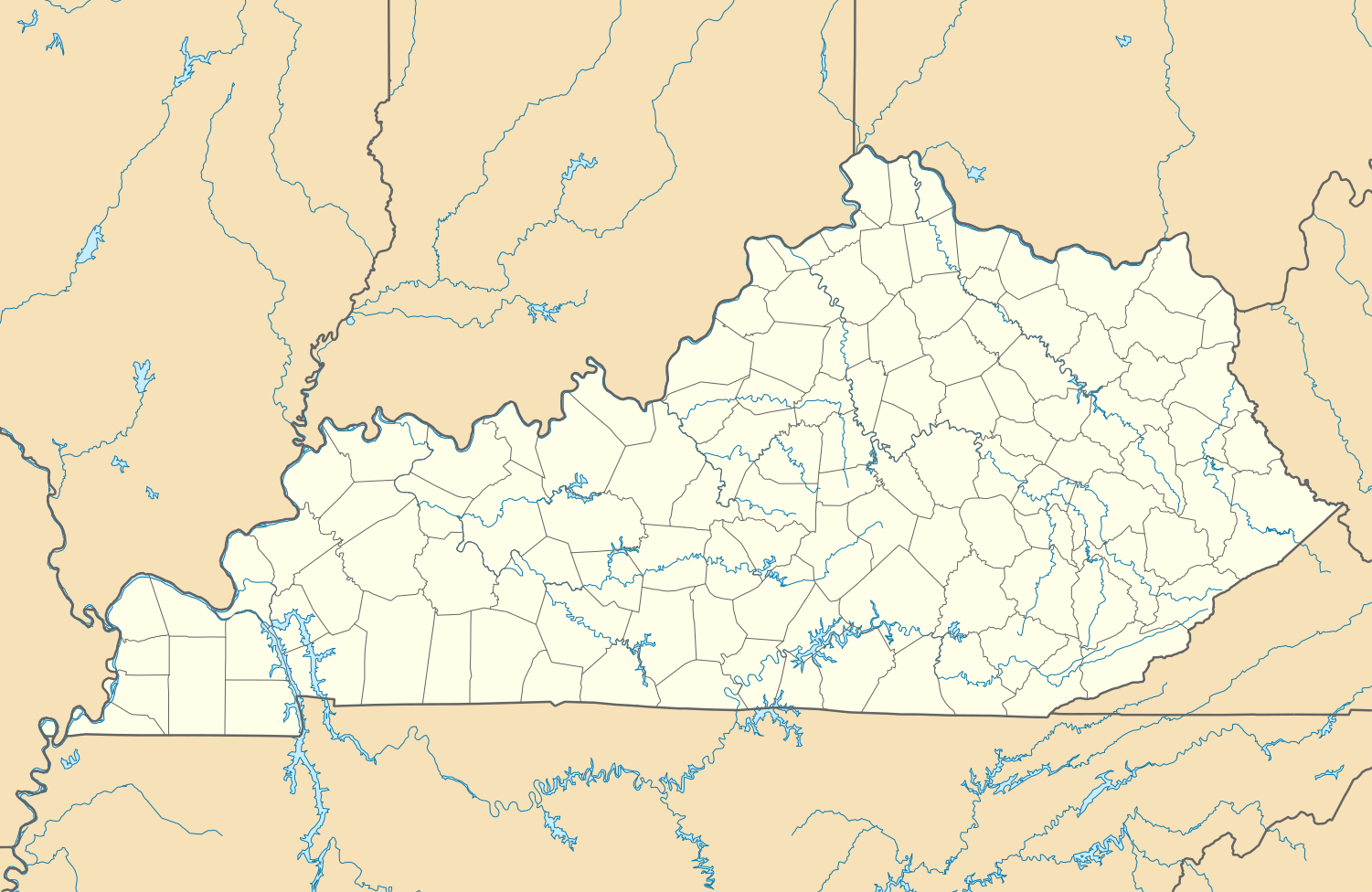 Mockingbird Valley, Kentucky Location within the state of Kentucky | |
| Coordinates: 38°16′14″N 85°40′46″W / 38.27056°N 85.67944°WCoordinates: 38°16′14″N 85°40′46″W / 38.27056°N 85.67944°W | |
| Country | United States |
| State | Kentucky |
| County | Jefferson |
| Incorporated | c. 1940[1] |
| Area | |
| • Total | 0.2 sq mi (0.5 km2) |
| • Land | 0.2 sq mi (0.5 km2) |
| • Water | 0.0 sq mi (0.0 km2) |
| Elevation | 446 ft (136 m) |
| Population (2000) | |
| • Total | 190 |
| • Density | 905.4/sq mi (349.6/km2) |
| Time zone | Eastern (EST) (UTC-5) |
| • Summer (DST) | EDT (UTC-4) |
| FIPS code | 21-52842 |
| GNIS feature ID | 0498467 |

Mockingbird Valley is a 6th-class city in Jefferson County, Kentucky, United States.[1] Since incorporation, there has been some interest in making it a historic preservation district, largely to prevent unwanted development. The population was 190 at the 2000 census. It has the highest per capita income of any location in Kentucky and the tenth-highest of any location in the United States.
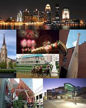
Located directly to the east of Louisville along the Ohio River, Mockingbird Valley is frequently referred to as a "country enclave" and is noted for its rural feel. It is located on river bluffs and rolling hills, with large homes set back from the road, heavy tree density, bridges and walls using traditional local materials, as well as undisturbed rock outcroppings. One-third of the roads are privately owned, and the entire city is zoned residential except for a small commercial parking lot.
History
The first house, Rock Hill, was built in 1840 near River Road and still remains. Although it was initially agricultural, wealthy Louisvillians eventually began building summer homes in Mockingbird Valley, starting with Atilla Cox in 1905 (nearby Cox Park is named for his wife Carrie). An interurban railroad soon allowed for commuting to Downtown Louisville, and the first year-round house was built by Stuart English Duncan in 1908. Planned subdivisions were soon built in the area: the Jarvis addition in 1912, Green Hills in 1924, and Overbrook in 1929. It incorporated as a city in 1940. Development has continued slowly as late as 2006, with a final subdivision, Mockingbird Valley River Bluff, being built on 15 lots covering 54 acres (220,000 m2). The city's history is roughly similar to that of Glenview and Anchorage, two other eastern Jefferson county cities.
The Louisville Country Club is located near Mockingbird Valley, built in 1905 and designed by Walter Travis. In 1999, it was one of several private clubs named in a discrimination lawsuit and was eventually forced to turn over its membership records, though no investigation was ever conducted by the state Human Rights Commission. It admitted its first black member in February 2006.[2]
Geography and wildlife
Mockingbird Valley is located at 38°16′14″N 85°40′46″W / 38.27056°N 85.67944°W (38.270520, -85.679496).[3] According to the United States Census Bureau, the city has a total area of 0.2 square miles (0.5 km²), all land.
Numerous wild animals reside in Mockingbird Valley including: white-tailed deer, red fox, groundhog, opossum, raccoon and the occasional coyote. Birding enthusiasts have also recorded sightings of wild turkey, blue heron, turkey vulture, red tail hawk, pileated woodpecker, and the great horned owl. Due to the karst topography, reptiles and amphibians such as the red salamander and five-lined skink are also common.
Demographics
| Historical population | |||
|---|---|---|---|
| Census | Pop. | %± | |
| 1940 | 146 | — | |
| 1950 | 150 | 2.7% | |
| 1960 | 169 | 12.7% | |
| 1970 | 255 | 50.9% | |
| 1980 | 205 | −19.6% | |
| 1990 | 177 | −13.7% | |
| 2000 | 190 | 7.3% | |
| 2010 | 167 | −12.1% | |
| Est. 2015 | 169 | [4] | 1.2% |
As of the census[6] of 2000, there were 190 people, 74 households, and 58 families residing in the city. The population density was 905.4 people per square mile (349.3/km²). There were 82 housing units at an average density of 390.8 per square mile (150.8/km²). The racial makeup of the city was 97.37% White, 1.05% Asian, and 1.58% from two or more races.
There were 74 households out of which 29.7% had children under the age of 18 living with them, 77.0% were married couples living together, 2.7% had a female householder with no husband present, and 20.3% were non-families. 18.9% of all households were made up of individuals and 16.2% had someone living alone who was 65 years of age or older. The average household size was 2.57 and the average family size was 2.95.
In the city the population was spread out with 25.8% under the age of 18, 2.1% from 18 to 24, 16.8% from 25 to 44, 31.6% from 45 to 64, and 23.7% who were 65 years of age or older. The median age was 49 years. For every 100 females there were 90.0 males. For every 100 females age 18 and over, there were 78.5 males.
The median income for a household in the city was in excess of $200,000, as is the median income for a family. Males have a median income over $100,000 versus $14,375 for females. The per capita income for the city was $134,745. None of the families and none of the population were below the poverty line.
References
- 1 2 Commonwealth of Kentucky. Office of the Secretary of State. Land Office. "Mockingbird Valley, Kentucky". Accessed 26 Aug 2013.
- ↑ Shafer, Sheldon (2006-02-20). "Country club gets first black member". The Courier-Journal. p. 1B.
- ↑ "US Gazetteer files: 2010, 2000, and 1990". United States Census Bureau. 2011-02-12. Retrieved 2011-04-23.
- ↑ "Annual Estimates of the Resident Population for Incorporated Places: April 1, 2010 to July 1, 2015". Retrieved July 2, 2016.
- ↑ "Census of Population and Housing". Census.gov. Retrieved June 4, 2015.
- ↑ "American FactFinder". United States Census Bureau. Retrieved 2008-01-31.
Further reading
- Elson, Martha (August 18, 2002). "Wealth defined: Median income tops $200,000 in tiny city". Courier-Journal.
- Elson, Martha (June 8, 2005). "Estates are planned on bluff". Courier-Journal.
- Bickel III, Paul; et al. (2006). "Mockingbird Valley Neighborhood Plan" (PDF).
| History |
|  |
|---|---|---|
| Geography |
| |
| Government |
| |
| Transportation | ||
| Other subject areas | ||
| Top subjects | ||
| National Historic Landmarks | ||
| Prominent suburbs (over 10K pop.) | ||
| ||