Middletown, Kentucky
| Middletown, Kentucky | |
|---|---|
| City | |
|
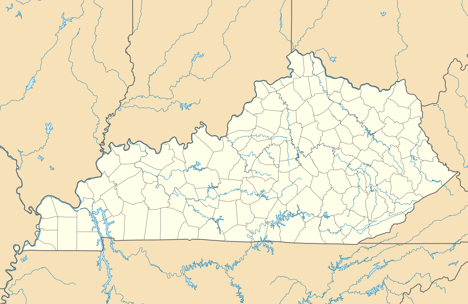
Main Street in Middletown | |
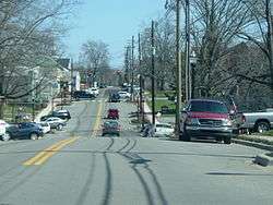
 Middletown, Kentucky Location within the state of Kentucky | |
| Coordinates: 38°14′36″N 85°31′51″W / 38.24333°N 85.53083°WCoordinates: 38°14′36″N 85°31′51″W / 38.24333°N 85.53083°W | |
| Country | United States |
| State | Kentucky |
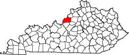
| County | Jefferson |
| Established | 1797 |
| Incorporated | 1866 |
| Reïncorporated | 1979 |
| Area | |
| • Total | 5.101 sq mi (13.21 km2) |
| • Land | 5.04 sq mi (13.05 km2) |
| • Water | 0.061 sq mi (0.16 km2) |
| Elevation | 725 ft (221 m) |
| Population (2010) | |
| • Total | 7,218 |
| • Density | 1,414.9/sq mi (546.3/km2) |
| Time zone | Eastern (EST) (UTC-5) |
| • Summer (DST) | EDT (UTC-4) |
| ZIP codes | 40243, 40253 |
| Area code(s) | 502 |
| FIPS code | 21-51978 |
| GNIS feature ID | 0498159 |
| Website | www.cityofmiddletownky.org |
Middletown is a city in Jefferson County, Kentucky, United States, and a neighborhood of Louisville. The population was 7,218 at the 2010 census.
Eastern High School is located in Middletown. The city is also home to the main campus of the largest church in the state (and one of the country's largest Protestant churches), the Southeast Christian Church.
History
The City of Middletown was originally incorporated in 1797 by the Jefferson County Court on 500 acres of land lying on a branch of the forks of Beargrass Creek that originally belonged to Jacob Meyers and Culberth Harrison. Though there is no recorded explanation why the city was named Middletown, it is commonly believed that that name was chosen because the town was in the "middle" of the two older cities of Louisville which was founded June 24, 1778, and Shelbyville, which was founded December 20, 1792. In 1871 the Kentucky General Assembly amended the original charter to increase Middletown's boundaries.
After failing to hold elections and collect taxes after 1919, Circuit Judge McCauley Smith dissolved the city's charter on July 26, 1960, and Middletown lost its 163-year-old city status. The city's charter was restored as a sixth class city on August 7, 1976 with a commission form of government. On July 15, 1982, this was upgraded to the status of a fourth class city.[1]
Geography
Middletown is located at 38°14′36″N 85°31′51″W / 38.24333°N 85.53083°W (38.243342, -85.530842).[2]
According to the United States Census Bureau, the city has a total area of 5.10 square miles (13.2 km2), of which 5.04 square miles (13.1 km2) is land and 0.061 square miles (0.16 km2) (1.20%) is water.
Demographics

2010
As of the census[3] of 2010, there were 7,218 people, 3,292 households, and 1,966 families residing in the city. The population density was 1,414.9 people per square mile (546.3/km²). There were 3,547 housing units at an average density of 695.3 per square mile (268.5/km²). The racial makeup of the city was 87.1% White (85.1% non-Hispanic), 7.1% African American, 0.11% Native American or Alaska Native, 2.8% Asian, 0.07% Pacific Islander, 0.87% from other races, and 1.9% from two or more races. Hispanics or Latinos of any race were 3.2% of the population.
There were 3,292 households out of which 26.7% had children under the age of 18 living with them, 45.4% were married couples living together, 11.5% had a female householder with no husband present, 2.9% had a male householder with no wife present, and 40.3% were non-families. 35.4% of all households were made up of individuals and 16.6% had someone living alone who was 65 years of age or older. The average household size was 2.19 and the average family size was 2.86.

The age distribution was 21.4% under 18, 5.7% from 18 to 24, 24.3% from 25 to 44, 30.2% from 45 to 64, and 18.4% who were 65 or older. The median age was 43.8 years. For every 100 females there were 85.6 males. For every 100 females age 18 and over, there were 80.0 males.
| Historical population | |||
|---|---|---|---|
| Census | Pop. | %± | |
| 1890 | 302 | — | |
| 1980 | 414 | — | |
| 1990 | 5,016 | 1,111.6% | |
| 2000 | 5,744 | 14.5% | |
| 2010 | 7,218 | 25.7% | |
| Est. 2015 | 7,874 | [4] | 9.1% |
2000 census
As of the census[6] of 2000, there were 5,744 people, 2,391 households, and 1,654 families residing in the city. The population density was 1,181.4 people per square mile (456.3/km²). There were 2,543 housing units at an average density of 523.0 per square mile (202.0/km²). The racial makeup of the city was 90.39% White, 5.54% African American, 0.30% Native American or Alaska Native, 1.44% Asian, 0.09% Pacific Islander, 0.66% from other races, and 1.58% from two or more races. Hispanics or Latinos of any race were 1.50% of the population.
There were 2,391 households out of which 33.0% had children under the age of 18 living with them, 55.7% were married couples living together, 11.2% had a female householder with no husband present, and 30.8% were non-families. 26.9% of all households were made up of individuals and 9.5% had someone living alone who was 65 years of age or older. The average household size was 2.40 and the average family size was 2.92.
The age distribution was 24.8% under the age of 18, 6.4% from 18 to 24, 31.1% from 25 to 44, 25.6% from 45 to 64, and 12.1% who were 65 years of age or older. The median age was 38 years. For every 100 females there were 90.1 males. For every 100 females age 18 and over, there were 84.5 males.
The median income for a household in the city was $53,608, and the median income for a family was $61,667. Males had a median income of $45,417 versus $33,135 for females. The per capita income for the city was $26,660. About 2.3% of families and 4.1% of the population were below the poverty line, including 3.6% of those under age 18 and 8.0% of those age 65 or over.
References
- ↑ http://archive.courier-journal.com/article/99999999/ZONE05/70320075/Middletown-Early-settlers-came-from-Louisville
- ↑ "US Gazetteer files: 2010, 2000, and 1990". United States Census Bureau. 2011-02-12. Retrieved 2011-04-23.
- ↑ "American FactFinder". United States Census Bureau. Retrieved 2011-05-14.
- ↑ "Annual Estimates of the Resident Population for Incorporated Places: April 1, 2010 to July 1, 2015". Retrieved July 2, 2016.
- ↑ "Census of Population and Housing". Census.gov. Retrieved June 4, 2015.
- ↑ "American FactFinder". United States Census Bureau. Retrieved 2008-01-31.
External links
- City website
- Chamber of Commerce
- Middletown Fire Department
- "America's Emptiest Cities", Forbes.com, 02.12.09 at Archive.is (archived 2013-01-24)
- "Middletown: As a Prime Stagecoach Stop, the Community Saw Much of Its Activity Centered on Two Thriving Inns" — Article by Kay Stewart of The Courier-Journal
| History |
|  |
|---|---|---|
| Geography |
| |
| Government |
| |
| Transportation | ||
| Other subject areas | ||
| Top subjects | ||
| National Historic Landmarks | ||
| Prominent suburbs (over 10K pop.) | ||
| ||