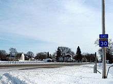
Minnesota State Highway 30
| ||||
|---|---|---|---|---|
| Route information | ||||
| Maintained by Mn/DOT | ||||
| Length: | 266 mi[1] (428 km) | |||
| Existed: | 1933[2] – present | |||
| Major junctions | ||||
| West end: |
at the Minnesota — South Dakota state line | |||
|
| ||||
| East end: |
| |||
| Location | ||||
| Counties: | Pipestone, Murray, Cottonwood, Watonwan, Blue Earth, Waseca, Steele, Dodge, Olmsted, Fillmore | |||
| Highway system | ||||
| ||||

Minnesota State Highway 30 (MN 30) is a highway in southwest and southeast Minnesota, which runs from South Dakota Highway 34 at the South Dakota state line near Airlie and Pipestone, and continues east to its eastern terminus at its intersection with Minnesota Highway 43 in Rushford.
Highway 30 is 266 miles (428 km) in length.
Route description
State Highway 30 serves as an east–west route between Pipestone, Slayton, St. James, Stewartville, Chatfield, and Rushford.
Highway 30 parallels U.S. Highway 14 and Interstate Highway 90 throughout its route.
The Pipestone National Monument is located immediately north of Highway 30 in Pipestone.
Lake Shetek State Park is located near Highway 30 in Murray County on the shore of Lake Shetek. The park is located immediately north of the town of Currie and northeast of Slayton.
Highway 30 passes through the Richard J. Dorer Memorial Hardwood State Forest in Olmsted and Fillmore counties.
History
State Highway 30 was authorized in 1933.
The section of Highway 30 between the South Dakota state line to State Highway 4 near St. James was originally designated as old State Highway 47 from 1934 to 1963. This section was renumbered 30 in 1963.
In 1940, only the western segment of Highway 30 was paved. In the 1950s, the central portions of Highway 30 were still gravel. Highway 30 was paved in its entirety by 1963.
Future
There are plans to reroute the highway into the City of Rochester, as seen in the Rochester International Airport Area Plan [3]
Major intersections
| County | Location | mi[1] | km | Destinations | Notes |
|---|---|---|---|---|---|
| Pipestone | | 0.000 | 0.000 | Continuation into South Dakota | |
| Pipestone | 7.718 | 12.421 | West end of MN 23 overlap | ||
| 7.937 | 12.773 | West end of US 75 overlap; east end of MN 23 overlap | |||
| 8.285 | 13.333 | East end of US 75 overlap | |||
| Murray | Lake Wilson | 25.678 | 41.325 | West end of MN 91 overlap | |
| 25.983 | 41.816 | East end of MN 91 overlap | |||
| Slayton Township | 34.075 | 54.838 | |||
| Slayton | 35.709 | 57.468 | South end of US 59 overlap | ||
| Mason Township | 41.434 | 66.682 | North end of US 59 overlap | ||
| Cottonwood | Amboy Township | 73.689 | 118.591 | ||
| Watonwan | Nelson Township | 97.652 | 157.156 | North end of MN 4 overlap | |
| St. James Township | 104.231 | 167.744 | South end of MN 4 overlap, West end of MN 60 overlap | ||
| Rosendale Township | CR 12 | Interchange | |||
| Fieldon Township | 113.915 | 183.328 | East end of MN 60 overlap; north end of MN 15 overlap | ||
| Antrim Township | 118.961 | 191.449 | South end of MN 15 overlap | ||
| Blue Earth | Shelby Township | 131.847 | 212.187 | North end of US 169 overlap | |
| 132.203 | 212.760 | South end of US 169 overlap | |||
| Mapleton | 144.310 | 232.244 | North end of MN 22 overlap | ||
| Mapleton Township | 146.882 | 236.384 | South end of MN 22 overlap | ||
| Waseca | Vivian Township | 157.936 | 254.173 | ||
| New Richland Township | 168.464 | 271.117 | |||
| Steele | Summit Township | 179.566– 179.718 | 288.983– 289.228 | I-35 exit 26; interchange. | |
| Blooming Prairie | 190.903 | 307.229 | North end of US 218 overlap | ||
| 191.462 | 308.128 | South end of US 218 overlap | |||
| Dodge | Hayfield | 202.561 | 325.990 | ||
| Olmsted | Rochester | 221.368 | 356.257 | North end of US 63 overlap | |
| High Forest Township | I-90 exits 209A-B; interchange. | ||||
| Stewartville | 223.892 | 360.319 | South end of US 63 overlap | ||
| Chatfield | 239.804 | 385.927 | North end of US 52 overlap | ||
| Fillmore | 240.303 | 386.730 | South end of US 52 overlap; west end of MN 74 overlap | ||
| Olmsted | Elmira Township | 244.419 | 393.354 | East end of MN 74 overlap | |
| Fillmore | Arendahl Township | 254.517 | 409.605 | ||
| Rushford | 265.503 | 427.286 | |||
1.000 mi = 1.609 km; 1.000 km = 0.621 mi
| |||||
References
- 1 2 "Statewide Trunk Logpoint Listing" (PDF). Minnesota Department of Transportation. Retrieved December 26, 2011.
- ↑ Riner, Steve. "Details of Routes 26-50". The Unofficial Minnesota Highways Page. Retrieved 2007-02-24.
- ↑ RIA Area Study
