Dodge County, Minnesota
| Dodge County, Minnesota | |
|---|---|
 Dodge County Courthouse | |
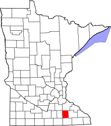 Location in the U.S. state of Minnesota | |
 Minnesota's location in the U.S. | |
| Founded | February 20, 1855[1] |
| Named for | Henry Dodge |
| Seat | Mantorville |
| Largest city | Kasson |
| Area | |
| • Total | 440 sq mi (1,140 km2) |
| • Land | 439 sq mi (1,137 km2) |
| • Water | 0.3 sq mi (1 km2), 0.07% |
| Population (est.) | |
| • (2015) | 20,364 |
| • Density | 46/sq mi (18/km²) |
| Congressional district | 1st |
| Time zone | Central: UTC-6/-5 |
| Website |
www |
Dodge County is a county located in the U.S. state of Minnesota. The population was 20,087 as of the 2010 census.[2] Its county seat is Mantorville.[3]
Dodge County is part of the Rochester, MN Metropolitan Statistical Area.
History
Dodge County was originally inhabited by American Indians, as many counties in Minnesota were. This area was a common hunting and battle ground for the Mdewakanton Sioux, often fighting the Sauk and Fox Indians who had wandered into their territory. The first white person to visit Dodge County, however, is not known. It is believed by some that a French fur trader from Canada was the first, setting foot on its soil in the spring of 1655. Guides deemed this area unsafe due to the Natives living there. But, it was not until over two hundred years later that the locality truly came to life.
The original founders of Dodge County consisted entirely of settlers from New England. These people were "Yankee's", that is to say they were descended from the English Puritans who settled New England in the 1600s. They were part of a wave of New England farmers who headed west into what was then the wilds of the Northwest Territory during the early 1800s. Most of them arrived as a result of the completion of the Erie Canal. When they arrived in what is now Dodge County there was nothing but a virgin forest and wild prairie, the New Englanders laid out farms, constructed roads, erected government buildings and established post routes. They brought with them many of their Yankee New England values, such as a passion for education, establishing many schools as well as staunch support for abolitionism. They were mostly members of the Congregationalist Church though some were Episcopalian. Culturally Dodge County, like much of Minnesota would be culturally very continuous with early New England culture, for most of its history.[4] It was in 1853 that government surveyors set lines for the townships. A year later, the Mantor brothers, along with Eli P. Waterman, established their claims, which would later be an important town to the area known as "Mantorville." Still a year later, in 1855, Dodge County was organized for local government. Later on in its history, immigrants from Germany, Sweden and Norway would settle in the county. With increasing growth and improvement, Dodge County was officially placed in the Fifth Judicial District by the State Constitution on May 11, 1858. Its name was given in honor of Wisconsin governor Henry Dodge.[5] The Dodge County Courthouse, designed by E. Townsend Mix and built of locally quarried limestone in 1865,[6] is the oldest working courthouse in Minnesota.
| Year | Democratic | Republican |
|---|---|---|
| 2016 | 29.12% 3,102 | 61.26% 6,527 |
| 2012 | 43.45% 4,487 | 53.47% 5,522 |
| 2008 | 43.70% 4,463 | 53.54% 5,468 |
| 2004 | 41.72% 4,117 | 56.68% 5,593 |
| 2000 | 41.86% 3,370 | 52.34% 4,213 |
Geography
According to the U.S. Census Bureau, the county has a total area of 440 square miles (1,100 km2), of which 439 square miles (1,140 km2) is land and 0.3 square miles (0.78 km2) (0.07%) is water.[8]
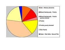
Dodge County is located in the Southeastern part of Minnesota and spans 24 miles (39 km) long and 18 miles (29 km) wide. To the North and center of the county, it is hilly, high, and rolling with pebbly, loose soil, laid with a considerable amount of timber. This makes it well-suited for grain raising. The Southern part is quite the opposite. Being it is flat and wet, it's adapted perfectly for grazing and raising stock. The soil in this area is excellent for yielding huge crops, considering its extremely fertile soil. The heavy, black, clay loam makes this area a prime location for agriculture. Dodge is one of seven southern Minnesota counties that have no forest ecosystems; only prairie and savanna soils exist here.
Dodge County's plentiful amount of sand and rock also make the area a center for building. Quarries in Mantorville were once enterprises and consist of layers of thick stone which can be cut into any desired shape. Wasioja is also known around the nation for its excellent "Wasioja stone."
Streams
- Dodge Center Creek
- Harkcom Creek
- Henslin Creek
- Little Cedar River
- Maston Creek
- Millikin Creek
- Tompkins Creek
- Salem Creek
Lakes
- Zumbro River Reservoir
- Rice Lake
Rice Lake is located almost entirely in Steele County (Havana Township), but the far eastern edge extends into Dodge County.
Adjacent counties
- Rice County (northwest)
- Goodhue County (northeast)
- Olmsted County (east)
- Mower County (south)
- Steele County (west)
Demographics
| Historical population | |||
|---|---|---|---|
| Census | Pop. | %± | |
| 1860 | 3,797 | — | |
| 1870 | 8,598 | 126.4% | |
| 1880 | 11,344 | 31.9% | |
| 1890 | 10,864 | −4.2% | |
| 1900 | 13,340 | 22.8% | |
| 1910 | 12,094 | −9.3% | |
| 1920 | 12,552 | 3.8% | |
| 1930 | 12,127 | −3.4% | |
| 1940 | 12,931 | 6.6% | |
| 1950 | 12,624 | −2.4% | |
| 1960 | 13,259 | 5.0% | |
| 1970 | 13,037 | −1.7% | |
| 1980 | 14,773 | 13.3% | |
| 1990 | 15,731 | 6.5% | |
| 2000 | 17,731 | 12.7% | |
| 2010 | 20,087 | 13.3% | |
| Est. 2015 | 20,364 | [9] | 1.4% |
| U.S. Decennial Census[10] 1790-1960[11] 1900-1990[12] 1990-2000[13] 2010-2015[2] | |||
As of the census of 2000,[14] there were 17,731 people, 6,420 households, and 4,853 families residing in the county. The population density was 40 people per square mile (16/km²). There were 6,642 housing units at an average density of 15 per square mile (6/km²). The racial makeup of the county was 96.58% White, 0.20% Black or African American, 0.17% Native American, 0.41% Asian, 0.01% Pacific Islander, 1.89% from other races, and 0.73% from two or more races. 2.99% of the population were Hispanic or Latino of any race. 34.2% were of German, 26.9% Norwegian, 5.8% Irish, 5.8% American and 5.1% English ancestry.

There were 6,420 households out of which 40.70% had children under the age of 18 living with them, 64.70% were married couples living together, 7.20% had a female householder with no husband present, and 24.40% were non-families. 20.20% of all households were made up of individuals and 9.70% had someone living alone who was 65 years of age or older. The average household size was 2.73 and the average family size was 3.15.
In the county the population was spread out with 30.20% under the age of 18, 7.60% from 18 to 24, 29.90% from 25 to 44, 20.20% from 45 to 64, and 12.10% who were 65 years of age or older. The median age was 35 years. For every 100 females there were 98.80 males. For every 100 females age 18 and over, there were 97.90 males.
The median income for a household in the county was $47,437, and the median income for a family was $54,261. Males had a median income of $34,195 versus $25,903 for females. The per capita income for the county was $19,259. About 4.40% of families and 5.80% of the population were below the poverty line, including 5.80% of those under age 18 and 9.60% of those age 65 or over.
Transportation
Major highways
 U.S. Highway 14
.svg.png) U.S. Highway 218
U.S. Highway 218 Minnesota State Highway 30
 Minnesota State Highway 56
 Minnesota State Highway 57
Airport
Dodge Center Municipal Airport is the only public airport in the county.
Communities
Cities
- Blooming Prairie (partly in Steele County)
- Claremont
- Dodge Center
- Hayfield
- Kasson
- Mantorville (county seat)
- West Concord
Townships
Unincorporated communities
Ghost town
See also
References
- ↑ "Minnesota Place Names". Minnesota Historical Society. Retrieved March 18, 2014.
- 1 2 "State & County QuickFacts". United States Census Bureau. Retrieved August 31, 2013.
- ↑ "Find a County". National Association of Counties. Retrieved 2011-06-07.
- ↑ The Jones-Steele Family History: Dodge County, Minnesota by Earl W. Velander, Georgean Velander E. & G. Velander, 1990
- ↑ Upham, Warren (1920). Minnesota Geographic Names: Their Origin and Historic Significance. Minnesota Historical Society. p. 171.
- ↑ "Dodge County Courthouse". Minnesota Judicial Branch. Retrieved 14 May 2015.
- ↑ Nelson, Steven (2011). Savanna Soils of Minnesota. Minnesota: Self. pp. 43 - 48. ISBN 978-0-615-50320-2.
- ↑ "2010 Census Gazetteer Files". United States Census Bureau. August 22, 2012. Retrieved October 15, 2014.
- ↑ "County Totals Dataset: Population, Population Change and Estimated Components of Population Change: April 1, 2010 to July 1, 2015". Retrieved July 2, 2016.
- ↑ "U.S. Decennial Census". United States Census Bureau. Retrieved October 15, 2014.
- ↑ "Historical Census Browser". University of Virginia Library. Retrieved October 15, 2014.
- ↑ "Population of Counties by Decennial Census: 1900 to 1990". United States Census Bureau. Retrieved October 15, 2014.
- ↑ "Census 2000 PHC-T-4. Ranking Tables for Counties: 1990 and 2000" (PDF). United States Census Bureau. Retrieved October 15, 2014.
- ↑ "American FactFinder". United States Census Bureau. Retrieved 2008-01-31.
External links
 |
Rice County | Goodhue County | | |
| Steele County | |
Olmsted County | ||
| ||||
| | ||||
| Mower County |
Municipalities and communities of Dodge County, Minnesota, United States | ||
|---|---|---|
| Cities | | |
| Townships | ||
| Unincorporated communities | ||
| Ghost town | ||
| Footnotes | ‡This populated place also has portions in an adjacent county or counties | |
Coordinates: 44°02′N 92°52′W / 44.03°N 92.86°W