Milecastle 2
Coordinates: 54°58′44″N 1°34′10″W / 54.978979°N 1.569447°W
| Milecastle 2 | |
|---|---|
|
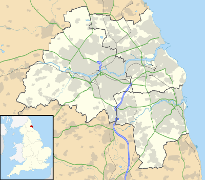
Milecastle 2 probably lies under the A187 road | |
 Milecastle 2 | |
| OS grid reference | NZ27656501 |
| |
_-_geograph.org.uk_-_2879628.jpg)
 | ||||
| Part of a series on the | ||||
| Military of ancient Rome | ||||
|---|---|---|---|---|
| Structural history | ||||
|
||||
| Campaign history | ||||
| Technological history | ||||
|
||||
| Political history | ||||
|
|
||||
| Strategy and tactics | ||||
|
||||
|
| ||||
Milecastle 2 (Walker) was a milecastle of the Roman Hadrian's Wall. No remains are currently visible, having been built over, but its probable location is at or near the junction of the A187 Fossway and Tunstall Avenue.
Construction
Milecastle 2 was a short-axis milecastle of unknown gateway type. Short-axis milecastles were thought to have been constructed by the legio II Augusta who were based in Isca Augusta (Caerleon).[1]
Excavations and investigations
- 1848 - Collingwood Bruce studied the wall[3] and found the site to have been covered by a brick kiln.[4]
- 1852-4 - Henry MacLauchlan surveyed the milecastle's position, reporting it as short-axis, and recorded.[4]
| “ | faint traces of it being discernible in the ploughed ground. | ” |
- 1928 - FG Simpson attempted to locate the site, but despite the previous removal of the brick kiln, found only Roman occupation earth and debris. He recorded distances from the presumed location to the centre of Milecastle 1 as 1,453 yards (1,329 m), and to the centre of Milecastle 3 as 1,453 yards (1,329 m).[4]
Associated Turrets
Each milecastle on Hadrian's Wall had two associated turret structures. These turrets were positioned approximately one-third and two-thirds of a Roman mile to the west of the Milecastle, and would probably have been manned by part of the milecastle's garrison. The turrets associated with Milecastle 2 are known as Turret 2A and Turret 2B.
Turret 2A
No remains have been identified of Turret 2A. Two locations have been suggested, one by Eric Birley in 1961,
[5]
based on Horsley's locations of Milecastle 2 and Milecastle 3,and an alternative by Grace Simpson in 1978, based on Maclauchlin's locations of Milecastle 2 and Milecastle 3.
[6]
Location: 54°58′39″N 1°34′33″W / 54.977519°N 1.575791°W (both locations lie within the same 100m grid square).
Turret 2B
No remains have been identified of Turret 2B. Two locations have been suggested, one by Eric Birley in 1961,
[5]
based on Horsley's locations of Milecastle 2 and Milecastle 3,and an alternative by Grace Simpson in 1978, based on Maclauchlin's locations of Milecastle 2 and Milecastle 3.
[7]
Location: 54°58′36″N 1°34′50″W / 54.976636°N 1.580487°W
Alternative location: 54°58′36″N 1°34′55″W / 54.976642°N 1.582049°W
Monument Records
| Monument | Monument Number | English Heritage Archive Number |
| Milecastle 2 | 24840 | NZ 26 NE 25 |
| Turret 2A | 24898 | NZ 26 SE 13 |
| Turret 2A (alternative) | 25012 | NZ 26 SE 57 |
| Turret 2B | 24901 | NZ 26 SE 14 |
| Turret 2B (alternative) | 25013 | NZ 26 SE 58 |
References
- ↑ David J Breeze and Brian Dobson (1976). Hadrian's Wall. Allen Lane. pp. 14–15. ISBN 0-14-027182-1.
- ↑ Horsley, John (1732), Britannia Romana or the Roman Antiquities of Britain, Frank Graham (published 1974), ISBN 0-85983-090-X
- ↑ Breeze, David J (1934), Handbook to the Roman Wall (14th Revised edition - Nov 2006), Society of Antiquaries of Newcastle upon Tyne, p. 17, ISBN 0-901082-65-1
- 1 2 3 "Milecastle 2". Pastscape. English Heritage. Retrieved 19 May 2010.
- 1 2 Birley, Eric B (1961), Research on Hadrian's Wall, Titus Wilson & Son, p. 71
- ↑ "Turret 2A". Pastscape. English Heritage. Retrieved 19 May 2010.
- ↑ "Turret 2B". Pastscape. English Heritage. Retrieved 19 May 2010.
Bibliography
- Daniels, Charles (1979), "Review: Fact and Theory on Hadrian's Wall", Britannia, 10: 357–364, JSTOR 526069
Structures of Hadrian's Wall | ||
|---|---|---|
| Milecastles |  | |
| Milefortlets | ||
| Other structures on Hadrian's Wall | ||
| Regular and linear features | ||