Milecastle 12
Coordinates: 54°59′48″N 1°47′23″W / 54.996768°N 1.789811°W
| Milecastle 12 | |
|---|---|
|
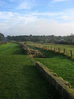
The curtain wall in Heddon-on-the-Wall (east of Milecastle 12) | |
 Milecastle 12 | |
| OS grid reference | NZ135669 |
| |
 | ||||
| Part of a series on the | ||||
| Military of ancient Rome | ||||
|---|---|---|---|---|
| Structural history | ||||
|
||||
| Campaign history | ||||
| Technological history | ||||
|
||||
| Political history | ||||
|
|
||||
| Strategy and tactics | ||||
|
||||
|
| ||||
Milecastle 12 (Heddon) was a milecastle of the Roman Hadrian's Wall. Its remains lay under Town Farm, Heddon-on-the-Wall, (just opposite the farm house) with nothing visible on the surface.[1]
Construction
Milecastle 12 is of unknown axis and gateway types.[2]
Excavations and investigations
- circa 1746 - During construction of the Military Road, two inscriptions were discovered (presumed to be from the Heddon-on-the-Wall area). These attest rebuilding work by the Legio VI Victrix. One reads "LEG·VI·V·P·F·REF·TER·ET·SAC·COS", referring to Tertullus and Sacerdos (Consuls for 158AD).[2]
- 1752 - A large hoard of coins in wooden boxes is found here.[2]
- 1820 - A small hoard of coins is found near here. These comprise coins from Emperor Maximian (286 - 305 AD) to Emperor Arcadius (383 - 408 AD).[2]
- 1926 - The north gate is recorded as having been found.[2]
- 1928-29 - A further search is made, without success.[1]
- 1966 - English Heritage Field Investigation. It was noted that there were no surface indications from which the site could be established, and the area was largely covered by modern farm buildings.[3]
- 1989 - English Heritage Field Investigation. It was noted that there was no surface trace of the milecastle, though its exact position is unknown.[3]
Associated turrets
Each milecastle on Hadrian's Wall had two associated turret structures. These turrets were positioned approximately one-third and two-thirds of a Roman mile to the west of the Milecastle, and would probably have been manned by part of the milecastle's garrison. The turrets associated with Milecastle 12 are known as Turret 12A and Turret 12B.
Turret 12A
Turret 12A (Heddon West) is located beside (and mainly beneath) the B6318 Military Road a short distance West North West of Heddon-on-the-Wall.[4] No surface traces are currently visible.[5]
The turret was located in 1928 as 548 yards (501 m) west of Milecastle 12. This location was confirmed by a partial excavation in 1930. It was found that the walls were reduced to ground level beyond the edge of the roadway, but had the same plan as Turret 12B. However, the platform (which occupied the South side of the interior of Turrets 12B and 13A), was too badly robbed for any trace to remain.[5] The mortared walls were recorded as 1.22 metres (4.0 ft) thick, with the doorway lying to the east.[2]
Location on Ordnance Survey 1:25 000 map: 54°59′53″N 1°47′51″W / 54.998174°N 1.797620°W[4]
Turret 12B
Turret 12B (North Lodge) is located beside the Military Road (at a point where the B6318 is diverted away from it, but it still exists as a narrow metaled track). It was located in 1928, 543 yards from Turret 12a and 529 yards from Milecastle 13. It was excavated in 1930, and found to be almost identical in plan to Turret 12A. The platform was rectangular and occupied the south side of the interior.[6]
Location on Ordnance Survey 1:25 000 map: 54°59′57″N 1°48′19″W / 54.999264°N 1.805243°W[4]
Monument Records
| Monument | Monument Number | English Heritage Archive Number |
| Milecastle 12 | 22775 | NZ 16 NW 3 |
| Turret 12A | 22778 | NZ 16 NW 4 |
| Turret 12B | 22781 | NZ 16 NW 5 |
References
- 1 2 Hope Dodds, Madeleine (1930). Northumberland County History. Vol. 13 : The Parishes of Heddon-on-the-Wall, Newburn, Longbenton, Wallsend, the Chapelries of Gosforth and Cramlington, the Townships of Benwell, Elswick, Heaton, Byker, Fenham, & Jesmond [in Newcastle-upon-Tyne]. The Northumberland County History Committee. p. 537.
- 1 2 3 4 5 6 Breeze, David J (1934), Handbook to the Roman Wall (14th Revised edition - Nov 2006), Society of Antiquaries of Newcastle upon Tyne, pp. 166–167, ISBN 0-901082-65-1
- 1 2 "Milecastle 12". Pastscape. English Heritage. Retrieved 18 June 2010.
- 1 2 3 OL43: Hadrian’s Wall (Map). 1:25 000. OS Explorer Map. Cartography by Ordnance Survey. Ordnance Survey. 09/11/2009. ISBN 978-0-319-24109-7. OL43. Check date values in:
|date=(help) - 1 2 "Turret 12A". Pastscape. English Heritage. Retrieved 17 Jun 2010.
- ↑ "Turret 12B". Pastscape. English Heritage. Retrieved 18 Jun 2010.
Bibliography
- Daniels, Charles (1979), "Review: Fact and Theory on Hadrian's Wall", Britannia, 10: 357–364, JSTOR 526069
External links
- Hadrian's Wall: visiting information English Heritage
- Hadrian's Wall: Archaeological research 1976-2000 English Heritage
Structures of Hadrian's Wall | ||
|---|---|---|
| Milecastles |  | |
| Milefortlets | ||
| Other structures on Hadrian's Wall | ||
| Regular and linear features | ||