Marlette, Michigan
| Marlette, Michigan | |
|---|---|
 Marlette, Michigan Location of Marlette, Michigan | |
| Coordinates: 43°19′39″N 83°4′45″W / 43.32750°N 83.07917°WCoordinates: 43°19′39″N 83°4′45″W / 43.32750°N 83.07917°W | |
| Country | United States |
| State | Michigan |
| County | Sanilac |
| Area[1] | |
| • Total | 1.64 sq mi (4.25 km2) |
| • Land | 1.64 sq mi (4.25 km2) |
| • Water | 0 sq mi (0 km2) |
| Elevation | 837 ft (255 m) |
| Population (2010)[2] | |
| • Total | 1,875 |
| • Estimate (2012[3]) | 1,839 |
| • Density | 1,143.3/sq mi (441.4/km2) |
| Time zone | Eastern (EST) (UTC-5) |
| • Summer (DST) | EDT (UTC-4) |
| ZIP code | 48453 |
| Area code(s) | 989 |
| FIPS code | 26-51820[4] |
| GNIS feature ID | 0631595[5] |
Marlette is a city in Sanilac County in the U.S. state of Michigan. The population was 1,875 at the 2010 census. The city is located within Marlette Township, but is politically autonomous.
Marlette is known as "The Heart of the Thumb" due to its location in Michigan's thumb.
History
Marlette was first settled in the mid-19th century by people from Ontario who sought tall timber and fertile soil. The city name was derived from the family of settlers, "Marlatt" who carved their name on a log shanty.[6]
Geography
According to the United States Census Bureau, the city has a total area of 1.64 square miles (4.25 km2), all land.[1]
The Marlette ZIP code 48453 also serves all of Marlette Township, except for the northeast corner, as well as parts of southern Lamotte Township, the southwest part of Elmer Township, the northwest part of Flynn Township, the northeast corner of Elk Township, parts of northern Burnside Township in Lapeer County and the southeast corner of Koylton Township in Tuscola County.[7]
Media
Marlette's commercial radio station, WBGV 92.5 FM, features a country music format. It is owned by Sanilac/GB Broadcasting, who also owns WMIC and WTGV, in nearby Sandusky. Marlette is also served by Smile FM broadcasting on 88.1 FM (WHYT) from Imlay City and 103.7 FM (WCZE) from Harbor Beach with Contemporary Christian Music radio, local news and weather.
Hospital
The town is home to Marlette Regional Hospital and Seton Cancer Institute - a partnership of Marlette Regional and St. Mary's of Michigan. This provides Thumb residents advanced cancer research and treatment.
Demographics
| Historical population | |||
|---|---|---|---|
| Census | Pop. | %± | |
| 1900 | 996 | — | |
| 1910 | 1,062 | 6.6% | |
| 1920 | 969 | −8.8% | |
| 1930 | 990 | 2.2% | |
| 1940 | 1,161 | 17.3% | |
| 1950 | 1,489 | 28.3% | |
| 1960 | 1,640 | 10.1% | |
| 1970 | 1,706 | 4.0% | |
| 1980 | 1,761 | 3.2% | |
| 1990 | 1,924 | 9.3% | |
| 2000 | 2,104 | 9.4% | |
| 2010 | 1,875 | −10.9% | |
| Est. 2015 | 1,801 | [8] | −3.9% |
2010 census
As of the census[2] of 2010, there were 1,875 people, 742 households, and 469 families residing in the city. The population density was 1,143.3 inhabitants per square mile (441.4/km2). There were 864 housing units at an average density of 526.8 per square mile (203.4/km2). The racial makeup of the city was 95.9% White, 0.3% African American, 0.6% Native American, 0.7% Asian, 0.4% from other races, and 2.1% from two or more races. Hispanic or Latino of any race were 3.4% of the population.
There were 742 households of which 34.1% had children under the age of 18 living with them, 43.8% were married couples living together, 15.6% had a female householder with no husband present, 3.8% had a male householder with no wife present, and 36.8% were non-families. 31.5% of all households were made up of individuals and 18% had someone living alone who was 65 years of age or older. The average household size was 2.43 and the average family size was 3.03.
The median age in the city was 39.4 years. 25.2% of residents were under the age of 18; 8.7% were between the ages of 18 and 24; 23.1% were from 25 to 44; 25.6% were from 45 to 64; and 17.2% were 65 years of age or older. The gender makeup of the city was 47.3% male and 52.7% female.
2000 census
As of the census[4] of 2000, there were 2,104 people, 787 households, and 497 families residing in the city. The population density was 1,277.3 per square mile (492.3/km²). There were 839 housing units at an average density of 509.4 per square mile (196.3/km²). The racial makeup of the city was 93.82% White, 2.28% African American, 0.33% Native American, 0.29% Asian, 1.47% from other races, and 1.81% from two or more races. Hispanic or Latino of any race were 2.52% of the population.
There were 787 households out of which 34.3% had children under the age of 18 living with them, 47.1% were married couples living together, 12.8% had a female householder with no husband present, and 36.8% were non-families. 32.9% of all households were made up of individuals and 15.0% had someone living alone who was 65 years of age or older. The average household size was 2.44 and the average family size was 3.09.
In the city the population was spread out with 30.7% under the age of 18, 8.8% from 18 to 24, 25.2% from 25 to 44, 18.8% from 45 to 64, and 16.5% who were 65 years of age or older. The median age was 34 years. For every 100 females there were 97.0 males. For every 100 females age 18 and over, there were 82.1 males.
The median income for a household in the city was $30,938, and the median income for a family was $37,880. Males had a median income of $33,250 versus $21,725 for females. The per capita income for the city was $15,592. About 9.0% of families and 10.9% of the population were below the poverty line, including 10.7% of those under age 18 and 7.8% of those age 65 or over.
Notable people
- Tom Wargo, professional golfer was born in Marlette
References
- 1 2 "US Gazetteer files 2010". United States Census Bureau. Retrieved 2012-11-25.
- 1 2 "American FactFinder". United States Census Bureau. Retrieved 2012-11-25.
- ↑ "Population Estimates". United States Census Bureau. Retrieved 2013-06-03.
- 1 2 "American FactFinder". United States Census Bureau. Retrieved 2008-01-31.
- ↑ "US Board on Geographic Names". United States Geological Survey. 2007-10-25. Retrieved 2008-01-31.
- ↑ MultiMag.com
- ↑ 48453 5-Digit ZCTA, 484 3-Digit ZCTA - Reference Map - American FactFinder, U.S. Census Bureau, 2000 Census
- ↑ "Annual Estimates of the Resident Population for Incorporated Places: April 1, 2010 to July 1, 2015". Retrieved July 2, 2016.
- ↑ "Census of Population and Housing". Census.gov. Retrieved June 4, 2015.
External links
Municipalities and communities of Sanilac County, Michigan, United States | ||
|---|---|---|
| Cities | 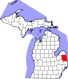 | |
| Villages | ||
| Townships | ||
| CDP | ||
| Other unincorporated communities | ||
| Footnotes | ‡This populated place also has portions in an adjacent county or counties | |