Applegate, Michigan
| Applegate, Michigan | |
|---|---|
| Village | |
 Location of Applegate in Sanilac County, Michigan | |
| Coordinates: 43°21′19″N 82°38′13″W / 43.35528°N 82.63694°WCoordinates: 43°21′19″N 82°38′13″W / 43.35528°N 82.63694°W | |
| Country | United States |
| State | Michigan |
| County | Sanilac |
| Area[1] | |
| • Total | 1.01 sq mi (2.62 km2) |
| • Land | 1.00 sq mi (2.59 km2) |
| • Water | 0.01 sq mi (0.03 km2) |
| Elevation | 748 ft (228 m) |
| Population (2010)[2] | |
| • Total | 248 |
| • Estimate (2012[3]) | 244 |
| • Density | 248.0/sq mi (95.8/km2) |
| Time zone | Eastern (EST) (UTC-5) |
| • Summer (DST) | EDT (UTC-4) |
| ZIP code | 48401 |
| Area code(s) | 810 |
| FIPS code | 26-03200[4] |
| GNIS feature ID | 2397974[5] |
Applegate is a village in Sanilac County of the U.S. state of Michigan. The population was 248 at the 2010 census. Applegate is in the southeast corner of Washington Township on the boundary with Sanilac Township.
History
Applegate originated in 1856 when George Pack (brother of John Pack) built a sawmill here.[6]
Geography
According to the United States Census Bureau, the village has a total area of 1.01 square miles (2.62 km2), of which 1.00 square mile (2.59 km2) is land and 0.01 square miles (0.03 km2) is water.[1]
Demographics
| Historical population | |||
|---|---|---|---|
| Census | Pop. | %± | |
| 1910 | 155 | — | |
| 1920 | 177 | 14.2% | |
| 1930 | 207 | 16.9% | |
| 1940 | 231 | 11.6% | |
| 1950 | 244 | 5.6% | |
| 1960 | 252 | 3.3% | |
| 1970 | 301 | 19.4% | |
| 1980 | 257 | −14.6% | |
| 1990 | 297 | 15.6% | |
| 2000 | 287 | −3.4% | |
| 2010 | 248 | −13.6% | |
| Est. 2015 | 240 | [7] | −3.2% |
2010 census
As of the census[2] of 2010, there were 248 people, 95 households, and 65 families residing in the village. The population density was 248.0 inhabitants per square mile (95.8/km2). There were 111 housing units at an average density of 111.0 per square mile (42.9/km2). The racial makeup of the village was 93.1% White, 3.2% African American, 2.4% Asian, and 1.2% from other races. Hispanic or Latino of any race were 3.2% of the population.
There were 95 households of which 35.8% had children under the age of 18 living with them, 45.3% were married couples living together, 18.9% had a female householder with no husband present, 4.2% had a male householder with no wife present, and 31.6% were non-families. 29.5% of all households were made up of individuals and 13.7% had someone living alone who was 65 years of age or older. The average household size was 2.61 and the average family size was 3.25.
The median age in the village was 34.6 years. 30.6% of residents were under the age of 18; 8.7% were between the ages of 18 and 24; 26.6% were from 25 to 44; 22.2% were from 45 to 64; and 12.1% were 65 years of age or older. The gender makeup of the village was 45.6% male and 54.4% female.
2000 census
As of the census[4] of 2000, there were 287 people, 102 households, and 79 families residing in the village. The population density was 290.1 per square mile (111.9/km²). There were 106 housing units at an average density of 107.1 per square mile (41.3/km²). The racial makeup of the village was 96.52% White, 2.09% from other races, and 1.39% from two or more races. Hispanic or Latino of any race were 6.97% of the population.
There were 102 households out of which 43.1% had children under the age of 18 living with them, 55.9% were married couples living together, 13.7% had a female householder with no husband present, and 22.5% were non-families. 20.6% of all households were made up of individuals and 11.8% had someone living alone who was 65 years of age or older. The average household size was 2.81 and the average family size was 3.22.
In the village the population was spread out with 32.8% under the age of 18, 7.0% from 18 to 24, 27.9% from 25 to 44, 19.5% from 45 to 64, and 12.9% who were 65 years of age or older. The median age was 31 years. For every 100 females there were 90.1 males. For every 100 females age 18 and over, there were 85.6 males.
The median income for a household in the village was $32,188, and the median income for a family was $36,094. Males had a median income of $26,964 versus $20,000 for females. The per capita income for the village was $12,977. None of the families and 3.9% of the population were living below the poverty line, including no under eighteens and 10.8% of those over 64.
References
Notes
- 1 2 "US Gazetteer files 2010". United States Census Bureau. Archived from the original on 2012-01-24. Retrieved 2012-11-25.
- 1 2 "American FactFinder". United States Census Bureau. Retrieved 2012-11-25.
- ↑ "Population Estimates". United States Census Bureau. Archived from the original on 2013-06-17. Retrieved 2013-06-03.
- 1 2 "American FactFinder". United States Census Bureau. Archived from the original on 2013-09-11. Retrieved 2008-01-31.
- ↑ U.S. Geological Survey Geographic Names Information System: Applegate, Michigan
- ↑ Romig 1986, p. 26.
- ↑ "Annual Estimates of the Resident Population for Incorporated Places: April 1, 2010 to July 1, 2015". Retrieved July 2, 2016.
- ↑ "Census of Population and Housing". Census.gov. Archived from the original on May 11, 2015. Retrieved June 4, 2015.
Sources
- Romig, Walter (October 1, 1986) [1973]. Michigan Place Names: The History of the Founding and the Naming of More Than Five Thousand Past and Present Michigan Communities. Great Lakes Books Series (Paperback). Detroit, Michigan: Wayne State University Press. ISBN 081431838X. ISBN 978-0814318386.
Municipalities and communities of Sanilac County, Michigan, United States | ||
|---|---|---|
| Cities | 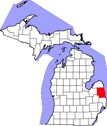 | |
| Villages | ||
| Townships | ||
| CDP | ||
| Other unincorporated communities | ||
| Footnotes | ‡This populated place also has portions in an adjacent county or counties | |