Loyalton, California
| City of Loyalton | |
|---|---|
| City | |
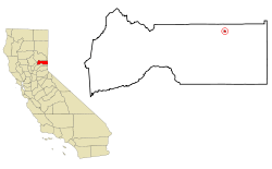 Location in Sierra County and the state of California | |
 City of Loyalton Location in the United States | |
| Coordinates: 39°40′36″N 120°14′35″W / 39.67667°N 120.24306°WCoordinates: 39°40′36″N 120°14′35″W / 39.67667°N 120.24306°W | |
| Country |
|
| State |
|
| County | Sierra |
| Incorporated | August 21, 1901[1] |
| Area[2] | |
| • Total | 0.355 sq mi (0.921 km2) |
| • Land | 0.355 sq mi (0.921 km2) |
| • Water | 0 sq mi (0 km2) 0% |
| Elevation | 4,951 ft (1,509 m) |
| Population (2010) | |
| • Total | 769 |
| • Density | 2,200/sq mi (830/km2) |
| Time zone | Pacific (PST) (UTC-8) |
| • Summer (DST) | PDT (UTC-7) |
| ZIP code | 96118 |
| Area code(s) | 530 |
| FIPS code | 06-44364 |
| GNIS feature ID | 0277550 |
| Website |
www |
Loyalton is a city in Sierra County, California, United States. As of the 2010 United States Census, the population was 769, reflecting a decline of 93 from the 862 counted in 2000. The ZIP code for the community is 96118. Wired telephone numbers in the community follow the format (530) 993-xxxx. The town is near the north extent of State Route 49, which ends at State Route 70 in Vinton. According to Rand-McNally, it is a fifty-mile drive on State Route 49 to the county seat, Downieville. Many of the population are ranchers, loggers, former loggers, or suburbanites escaping from the San Francisco Bay Area, Sacramento, and the growing Reno-Tahoe area.
Geography
Loyalton is located at 39°40′36″N 120°14′35″W / 39.67667°N 120.24306°W (39.676558, -120.243157).[3] Elevation above mean sea level for the area was listed as roughly 4,930 feet (1,500 m).
According to the United States Census Bureau, the city has a total area of 0.4 square miles (1.0 km2), all land.
Climate
This region experiences warm (but not hot) and dry summers, with no average monthly temperatures above 71.6 °F. According to the Köppen Climate Classification system, Loyalton has a warm-summer Mediterranean climate, abbreviated "Csb" on climate maps.[4]
Demographics
| Historical population | |||
|---|---|---|---|
| Census | Pop. | %± | |
| 1880 | 84 | — | |
| 1910 | 983 | — | |
| 1920 | 442 | −55.0% | |
| 1930 | 837 | 89.4% | |
| 1940 | 925 | 10.5% | |
| 1950 | 911 | −1.5% | |
| 1960 | 936 | 2.7% | |
| 1970 | 945 | 1.0% | |
| 1980 | 1,030 | 9.0% | |
| 1990 | 931 | −9.6% | |
| 2000 | 862 | −7.4% | |
| 2010 | 769 | −10.8% | |
| Est. 2015 | 702 | [5] | −8.7% |
2010
The 2010 United States Census[7] reported that Loyalton had a population of 769. The population density was 21 people per square mile (835.2/km²). The racial makeup of Loyalton was 701 (91.2%) White, 2 (0.3%) African American, 21 (2.7%) Native American, 0 (0.0%) Asian, 0 (0.0%) Pacific Islander, 20 (2.6%) from other races, and 25 (3.3%) from two or more races. Hispanic or Latino of any race were 108 persons (14.0%).
The Census reported that 738 people (96.0% of the population) lived in households, 0 (0%) lived in non-institutionalized group quarters, and 31 (4.0%) were institutionalized.
There were 308 households, out of which 86 (27.9%) had children under the age of 18 living in them, 163 (52.9%) were opposite-sex married couples living together, 28 (9.1%) had a female householder with no husband present, 19 (6.2%) had a male householder with no wife present. There were 25 (8.1%) unmarried opposite-sex partnerships, and 0 (0%) same-sex married couples or partnerships. 81 households (26.3%) were made up of individuals and 35 (11.4%) had someone living alone who was 65 years of age or older. The average household size was 2.40. There were 210 families (68.2% of all households); the average family size was 2.84.
The population was spread out with 156 people (20.3%) under the age of 18, 55 people (7.2%) aged 18 to 24, 164 people (21.3%) aged 25 to 44, 243 people (31.6%) aged 45 to 64, and 151 people (19.6%) who were 65 years of age or older. The median age was 46.2 years. For every 100 females there were 101.3 males. For every 100 females age 18 and over, there were 98.4 males.
There were 371 housing units at an average density of 1,043.6 per square mile (402.9/km²), of which 225 (73.1%) were owner-occupied, and 83 (26.9%) were occupied by renters. The homeowner vacancy rate was 3.4%; the rental vacancy rate was 8.8%. 526 people (68.4% of the population) lived in owner-occupied housing units and 212 people (27.6%) lived in rental housing units.
2000
As of the census[8] of 2000, there were 862 people, 323 households, and 235 families residing in the city. The population density was 2,516.4 people per square mile (978.9/km²). There were 347 housing units at an average density of 1,013.0 per square mile (394.1/km²). The racial makeup of the city was 94.90% White, 0.23% African American, 2.67% Native American, 0.12% Asian, 0.58% from other races, and 1.51% from two or more races. Hispanic or Latino of any race were 7.19% of the population.
There were 323 households out of which 38.4% had children under the age of 18 living with them, 53.6% were married couples living together, 11.1% had a female householder with no husband present, and 27.2% were non-families. 23.8% of all households were made up of individuals and 10.2% had someone living alone who was 65 years of age or older. The average household size was 2.58 and the average family size was 3.00.
In the city the population was spread out with 29.1% under the age of 18, 6.0% from 18 to 24, 24.8% from 25 to 44, 24.4% from 45 to 64, and 15.7% who were 65 years of age or older. The median age was 39 years. For every 100 females there were 94.6 males. For every 100 females age 18 and over, there were 91.5 males.
The median income for a household in the city was $34,063, and the median income for a family was $39,750. Males had a median income of $38,864 versus $23,571 for females. The per capita income for the city was $15,732. About 20.3% of families and 18.1% of the population were below the poverty line, including 22.0% of those under age 18 and 6.7% of those age 65 or over.
Politics
In the state legislature, Loyalton is in the 1st Senate District, represented by Republican Ted Gaines,[9] and the 1st Assembly District, represented by Republican Brian Dahle.[10]
Federally, Loyalton is in California's 1st congressional district, represented by Republican Doug LaMalfa.[11]
Government
Local
Because Loyalton is Sierra County's most populous municipality and its only incorporated city, generally half of the meetings of the county's board of supervisors are held in Downieville (the county seat) and the other half are held in Loyalton.[12]
The City of Loyalton’s total expenditures for 2012 were $1.2 million, funded mostly from outside sources such as federal and county grants.[13] Local tax collection revenue that year was $163,000.[13] In 2016, the city recovered over $400,000 that had been embezzled by an employee but it still faces an $80,000 budget shortfall.[13]
In 2012, the Loyalton City Council decided to withdraw from CalPERS because its last employee with a guaranteed pension had retired.[13] The city had been fully paying its required annual contribution of $30,000 and had only four remaining pensioners.[13] CalPERS then demanded $1.6 million from the city.[13] CalPERS publicly uses actuarial present value to calculate member contributions but when a member withdraws it utilizes a non-public calculation to define unfunded liabilities.[14] Loyalton has not yet paid the bill so CalPERS is charging 7.5% annual interest and had sent a final demand letter in September 2016.[13]
References
- ↑ "California Cities by Incorporation Date" (Word). California Association of Local Agency Formation Commissions. Retrieved August 25, 2014.
- ↑ "2010 Census U.S. Gazetteer Files – Places – California". United States Census Bureau.
- ↑ "US Gazetteer files: 2010, 2000, and 1990". United States Census Bureau. 2011-02-12. Retrieved 2011-04-23.
- ↑ Climate Summary for Loyalton, California
- ↑ "Annual Estimates of the Resident Population for Incorporated Places: April 1, 2010 to July 1, 2015". Retrieved July 2, 2016.
- ↑ "Census of Population and Housing". Census.gov. Retrieved June 4, 2015.
- ↑ "2010 Census Interactive Population Search: CA - Loyalton city". U.S. Census Bureau. Retrieved July 12, 2014.
- ↑ "American FactFinder". United States Census Bureau. Retrieved 2008-01-31.
- ↑ "Senators". State of California. Retrieved March 10, 2013.
- ↑ "Members Assembly". State of California. Retrieved March 2, 2013.
- ↑ "California's 1st Congressional District - Representatives & District Map". Civic Impulse, LLC. Retrieved March 3, 2013.
- ↑ "Sierra County Government Directory". Retrieved 2011-03-05.
- 1 2 3 4 5 6 7 Walsh, Mary Williams (10 October 2016). "$1.6 Million Bill Tests Tiny Town and 'Bulletproof' Public Pension Plan". The New York Times. p. A10. Retrieved 10 October 2016.
- ↑ Walsh, Mary Williams (18 September 2016). "A Sour Surprise for Public Pensions: Two Sets of Books". The New York Times. p. BU1. Retrieved 10 October 2016.
External links
Municipalities and communities of Sierra County, California, United States | ||
|---|---|---|
| City | 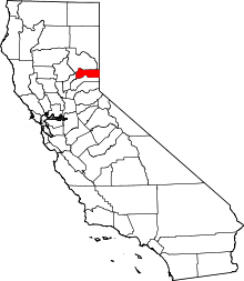 | |
| CDPs | ||
| Unincorporated communities | ||
| Ghost towns |
| |