Longecourt-en-Plaine
| Longecourt-en-Plaine | ||
|---|---|---|
|
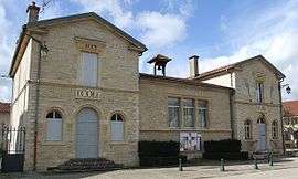
Town hall | ||
| ||
 Longecourt-en-Plaine | ||
|
Location within Bourgogne-Franche-Comté region  Longecourt-en-Plaine | ||
| Coordinates: 47°11′56″N 5°09′00″E / 47.1989°N 5.15°ECoordinates: 47°11′56″N 5°09′00″E / 47.1989°N 5.15°E | ||
| Country | France | |
| Region | Bourgogne-Franche-Comté | |
| Department | Côte-d'Or | |
| Arrondissement | Dijon | |
| Canton | Genlis | |
| Intercommunality | Plaine Dijonnaise | |
| Government | ||
| • Mayor (2008–2014) | Daniel Baudron | |
| Area1 | 10.01 km2 (3.86 sq mi) | |
| Population (2008)2 | 1,274 | |
| • Density | 130/km2 (330/sq mi) | |
| Time zone | CET (UTC+1) | |
| • Summer (DST) | CEST (UTC+2) | |
| INSEE/Postal code | 21353 / 21110 | |
| Elevation | 193–203 m (633–666 ft) | |
|
1 French Land Register data, which excludes lakes, ponds, glaciers > 1 km² (0.386 sq mi or 247 acres) and river estuaries. 2 Population without double counting: residents of multiple communes (e.g., students and military personnel) only counted once. | ||
.svg.png)
Longecourt-en-Plaine is a commune in the Côte-d'Or department in eastern France.
Population
| Historical population | ||
|---|---|---|
| Year | Pop. | ±% |
| 1793 | 326 | — |
| 1800 | 372 | +14.1% |
| 1806 | 405 | +8.9% |
| 1821 | 545 | +34.6% |
| 1831 | 546 | +0.2% |
| 1836 | 589 | +7.9% |
| 1841 | 620 | +5.3% |
| 1846 | 652 | +5.2% |
| 1851 | 680 | +4.3% |
| 1856 | 697 | +2.5% |
| 1861 | 703 | +0.9% |
| 1866 | 715 | +1.7% |
| 1872 | 656 | −8.3% |
| 1876 | 671 | +2.3% |
| 1881 | 614 | −8.5% |
| 1886 | 607 | −1.1% |
| 1891 | 605 | −0.3% |
| 1896 | 594 | −1.8% |
| 1901 | 610 | +2.7% |
| 1906 | 533 | −12.6% |
| 1911 | 544 | +2.1% |
| 1921 | 512 | −5.9% |
| 1926 | 519 | +1.4% |
| 1931 | 479 | −7.7% |
| 1936 | 417 | −12.9% |
| 1946 | 464 | +11.3% |
| 1954 | 494 | +6.5% |
| 1962 | 560 | +13.4% |
| 1968 | 582 | +3.9% |
| 1975 | 562 | −3.4% |
| 1982 | 713 | +26.9% |
| 1990 | 1,023 | +43.5% |
| 1999 | 1,189 | +16.2% |
| 2008 | 1,274 | +7.1% |
See also
References
| Wikimedia Commons has media related to Longecourt-en-Plaine. |
This article is issued from Wikipedia - version of the 4/10/2013. The text is available under the Creative Commons Attribution/Share Alike but additional terms may apply for the media files.
