Las Lomas, California
| Las Lomas | |
|---|---|
| Census-designated place | |
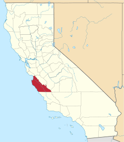
 Location in Monterey County and the state of California | |
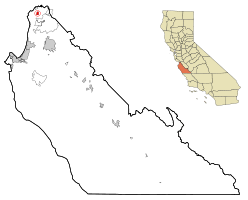
 Las Lomas Location in the United States | |
| Coordinates: 36°51′55″N 121°44′06″W / 36.86528°N 121.73500°WCoordinates: 36°51′55″N 121°44′06″W / 36.86528°N 121.73500°W | |
| Country |
|
| State |
|
| County | Monterey |
| Government | |
| • State senator | Bill Monning (D)[1] |
| • Assemblymember | Mark Stone (D)[1] |
| • U. S. rep. | Sam Farr (D)[2] |
| Area[3] | |
| • Total | 1.037 sq mi (2.686 km2) |
| • Land | 1.037 sq mi (2.686 km2) |
| • Water | 0 sq mi (0 km2) 0% |
| Elevation[4] | 43 ft (13 m) |
| Population (2010) | |
| • Total | 3,024 |
| • Density | 2,900/sq mi (1,100/km2) |
| Time zone | Pacific (UTC-8) |
| • Summer (DST) | PDT (UTC-7) |
| ZIP code | 95076 |
| Area code | 831 |
| FIPS code | 06-40592 |
| GNIS feature IDs | 1655082, 2408578 |
Las Lomas (formerly, Hall) is a census-designated place (CDP) in Monterey County, California, United States.[4] Las Lomas is located 7 miles (11 km) north-northwest of Prunedale,.[5] The elevation is 43 feet (13 m).[4] The population was 3,024 at the 2010 census, down from 3,078 at the 2000 census.
Geography
Las Lomas is located on County Route G12 between Prunedale and Pajaro. The Elkhorn Slough, a 7-mile-long (11 km) tidal slough and estuary that flows out in Monterey Bay, is just south of the community.
According to the United States Census Bureau, the CDP has a total area of 1.0 square mile (2.6 km2), all of it land.
Demographics
2010
The 2010 United States Census[6] reported that Las Lomas had a population of 3,024. The population density was 2,916.2 people per square mile (1,126.0/km²). The racial makeup of Las Lomas was 1,167 (38.6%) White, 37 (1.2%) African American, 93 (3.1%) Native American, 53 (1.8%) Asian, 24 (0.8%) Pacific Islander, 1,490 (49.3%) from other races, and 160 (5.3%) from two or more races. Hispanic or Latino of any race were 2,696 persons (89.2%).
The Census reported that 3,024 people (100% of the population) lived in households, 0 (0%) lived in non-institutionalized group quarters, and 0 (0%) were institutionalized.
There were 598 households, out of which 393 (65.7%) had children under the age of 18 living in them, 415 (69.4%) were opposite-sex married couples living together, 69 (11.5%) had a female householder with no husband present, 47 (7.9%) had a male householder with no wife present. There were 35 (5.9%) unmarried opposite-sex partnerships, and 4 (0.7%) same-sex married couples or partnerships. 42 households (7.0%) were made up of individuals and 9 (1.5%) had someone living alone who was 65 years of age or older. The average household size was 5.06. There were 531 families (88.8% of all households); the average family size was 5.13.
The population was spread out with 1,001 people (33.1%) under the age of 18, 368 people (12.2%) aged 18 to 24, 900 people (29.8%) aged 25 to 44, 560 people (18.5%) aged 45 to 64, and 195 people (6.4%) who were 65 years of age or older. The median age was 27.7 years. For every 100 females there were 111.2 males. For every 100 females age 18 and over, there were 112.3 males.
There were 623 housing units at an average density of 600.8 per square mile (232.0/km²), of which 368 (61.5%) were owner-occupied, and 230 (38.5%) were occupied by renters. The homeowner vacancy rate was 1.1%; the rental vacancy rate was 2.5%. 1,875 people (62.0% of the population) lived in owner-occupied housing units and 1,149 people (38.0%) lived in rental housing units.
2000
As of the census[7] of 2000, there were 3,078 people, 584 households, and 522 families residing in the CDP. The population density was 2,708.3 people per square mile (1,042.5/km²). There were 596 housing units at an average density of 524.4 per square mile (201.9/km²). The racial makeup of the CDP was 48.86% White, 0.81% African American, 1.40% Native American, 1.40% Asian, 0.23% Pacific Islander, 43.96% from other races, and 3.35% from two or more races. Hispanic or Latino of any race were 83.92% of the population.
There were 584 households out of which 57.0% had children under the age of 18 living with them, 69.2% were married couples living together, 13.2% had a female householder with no husband present, and 10.6% were non-families. 6.8% of all households were made up of individuals and 2.6% had someone living alone who was 65 years of age or older. The average household size was 5.26 and the average family size was 5.37.
In the CDP the population was spread out with 35.6% under the age of 18, 12.9% from 18 to 24, 31.7% from 25 to 44, 14.5% from 45 to 64, and 5.4% who were 65 years of age or older. The median age was 26 years. For every 100 females there were 107.1 males. For every 100 females age 18 and over, there were 105.2 males.
The median income for a household in the CDP was $48,802, and the median income for a family was $49,293. Males had a median income of $27,778 versus $27,813 for females. The per capita income for the CDP was $10,689. About 9.8% of families and 8.8% of the population were below the poverty line, including 10.5% of those under age 18 and 7.1% of those age 65 or over.
Prior to 1981, the community suffered from grave water contamination and public health problems. Sanitary sewers for the entire area were installed in 1981-82 due to federal grants secured by then Monterey County Supervisor Marc Del Piero.
References
- 1 2 "Statewide Database". UC Regents. Retrieved November 9, 2014.
- ↑ "California's 20th Congressional District - Representatives & District Map". Civic Impulse, LLC. Retrieved September 24, 2014.
- ↑ "2010 Census U.S. Gazetteer Files – Places – California". United States Census Bureau.
- 1 2 3 U.S. Geological Survey Geographic Names Information System: Las Lomas, California
- ↑ Durham, David L. (1998). California's Geographic Names: A Gazetteer of Historic and Modern Names of the State. Clovis, Calif.: Word Dancer Press. p. 903. ISBN 1-884995-14-4.
- ↑ "2010 Census Interactive Population Search: CA - Las Lomas CDP". U.S. Census Bureau. Retrieved July 12, 2014.
- ↑ "American FactFinder". United States Census Bureau. Retrieved 2008-01-31.