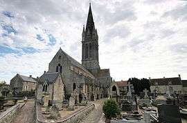
Langrune-sur-Mer
| Langrune-sur-Mer | ||
|---|---|---|
 | ||
| ||
 Langrune-sur-Mer | ||
|
Location within Normandy region  Langrune-sur-Mer | ||
| Coordinates: 49°19′23″N 0°22′18″W / 49.3231°N 0.3717°WCoordinates: 49°19′23″N 0°22′18″W / 49.3231°N 0.3717°W | ||
| Country | France | |
| Region | Normandy | |
| Department | Calvados | |
| Arrondissement | Caen | |
| Canton | Douvres-la-Délivrande | |
| Intercommunality | Cœur de Nacre | |
| Government | ||
| • Mayor (2008–2014) | Jean-Luc Guingouain | |
| Area1 | 4.74 km2 (1.83 sq mi) | |
| Population (2008)2 | 1,757 | |
| • Density | 370/km2 (960/sq mi) | |
| Time zone | CET (UTC+1) | |
| • Summer (DST) | CEST (UTC+2) | |
| INSEE/Postal code | 14354 / 14830 | |
| Elevation |
3–34 m (9.8–111.5 ft) (avg. 12 m or 39 ft) | |
|
1 French Land Register data, which excludes lakes, ponds, glaciers > 1 km² (0.386 sq mi or 247 acres) and river estuaries. 2 Population without double counting: residents of multiple communes (e.g., students and military personnel) only counted once. | ||
.svg.png)
Langrune-sur-Mer is a commune in the Calvados department in the Normandy region in northwestern France.
Population
| Historical population | ||
|---|---|---|
| Year | Pop. | ±% |
| 1962 | 1,012 | — |
| 1968 | 950 | −6.1% |
| 1975 | 1,047 | +10.2% |
| 1982 | 1,349 | +28.8% |
| 1990 | 1,539 | +14.1% |
| 1999 | 1,706 | +10.9% |
| 2008 | 1,757 | +3.0% |
International relations
The commune is twinned with:
- Fishbourne, UK since 1998
See also
References
| Wikimedia Commons has media related to Langrune-sur-Mer. |
This article is issued from Wikipedia - version of the 3/16/2016. The text is available under the Creative Commons Attribution/Share Alike but additional terms may apply for the media files.