Pertheville-Ners
| Pertheville-Ners | |
|---|---|
 | |
 Pertheville-Ners | |
|
Location within Normandy region  Pertheville-Ners | |
| Coordinates: 48°52′44″N 0°06′27″W / 48.8789°N 0.1075°WCoordinates: 48°52′44″N 0°06′27″W / 48.8789°N 0.1075°W | |
| Country | France |
| Region | Normandy |
| Department | Calvados |
| Arrondissement | Caen |
| Canton | Falaise-Sud |
| Intercommunality | Pays de Falaise |
| Government | |
| • Mayor (2008–2014) | Joël Patard |
| Area1 | 8.25 km2 (3.19 sq mi) |
| Population (2008)2 | 246 |
| • Density | 30/km2 (77/sq mi) |
| Time zone | CET (UTC+1) |
| • Summer (DST) | CEST (UTC+2) |
| INSEE/Postal code | 14498 / 14700 |
| Elevation |
71–153 m (233–502 ft) (avg. 119 m or 390 ft) |
|
1 French Land Register data, which excludes lakes, ponds, glaciers > 1 km² (0.386 sq mi or 247 acres) and river estuaries. 2 Population without double counting: residents of multiple communes (e.g., students and military personnel) only counted once. | |
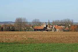
Pertheville-Ners is a commune in the Calvados department in the Normandy region in northwestern France.
History
The commune resulted from the fusion in 1858 of Pertheville (259 inhabitants in 1856) and Ners (113 inhabitants).
Administration
The mayor from 1990 to March 2008 was Michel Malet, a farmer, who was politically independent. The current mayor is Joël Patard, a teacher, also an independent.
Population
| Historical population | ||
|---|---|---|
| Year | Pop. | ±% |
| 1962 | 214 | — |
| 1968 | 191 | −10.7% |
| 1975 | 179 | −6.3% |
| 1982 | 197 | +10.1% |
| 1990 | 188 | −4.6% |
| 1999 | 209 | +11.2% |
| 2008 | 246 | +17.7% |
Sights
- The church of Saint-Aubin at Ners
- The church of Saint-Pierre at Pertheville
- The chateau
- The Manoir du Chêne Sec (Manor House of the Dry Oak)
See also
References
| Wikimedia Commons has media related to Pertheville-Ners. |
This article is issued from Wikipedia - version of the 3/16/2016. The text is available under the Creative Commons Attribution/Share Alike but additional terms may apply for the media files.