Kurmi, Nigeria
| Kurmi, Nigeria Jakwai | |
|---|---|
| LGA | |
| Motto: Home of Abundant Natural Resource | |
| Country |
|
| State | Taraba State |
| Capital | Baissa |
| Local Government Area | 1996 |
| Government | |
| • Type | Local Government Area |
| • Chairman | Hon. Stephen Ibrahim AGYA |
| Area | |
| • Total | 1,681 sq mi (4,353 km2) |
| Elevation | 872 ft (265 m) |
| Time zone | WAT (UTC+1) |
Background
Kurmi is a Local Government Area in Taraba State, Nigeria. Its headquarters are in the town of Ba'Issa.
Kurmi is bounded in the south by the Republic of Cameroon, in the south-east and North-east by Sardauna and Donga Local Government areas respectively. It is also bounded in the North by Bali Local Government, in North-west and south-west by Donga and Ussa Local Government areas respectively. It lies in an area of 1681 sqm with the population of 91,531 based on the 2006 census.[1]
Kurmi Local Government lies roughly between Latitudes 5° 31' and 7° 18'N, longitudes 10°18' and 11° 37'E at an elevation of 872 ft (265 m).
Vegetation
Kurmi local government Area lies on the south border with Cameroon and these areas are richly blessed with fertile soil which grows a number of cash crops and food crops such as Bananas, Plantains, Rice, Groundnuts, Oranges, Palm trees, Cocoyam and Cocoa,.[2] Others include Maize, Guinea corn and Sesame. Kurmi is also a producer of high quality Timber and the only Local Government with the state owned abandoned Timber Company which was called Baissa Timber Development Corporation.[3][4]
In the North western part, is a grassland which also grows most off the cash and food crops. Majority of the populace being farmers, these crops are produced in large quantity for local consumption and the rest exported, either to other parts of the country or outside the country. While about 99% of the mountainous regions in the Local Government Area, are occupied by the Ndola ethnic group.[5] The Local Government is also endowed with various natural resource including precious stones like gemstones, Forest, Water falls and Mountains.
Ethnicity
There are three Major ethnic groups which include:
- Ndola
- Tigun
- Itchen
The Ndola and Tigun people are the native ethnic groups that occupy the fertile woodland of Kurmi while Itchen people, occupied the grassland and a handful of Tiv farmers and Fulani herders also make up the population.
History
Kurmi local government was created alongside Ardo-kola, Gassol, and Ussa local governments by the Late Gen. Sani Abacha’s administration in October 1996.[6] It should be noted that, before the creation of Kurmi Local Government, it has undergone lots of checkered Histories. On 1 April 1960, just some few months to independence and shortly after the then Premier of Northern Nigeria in 1959, Late Sir Ahmadu Bello (The Sardauna of Sokoto) visited Kurmi People, The United Hills Native Authority Was created. This was created alongside Gwoza in the present day Borno State, Ganye in the present day Adamawa State, Gashaka and Mambilla in the present Taraba State in fulfillment of the promises he had made during his visit. His politics was to expand the Northern parts of Nigeria and win the heart of the populace of these Trust Territories to join Nigeria and not Cameroon. In the end, it paid off during the 1961 plebiscite. Readers should also understand that, the first plebiscite in 1959 was a failure, because the people voted for deciding their future in a later date. This was the reason of conducting the second plebiscite in 1961.
The results of the 1959 plebiscite was a big slap to the Northern People Congress and to the French Cameroonian Authorities failing from their aspirations of winning these people or region. The Sardauna of Sokoto understood and vow not to treat the issue with kids gloves any longer, reflecting on the failed plebiscite and he never took it for granted when he campaigned vigorously to win the hearts of the people and he eventually won. These Native Authorities were baits that work so well because they were timely prepared.[7] Kurmi remain a United Hills Native Authority from 1961 to 1971.
To the disheartening of the Kurmi People, ten years after, in 1971, the Native Authority was dissolved. Kurmi and Gashaka Native Authorities were merged with Mambilla. Gembu becomes the New Headquarters of the areas merged. Kurmi and Gashaka then became districts under Mambilla Local Authority. This was the advent of the Local Government System we experience today.
See also
1.Kurmi
2.The postal code of the area is 671104.[8]
3.Ngada.[9]
References
- ↑ Taraba State Govt (2014). "Local Government Area". Taraba State Govt. Retrieved 2015-09-16.
- ↑ Terkula Igidi (2013-02-03). "The Poor Cocoa Farmers of Taraba". Dailytrust News Paper. Retrieved 2015-09-16.
- ↑ Terkula Igidi (2012-01-08). "Sorry story of abandoned Taraba timber company". Dailytrust News Paper. Retrieved 2015-09-17.
- ↑ Tarabagov (2012-01-08). "Facts about Taraba". Taraba State. Retrieved 2015-09-17.
- ↑ Terkula Igidi (2014-02-02). "Kurmi: Taraba's community of dying orphans". Dailytrust News Paper. Retrieved 2015-09-16.
- ↑ nigeriaroute (2015). "Taraba State". nigeriaroute. Retrieved 2015-09-14.
- ↑ Lenshie, Nsemba Edward, Gambo, Jiebreeal Yakubu (2014). "The United Nations Plebiscites in the Northern Cameroons: Post-Colonial Issues and Challenges in Sardauna Local Government Area of Taraba State, Nigeria". International knowledge platform. Retrieved 2015-09-16.
- ↑ "Post Offices- with map of LGA". NIPOST. Retrieved 2012-06-12.
- ↑ "Post Offices- with map of LGA". NIPOST. Retrieved 2016-09-11.
State capital: Jalingo | ||
| LGAs | 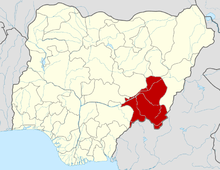 | |