Kirkwood, Delaware
| Kirkwood | |
|---|---|
| Unincorporated community | |
|
| |
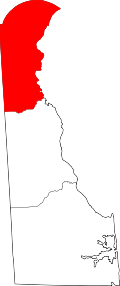
 Kirkwood  Kirkwood Location within the state of Delaware | |
| Coordinates: 39°34′18″N 75°41′47″W / 39.57167°N 75.69639°WCoordinates: 39°34′18″N 75°41′47″W / 39.57167°N 75.69639°W | |
| Country | United States |
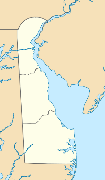
| State | Delaware |
| County | New Castle |
| Elevation | 69 ft (21 m) |
| Time zone | Eastern (EST) (UTC-5) |
| • Summer (DST) | EDT (UTC-4) |
| ZIP codes | 19708 |
| Area code(s) | 302 |
| GNIS feature ID | 216131[1] |

Kirkwood (also Kemps Corner or Saint Georges Station) is an unincorporated community in central New Castle County, Delaware, United States. It lies along Delaware Route 71, southwest of the city of Wilmington, the county seat of New Castle County.[2] Its elevation is 69 feet (21 m).[1] Although it is unincorporated, it has a post office, with the ZIP code of 19708.[3]
Kirkwood was named for Robert Kirkwood, a soldier who fought in the American Revolutionary War.[4]
Correll's Farm and Lawn Supply, Dragon Run Farm, Lum's Mill House, McCoy House, Old Cann Mansion House, Old Post Office, and Point Farm are listed on the National Register of Historic Places.[5]
References
- 1 2 "Kirkwood, Delaware". Geographic Names Information System. United States Geological Survey. Retrieved 2008-03-03.
- ↑ Rand McNally. The Road Atlas '08. Chicago: Rand McNally, 2008, p. 24.
- ↑ Zip Code Lookup
- ↑ Gannett, Henry (1905). The Origin of Certain Place Names in the United States. Govt. Print. Off. p. 176.
- ↑ National Park Service (2010-07-09). "National Register Information System". National Register of Historic Places. National Park Service.
This article is issued from Wikipedia - version of the 10/15/2016. The text is available under the Creative Commons Attribution/Share Alike but additional terms may apply for the media files.
