Clayton, Delaware
| Town of Clayton | |
| Town | |
 Entrance to St. Joseph's Industrial School | |
| Name origin: John Middleton Clayton | |
| Country | United States |
|---|---|
| State | Delaware |
| Counties | Kent, New Castle |
| Elevation | 46 ft (14.0 m) |
| Coordinates | 39°17′26″N 75°38′01″W / 39.29056°N 75.63361°WCoordinates: 39°17′26″N 75°38′01″W / 39.29056°N 75.63361°W |
| Area | 1.0 sq mi (2.6 km2) |
| - land | 1.0 sq mi (3 km2) |
| - water | 0.0 sq mi (0 km2), 0% |
| Population | 2,918 (2010) |
| Density | 1,242.3/sq mi (480/km2) |
| Timezone | EST (UTC-5) |
| - summer (DST) | EDT (UTC-4) |
| ZIP Code | 19938 |
| Area code | 302 |
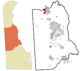 Location in Kent County and the state of Delaware.
| |
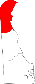
.svg.png) Location of Delaware in the United States
| |
Clayton is a town in Kent and New Castle counties in the U.S. state of Delaware. Located almost entirely in Kent County, it is part of the Dover, Delaware Metropolitan Statistical Area. The population was 2,918 at the 2010 census.[1]
History
Byrd's AME Church, the Clayton Railroad Station, Enoch Jones House, and St. Joseph's Industrial School are listed on the National Register of Historic Places.[2]
Geography
Clayton is located at 39°17′26″N 75°38′1″W / 39.29056°N 75.63361°W (39.290576, -75.633745).[3]
According to the United States Census Bureau, the town has a total area of 1.0 square mile (2.6 km2), all land. It was named after John Middleton Clayton a prominent 19th-century Delaware lawyer and politician.
Demographics
| Historical population | |||
|---|---|---|---|
| Census | Pop. | %± | |
| 1880 | 148 | — | |
| 1890 | 540 | 264.9% | |
| 1900 | 819 | 51.7% | |
| 1910 | 764 | −6.7% | |
| 1920 | 872 | 14.1% | |
| 1930 | 824 | −5.5% | |
| 1940 | 890 | 8.0% | |
| 1950 | 825 | −7.3% | |
| 1960 | 1,028 | 24.6% | |
| 1970 | 1,015 | −1.3% | |
| 1980 | 1,216 | 19.8% | |
| 1990 | 1,163 | −4.4% | |
| 2000 | 1,273 | 9.5% | |
| 2010 | 2,918 | 129.2% | |
| Est. 2015 | 3,123 | [4] | 7.0% |
As of the census[6] of 2000, there were 1,273 people, 499 households, and 346 families residing in the town. The population density was 1,242.3 people per square mile (481.9/km²). There were 524 housing units at an average density of 511.4 per square mile (198.4/km²). The racial makeup of the town was 90.26% White, 8.09% African American, 0.31% Native American, 0.08% Asian, 0.08% Pacific Islander, 0.47% from other races, and 0.71% from two or more races. Hispanic or Latino of any race were 1.34% of the population.
There were 499 households out of which 32.1% had children under the age of 18 living with them, 49.9% were married couples living together, 15.2% had a female householder with no husband present, and 30.5% were non-families. Of all households 25.7% were made up of individuals and 11.4% had someone living alone who was 65 years of age or older. The average household size was 2.55 and the average family size was 3.05.
In the town the population was spread out with 27.2% under the age of 18, 7.3% from 18 to 24, 31.2% from 25 to 44, 20.3% from 45 to 64, and 14.0% who were 65 years of age or older. The median age was 36 years. For every 100 females there were 89.2 males. For every 100 females age 18 and over, there were 81.1 males.
The median income for a household in the town was $43,462, and the median income for a family was $48,000. Males had a median income of $34,792 versus $25,862 for females. The per capita income for the town was $18,268. About 4.0% of families and 7.0% of the population were below the poverty line, including 5.6% of those under age 18 and 8.1% of those age 65 or over.
References
- ↑ http://www.stateplanning.delaware.gov/census_data_center/
- ↑ National Park Service (2010-07-09). "National Register Information System". National Register of Historic Places. National Park Service.
- ↑ "US Gazetteer files: 2010, 2000, and 1990". United States Census Bureau. 2011-02-12. Retrieved 2011-04-23.
- ↑ "Annual Estimates of the Resident Population for Incorporated Places: April 1, 2010 to July 1, 2015". Retrieved July 2, 2016.
- ↑ "Census of Population and Housing". Census.gov. Archived from the original on May 11, 2015. Retrieved June 4, 2015.
- ↑ "American FactFinder". United States Census Bureau. Archived from the original on 2013-09-11. Retrieved 2008-01-31.
Municipalities and communities of Kent County, Delaware, United States | ||
|---|---|---|
| Cities | ||
| Towns | ||
| CDPs | ||
| Unincorporated communities |
| |
| Hundreds | ||
| Footnotes | ‡This populated place also has portions in an adjacent county or counties | |