Jonesboro, Arkansas
| Jonesboro, Arkansas | ||
|---|---|---|
| City | ||
|
Clockwise from top: Craighead County Courthouse, house in the West Washington Avenue Historic District, downtown Jonesboro, and Arkansas State University's Dean B. Ellis Library | ||
| ||
| Nickname(s): J-boro | ||
| Motto: People, Pride, Progress | ||
 Location in the state of Arkansas | ||
 Jonesboro, Arkansas Location in the United States | ||
| Coordinates: 35°49′41″N 90°41′39″W / 35.82806°N 90.69417°WCoordinates: 35°49′41″N 90°41′39″W / 35.82806°N 90.69417°W | ||
| Country | United States | |
| State | Arkansas | |
| County | Craighead | |
| Incorporated | February 19, 1859 | |
| Government | ||
| • Mayor | Harold Perrin | |
| Area | ||
| • City | 79.3 sq mi (205.4 km2) | |
| • Land | 79.9 sq mi (206.9 km2) | |
| • Water | 0.6 sq mi (1.5 km2) | |
| Elevation | 259 ft (79 m) | |
| Population (2012 United States Census Estimate) | ||
| • City | 70,187 | |
| • Density | 879/sq mi (339.3/km2) | |
| • Metro | 124,042 | |
| Time zone | CST (UTC-6) | |
| • Summer (DST) | CDT (UTC-5) | |
| ZIP codes | 72401-72404 | |
| Area code(s) | 870 | |
| FIPS code | 05-35710 | |
| GNIS feature ID | 0077389 | |
| Website |
www | |


Jonesboro is a city in Craighead County, Arkansas, United States. According to the 2010 Census, the population of the city was 71,551.[1] A college town, Jonesboro is the largest city in northeastern Arkansas and the Arkansas Delta; it is the fifth-most populous city in the state.
It is the principal city of and is included in the Jonesboro, Arkansas Metropolitan Statistical Area. In 2010, the Jonesboro metropolitan area had a population of 121,026[2] and a population of 163,116 in the Jonesboro-Paragould Combined Statistical Area.[3]
Jonesboro is home to Arkansas State University and New York Institute of Technology College of Osteopathic Medicine's A-State campus. It is a regional center for manufacturing, agriculture, medicine, education, and trade.
History
The Jonesboro area was first inhabited for thousands of years by indigenous peoples. At the time of European encounter, historic tribes included the Osage, the Caddo, and the Quapaw.[4] The name of the state of Arkansas comes from the Quapaw language.[4] French and Spanish traders and trappers had relations with these groups.
After the United States acquired this territory in the Louisiana Purchase of 1803, American settlers eventually made their way to the area where Jonesboro is located. They began exploring, hunting, trapping, and trading with the local Indian tribes. A permanent settlement of Jonesboro was set up shortly after 1815.
In 1859, land was taken from nearby Greene, Mississippi, and Poinsett counties and was used to form Craighead County. Jonesboro was designated as the original county seat. As the population increased in the west of the county, Lake City was named as the second seat.[5] In 1859 Jonesboro had 150 residents. It was named after State Senator William A. Jones[6] in recognition of his support for the formation of Craighead County. Originally spelled Jonesborough, the city name was later shortened to its present-day spelling.

During the late 19th century, the city tried to develop its court system and downtown infrastructure. Shortly after being named county seat, the highest point in Jonesboro was identified and a court house was planned for construction. This was delayed for several years as the locals did not want to ruin their deer hunting. The first court house was finally completed but was destroyed by a fire in 1869. A store across from this site was rented and used as a court house. It was destroyed in an 1876 fire. Another building was constructed on the same site, but it fell to a fire in 1878, a major one that destroyed most of downtown Jonesboro. Soon afterward, another court house was constructed, and it still stands.
The St. Louis Southwestern Railway, known as the Cotton Belt Railroad was constructed through Jonesboro, with its tracks passing just north of the center of the city. During the first train's journey, it became stuck and supplies had to be carried into town.[4] It connected St. Louis to points in Arkansas and Texas. Other major railways began to construct tracks to and from Jonesboro, including the St. Louis–San Francisco Railway and Missouri Pacific Railroad. Some of the rail companies still own and use the tracks that run through Jonesboro.
The city set up the Jonesboro School District in 1899.[7] In 1900, St. Bernard's Regional Medical Center was established by the Olivetan Benedictine Sisters.[8] The Grand Leader Department Store, the first department store in the city, was opened in 1900. Woodland College and two schools within the Jonesboro School District were opened in 1904. Arkansas State College (now Arkansas State University) was established in 1909,[9] a year in which the first horseless carriages were driven in the city. The two oldest churches of the city were started in the 1910s. First Baptist Church was founded in 1911, and First Methodist Church in 1916.
On September 10, 1931, Governor Harvey Parnell authorized the Arkansas National Guard to be deployed in Jonesboro to quell the Church War, a clash between the followers of Joe Jeffers and Dow H. Heard, the pastor of the First Baptist Church of Jonesboro. Jeffers' supporters also attacked the mayor and police chief, resulting in front page coverage of the incident in The New York Times.
During the 20th century, Jonesboro began to diversify its economy, with industrial businesses that allowed it to grow beyond the cotton culture. The university attracts educated residents.
The Westside Middle School massacre occurred on March 24, 1998. Two young boys (aged 11 and 13 years) fired upon students at Westside Middle School while hidden in woodlands near the school. They killed four students and one teacher, and injured ten persons.
In the 2007-2008 school year the Jonesboro Public School District elementary schools were reclassified as magnet schools.[10]
Geography
Jonesboro is located at 35°49′41″N 90°41′39″W / 35.82806°N 90.69417°W (35.828067, -90.694048)[11] atop Crowley's Ridge in northeastern Arkansas.
According to the United States Census Bureau, the city has a total area of 80.5 square miles (208.4 km2), of which 79.9 square miles (206.9 km2) is land and 0.58 square miles (1.5 km2), or 0.72%, is water.[1]
Climate
Jonesboro has a humid subtropical climate (Köppen climate classification Cfa).
| Climate data for Jonesboro | |||||||||||||
|---|---|---|---|---|---|---|---|---|---|---|---|---|---|
| Month | Jan | Feb | Mar | Apr | May | Jun | Jul | Aug | Sep | Oct | Nov | Dec | Year |
| Average high °F (°C) | 46 (8) |
51 (11) |
61 (16) |
71 (22) |
80 (27) |
88 (31) |
92 (33) |
90 (32) |
83 (28) |
73 (23) |
60 (16) |
49 (9) |
70.3 (21.3) |
| Average low °F (°C) | 26 (−3) |
30 (−1) |
38 (3) |
48 (9) |
57 (14) |
66 (19) |
70 (21) |
68 (20) |
60 (16) |
48 (9) |
38 (3) |
29 (−2) |
48.2 (9) |
| Average precipitation inches (mm) | 3.29 (83.6) |
3.57 (90.7) |
4.45 (113) |
4.99 (126.7) |
4.92 (125) |
3.29 (83.6) |
2.73 (69.3) |
2.67 (67.8) |
3.12 (79.2) |
3.89 (98.8) |
5.02 (127.5) |
4.25 (108) |
46.18 (1,173) |
| Source: [12] | |||||||||||||
Demographics
| Historical population | |||
|---|---|---|---|
| Census | Pop. | %± | |
| 1890 | 2,065 | — | |
| 1900 | 4,508 | 118.3% | |
| 1910 | 7,123 | 58.0% | |
| 1920 | 9,384 | 31.7% | |
| 1930 | 10,326 | 10.0% | |
| 1940 | 11,729 | 13.6% | |
| 1950 | 16,310 | 39.1% | |
| 1960 | 21,418 | 31.3% | |
| 1970 | 27,050 | 26.3% | |
| 1980 | 31,530 | 16.6% | |
| 1990 | 46,534 | 47.6% | |
| 2000 | 55,515 | 19.3% | |
| 2010 | 67,263 | 21.2% | |
| Est. 2015 | 73,907 | [13] | 9.9% |

As of the census[15] of 2013, there were 71,551 people, 26,111 households, and 16,637 families residing in the city. The population density was 697.1 people per square mile (269.1/km²). There were 28,321 housing units at an average density of 304.7 per square mile (117.6/km²). The racial makeup of the city was 74.7% White, 18.4% Black, 0.4% Native American, 1.5% Asian, 0.03% Pacific Islander, 1.0% from other races, and 2.0% from two or more races. 5.2% of the population were Hispanic.
There were 26,111 households out of which 30.1% had children under the age of 18 living with them, 48.9% were married couples living together, 12.2% had a female householder with no husband present, and 35.4% were non-families. There are 878 unmarried partner households: 776 heterosexual, 50 same-sex male, and 52 same-sex female households. 27.5% of all households were made up of individuals and 9.0% had someone living alone who was 65 years of age or older. The average household size was 2.47 and the average family size was 2.93.
In the city the population was spread out with 22.9% under the age of 18, 16.6% from 18 to 24, 28.1% from 25 to 44, 20.5% from 45 to 64, and 11.8% who were 65 years of age or older. The median age was 32 years. For every 100 females there were 92.1 males. For every 100 females age 18 and over, there were 88.8 males.
The median income for a household in the city was $32,196, and the median income for a family was $42,082. Males had a median income of $21,633 versus $31,633 for females. The per capita income for the city was $17,884. About 12.9% of families and 23.1% of the population were below the poverty line, including 22.4% of those under age 18 and 12.3% of those age 65 or over.
Transportation
Air
The region is served by Jonesboro Municipal Airport. Scheduled flights between Jonesboro and St. Louis, Missouri, are offered daily by Air Choice One.
Public transport
The area is served by the Jonesboro Economic Transit System (JETS). As of 2011, JETS operates three fixed routes, as well as para-transit service for disabled persons.
List of highways
|
Education
Elementary and secondary education
.jpg)
There are four public school districts operating within the city limits of Jonesboro. They include:
- Jonesboro School District[16]
- Valley View School District[17]
- Nettleton School District[18]
- Westside Consolidated School District[19]
- North East Arkansas Career & Tech Center[16]
Notable people
- Jonathan Adams, composer of choral music, known for his settings of the poetry of Edgar Allan Poe, and his piece written in honor of the victims of Hurricane Katrina, "I Believe in the Sun"
- David Auburn, playwright and screenplay writer, best known for his award-winning play Proof (and the adapted screenplay for a film of the same name)
- Earl Bell, former pole vault champion and current coach of top US men and women vaulters
- Wes Bentley, actor, known for his role as Ricky in American Beauty
- Paul Bookout, former state senator for District 21; state Senate President, 2011 to 2013
- Gene Bradley, gridiron football player
- Rodger Bumpass, the voice of Squidward Tentacles on SpongeBob SquarePants
- Hattie Caraway, first woman elected to the United States Senate
- Paul Caraway, son of Hattie Caraway; High Commissioner of the United States Civil Administration of the Ryukyu Islands
- Matt Cavenaugh, Broadway actor
- Francis Cherry, governor of Arkansas from 1953 to 1955
- John Cooper, Republican state senator for District 21 since 2014; resident of Jonesboro
- Rick Crawford, U.S. congressman from Arkansas
- Ferd Dreher, American football player
- Woody Freeman, businessman; Republican gubernatorial nominee in 1984
- Michelle Gray, state representative since 2013 from Melbourne; former resident of Jonesboro[20]
- John Grisham, novelist
- Julia Butterfly Hill, environmental activist
- Larry Lacewell, former American football player, coach and scout
- Jack Ladyman, mechanical engineer and Republican member of the Arkansas House of Representatives from a part of Craighead County
- Mary Lambert, film director (Pet Sematary); various Madonna music videos
- Evan Lindquist, artist and first Artist Laureate of the State of Arkansas
- Kyle Dean Massey, Broadway actor
- Dustin McDaniel, former Arkansas Attorney General
- Pete Mead, middleweight boxing champion of the 1940s
- Ben Murphy, actor, formerly of ABC's Alias Smith and Jones
- Jon Olsen, Olympic gold medalist swimmer
- David Ring, motivational speaker
- Brandt Smith, Republican member of the Arkansas House of Representatives for District 58 in Craighead County
- W. Stephen Smith, voice teacher and author, Northwestern University Professor of Voice and Opera
- John W. Snyder, U.S. Secretary of the Treasury under President Harry S. Truman
- Dan A. Sullivan, Republican member of the Arkansas House of Representatives from Jonesboro since 2015
- Charley Thornton, sports figure
- Dwight Tosh, Republican member of the Arkansas House of Representatives from Jonesboro since 2015
- Bobby Lee Trammell, rockabilly musician
- Debbye Turner, Miss America 1990
- Jeff Hartwig, Pole Vaulter
Shopping

The Mall at Turtle Creek, opened in 2006, is the largest mall in northeast Arkansas. It was the only enclosed mall opened in the United States that year.[21] Before the opening of the mall, the Indian Mall was the primary shopping destination in northeast Arkansas. In 2012, Indian Mall, named for the former mascot of Arkansas State University, was demolished. The only store to remain in its original location was Sears.
In 2012, Kiplinger's Personal Finance ranked Jonesboro ninth of the "Ten Best Cities for Cheapskates".[22]
Local television and radio
Television:
- KAIT - 8.1 ABC
- KAIT - 8.2 NBC
- KTEJ - 19.1-19.4 AETN/PBS
- KJNB-LD/KJNE-LD - 39.1/42.1 Fox
- KJNB-LD/KJNE-LD - 39.2/42.2 CBS
- KVTJ - 48.1 VTN
Radio:
FM
- KASU-FM 91.9 FM Public Radio
- K224DW (KDXY-FM/HD2) 92.7 FM Sports ESPN Jonesboro
- K237FI (KNEA-AM) 95.3 FM Sports 95.3 The Ticket
- K253BQ (KJBX-FM/HD2) 98.5 FM Country The Outlaw 98.5
- KEGI-FM 100.5 FM Classic Rock 100.5 The Eagle Rocks
- K267AS (KBTM-AM) 101.3 FM News/Talk News Talk 1230
- KIYS-FM 101.7 FM Top 40 101.7 KISS-FM
- KDXY-FM 104.9 FM Country 104.9 The Fox
- KJBX-FM 106.3 FM Hot AC The Mix 106.3
- K298AV (KDXY-FM/HD3) 107.5 FM Top 40 107.5 The Party Station
- KFIN-FM 107.9 FM Country 107.9 K-FINE
- KLEK-LP 102.5 FM R&B/Blues/Gospel/Jazz Urban Adult Hits and Classics
- KFLO-LP 102.9 FM Southern Gospel
AM
- KNEA-AM 970 AM Sports 95.3 The Ticket
- KBTM-AM 1230 AM News/Talk News Talk 1230
References
- 1 2 "Geographic Identifiers: 2010 Demographic Profile Data (G001): Jonesboro city, Arkansas". U.S. Census Bureau, American Factfinder. Retrieved June 18, 2014.
- ↑ "Geographic Identifiers: 2010 Demographic Profile Data (G001): Jonesboro, AR Metro Area, Arkansas". U.S. Census Bureau, American Factfinder. Retrieved June 18, 2014.
- ↑ http://www.census.gov/popest/data/metro/totals/2012/tables/CBSA-EST2012-02.csv
- 1 2 3 History of Jonesboro
- ↑ "Craighead County Arkansas Genealogy Trails". Genealogytrails.com. 2006-03-03. Retrieved 2012-08-13.
- ↑ Gannett, Henry (1905). The Origin of Certain Place Names in the United States. Govt. Print. Off. p. 170.
- ↑ Jonesboro Public School System
- ↑ St. Bernard's Medical Center: History & Facts
- ↑ About Arkansas State University
- ↑ KAIT - Jonesboro, AR: Teachers get Ready for Magnet Schools
- ↑ "US Gazetteer files: 2010, 2000, and 1990". United States Census Bureau. 2011-02-12. Retrieved 2011-04-23.
- ↑ "Average weather for Jonesboro, Arkensas". Weather.com. July 2011. Retrieved December 21, 2008.
- ↑ "Annual Estimates of the Resident Population for Incorporated Places: April 1, 2010 to July 1, 2015". Retrieved July 2, 2016.
- ↑ "Census of Population and Housing". Census.gov. Retrieved June 4, 2015.
- ↑ "American FactFinder". United States Census Bureau. Retrieved 2008-01-31.
- 1 2 Jonesboro Public Schools
- ↑ Valley View School District, Jonesboro AR
- ↑ Nettleton Public Schools
- ↑ Westside Schools
- ↑ "Michelle Gray's Biography". Project Vote Smart. Retrieved April 12, 2015.
- ↑ "The Mall at Turtle Creek to hold grand opening March 28-April 8 - Memphis Business Journal". Memphis Business Journal. Retrieved 2016-02-24.
- ↑ "10 Best Cities for Cheapskates". Kiplinger. 2012-08-08. Retrieved 2012-08-13.
External links
| Wikimedia Commons has media related to Jonesboro, Arkansas. |
- City of Jonesboro official website
- Former Jonesboro Railroad Depot photo
- "Local Jonesboro Ar information" Information on Jonesboro, Arkansas, including maps and addresses
- Encyclopedia of Arkansas History & Culture entry: Jonesboro (Craighead County)
Municipalities and communities of Craighead County, Arkansas, United States | ||
|---|---|---|
| Cities | 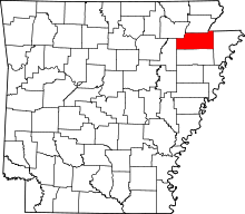 | |
| Towns | ||
| Unincorporated communities |
| |
