Interstate 77 in Ohio
| ||||
|---|---|---|---|---|
|
I-77 highlighted in red | ||||
| Route information | ||||
| Maintained by ODOT | ||||
| Length: | 163.03 mi (262.37 km) | |||
| Major junctions | ||||
| South end: |
| |||
|
| ||||
| North end: |
| |||
| Location | ||||
| Counties: | Washington, Noble, Guernsey, Tuscarawas, Stark, Summit, Cuyahoga | |||
| Highway system | ||||
| ||||

_map.svg.png)
Interstate 77 (I-77) is an Interstate Highway in the eastern United States. It traverses diverse terrain, from the mountainous state of West Virginia to the rolling farmlands of North Carolina and Ohio. It largely supplants the old U.S. Route 21 between Cleveland, Ohio, and Columbia, South Carolina, as an important north–south corridor through the middle Appalachians. The southern terminus of Interstate 77 is in Columbia at the junction with Interstate 26. The northern terminus is in Cleveland at the junction with Interstate 90.
Route description
Entering from West Virginia at Marietta via the Marietta–Williamstown Interstate Bridge, Interstate 77 passes through rolling Appalachian terrain.
The interchange with I-70 at Cambridge was noted on the cover of the 1969 Ohio Department of Highways official highway map as being the "World's Largest Interchange", covering over 300 acres (1.2 km2) of land.
Other major Interstate Highways I-77 connects with in Ohio are I-76, I-80 (Ohio Turnpike), and I-90. The interchange with the Ohio Turnpike was completed December 3, 2001,[1][2] providing direct access; previously, traffic had to exit at Ohio State Route 21 to get to the Turnpike.
Interstate 77 is also known as the "Vietnam Veterans' of America Highway" in Ohio,[3] and the Willow Freeway in Greater Cleveland.[4]
History
Officially designated to run from Port Huron to Charlotte, I-77 appeared on the original Interstate system route numbering plan in 1957. The part of Interstate 94 from Detroit northeast to Port Huron, Michigan was originally planned as I-77 in 1957; the current I-77 was I-79.[5] When the current Interstate 79 was added in Pennsylvania, the I-77 designation was moved to its current route, but the I-77 in Michigan also remained in the 1958 numbering plan,[6] so the designation followed Interstate 90 and Interstate 75 in order to keep it continuous; the designation north of I-77's westward turn was to have been Interstate 177.[7] I-77 in Michigan later became part of I-94.
Exit list
| County | Location | mi | km | Exit | Destinations | Notes |
|---|---|---|---|---|---|---|
| Ohio River | 0.00 | 0.00 | Marietta–Williamstown Interstate Bridge | |||
| Washington | Marietta | 0.50 | 0.80 | 1 | ||
| Muskingum Township | 6.26 | 10.07 | 6 | |||
| Aurelius Township | 16.54 | 26.62 | 16 | |||
| Noble | Olive Township | 25.22 | 40.59 | 25 | ||
| Belle Valley | 28.95 | 46.59 | 28 | |||
| Guernsey | Valley Township | 38.09 | 61.30 | 37 | ||
| Byesville | 41.83 | 67.32 | 41 | |||
| Cambridge Township | 44.26 | 71.23 | 44 | Signed as exits signed 44A (east) and 44B (west); I-70 exits 180A-B | ||
| 46.31 | 74.53 | 46 | Signed as exits signed 46A (east) and 46B (west) | |||
| 47.84 | 76.99 | 47 | ||||
| Liberty Township | 54.72 | 88.06 | 54 | |||
| Tuscarawas | Salem Township | 65.35 | 105.17 | 65 | ||
| Jefferson Township | 72.74 | 117.06 | 73 | |||
| New Philadelphia | 80.94 | 130.26 | 81 | Southern terminus of concurrency with US 250 | ||
| Dover | 83.41 | 134.24 | 83 | |||
| 85 | Schneiders Crossing Road – Dover | Interchange opened November 12, 2010[8][9] | ||||
| Franklin Township | 87.77 | 141.25 | 87 | Northern terminus of concurrency with US 250 | ||
| Bolivar | 93.46 | 150.41 | 93 | |||
| Stark | Pike–Canton township line | 99.71 | 160.47 | 99 | Fohl Street Southwest – Navarre | |
| Canton | 101.38 | 163.16 | 101 | Eastern terminus of SR 627 | ||
| 103.22 | 166.12 | 103 | Northern terminus of SR 800 | |||
| 104.27 | 167.81 | 104 | Southern terminus of concurrency with US 62; signed as exits 104A (east) and 104B (west) | |||
| 105.48 | 169.75 | 105 | ||||
| 106.31 | 171.09 | 106 | 13th Street Northwest – Canton Mercy Hospital, McKinley Memorial | |||
| 107.36 | 172.78 | 107A | Eastern terminus of SR 687 | |||
| 107.70 | 173.33 | 107B | Northern terminus of concurrency with US 62 | |||
| Plain Township | 110.06 | 177.12 | 109 | Everhard Road Northwest / Whipple Avenue Northwest – North Canton, Westfield Belden Village | Signed as 109A (east) and 109B (west) northbound | |
| Jackson Township | 111.66 | 179.70 | 111 | Portage Street Northwest – North Canton | ||
| 112.84 | 181.60 | 112 | Shuffel Street Northwest | Fred Krum Memorial Interchange, opened September 6, 2007[10][11][12] | ||
| Summit | Green | 114.04 | 183.53 | 113 | ||
| 118.07 | 190.02 | 118 | ||||
| 120.25 | 193.52 | 120 | South Arlington Road | |||
| Coventry Township | 112.95 | 181.78 | 122 | I-277 exits 4A-B; signed as exits 122A (east) and 122B (west). | ||
| Akron | 123.26 | 198.37 | 123A | East Waterloo Road | Southbound exit and northbound entrance | |
| 123.99 | 199.54 | 123B | ||||
| 124.42 | 200.23 | 124A | Archwood Avenue / Firestone Boulevard | Southbound exit and northbound entrance | ||
| 124.78 | 200.81 | 124B | Lovers Lane / Cole Avenue | Southbound exit only | ||
| 125.53 | 202.02 | 125 | Southern terminus of concurrency with I-76; signed as exits signed as 125A (SR 8 north) and 125B (I-76 east) northbound; no exit number northbound | |||
| 126.26 | 203.20 | 22A | Grant Street / Wolf Ledges Parkway | |||
| 126.66 | 203.84 | 22B | Broadway / Main Street | |||
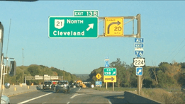
| 127.34 | 204.93 | 21 | Southern terminus of SR 59 | |||
| 128.76 | 207.22 | 129 | Northern terminus of concurrency with I-76; no exit number southbound | |||
| 129.20 | 207.93 | 130 | ||||
| 130.65 | 210.26 | 131 | ||||
| 131.82 | 212.14 | 132 | White Pond Road / Mull Avenue | |||
| 133.45 | 214.77 | 133 | Ridgewood Road / Miller Road | |||
| 134.99 | 217.25 | 134 | Cleveland-Massillon Road | |||
| Copley Township | 135.91 | 218.73 | 135 | Southern terminus of concurrency with SR 21 | ||
| 136.72 | 220.03 | 137 | Exits signed as 137A (east) and 137B (west) | |||
| Bath Township | 138.22 | 222.44 | 138 | Ghent Road | ||
| Richfield | 143.11 | 230.31 | 142 | |||
| 143.67 | 231.21 | 143 | ||||
| 145.76 | 234.58 | 145 | Northern terminus of concurrency with SR 21;northbound exit and southbound entrance | |||
| Summit–Cuyahoga county line | Richfield–Brecksville line | 146.97 | 236.53 | 146 | Exit 143 on I-80 | |
| Cuyahoga | Brecksville | 147.91 | 238.04 | 147 | Miller Road | Southbound exit and northbound entrance |
| Broadview Heights | 149.92 | 241.27 | 149 | Exits signed as149A (east) and 149B (west) southbound | ||
| 151.88 | 244.43 | 151 | Wallings Road | |||
| Independence | 153.06 | 246.33 | 153 | Pleasant Valley Road | ||
| 155.47 | 250.20 | 155 | Rockside Road | |||
| 156.26 | 251.48 | 156 | I-480 exits 20A-B | |||
| Cuyahoga Heights | 157.33 | 253.20 | 157 | Southbound exit and northbound entrance; northern terminus of SR 21 | ||
| 158.53 | 255.13 | 158 | Grant Avenue | |||
| Newburgh Heights | 159.22 | 256.24 | 159A | Harvard Avenue | ||
| Cleveland | 159.78 | 257.14 | 159B | Fleet Avenue | No southbound entrance | |
| 160.48 | 258.27 | 160 | Pershing Avenue | Northbound exit and southbound entrance | ||
| 161.19 | 259.41 | 161A | Northbound exit and southbound entrance | |||
| 161.47 | 259.86 | 161B | Southern end of future SR 10 concurrency; I-490 exit 2B | |||
| 162.33 | 261.24 | 162A | Northern end of future SR 10 concurrency; Broadway Ave. not signed northbound | |||
| 162.85 | 262.08 | 162B | East 22nd Street / East 14th Street | Northbound exit and southbound entrance | ||
| 163 | East 9th Street / Ontario Street | Northbound exit only | ||||
| 163.03 | 262.37 | 172B | East 22nd Street | Northbound exit only; exit numbers follow I-90 mileage | ||
| 172C | Carnegie Avenue | Northbound exit and southbound entrance | ||||
| I-90 exit 172A; northern terminus of I-77; direct access to I-90 westbound removed April 11–12, 2011.[13][14] | ||||||
1.000 mi = 1.609 km; 1.000 km = 0.621 mi
| ||||||
Interstate 77 Alternate
| |
|---|---|
| Location: | Summit County |
Interstate 77 Alternate is the designation of an Interstate route in Summit County. The route follows I-76 westbound from I-277 in Akron, then follows SR 21 northbound in Norton. The route terminates at I-77 in Copley Township.
References
| Wikimedia Commons has media related to Interstate 77 in Ohio. |
- ↑ Exner, Rich (2001-12-02). "Turnpike ramps to I-77 open tomorrow". The Plain Dealer. Retrieved 2008-06-16.
- ↑ "Ohio Turnpike, I-77 Interchange Opens To Traffic". WEWS-TV. 2001-12-03. Archived from the original on May 11, 2008. Retrieved 2008-06-16.
- ↑ Ohio Revised Code 5533.37
- ↑ "Willow Freeway" from Encyclopedia of Cleveland History
- ↑ Official Route Numbering for the National System of Interstate and Defense Highways, August 14, 1957
- ↑ Official Route Numbering for the National System of Interstate and Defense Highways, June 27, 1958
- ↑ 3-digit Interstates from I-77. Kurumi.com. Retrieved on 2010-05-10.
- ↑ I77/CR80 Interchange Project. Ohio Department of Transportation District 11.
- ↑ Mizer, Joe (2010-11-11). "Ceremonies at Dover today to mark opening of new bridges". The Times Reporter. Retrieved 2010-12-08.
- ↑ Ohio Revised Code 5533.931
- ↑ Wang, Robert (2010-03-29). "Has Shuffel interchange lived up to expectations?". The Repository. Retrieved 2010-05-10.
- ↑ Rossiter, Bob (2007-09-06). "Shuffel Street interchange on Interstate 77 opens". The Repository. Retrieved 2010-05-10.
- ↑ "Two Interstate 77/90 Ramps to Close Permanently as Part of Innerbelt Work" (press release). Ohio Department of Transportation District 12, 2011-04-05. Retrieved on 2011-04-07.
- ↑ Wendel, Kim (2011-04-10). "ODOT: Two I-77/90 ramps to close permanently". WKYC. Retrieved 2011-04-12.
| Previous state: West Virginia |
Ohio | Next state: Terminus |
