Lower Salem, Ohio
| Lower Salem, Ohio | |
|---|---|
| Village | |
 Location of Lower Salem, Ohio | |
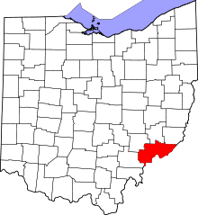
 Location of Lower Salem in Washington County | |
| Coordinates: 39°33′45″N 81°23′42″W / 39.56250°N 81.39500°WCoordinates: 39°33′45″N 81°23′42″W / 39.56250°N 81.39500°W | |
| Country | United States |
| State | Ohio |
| County | Washington |
| Government | |
| • Mayor | Lloyd Ullman [1] |
| Area[2] | |
| • Total | 0.06 sq mi (0.16 km2) |
| • Land | 0.06 sq mi (0.16 km2) |
| • Water | 0 sq mi (0 km2) |
| Elevation[3] | 650 ft (198 m) |
| Population (2010)[4] | |
| • Total | 86 |
| • Estimate (2012[5]) | 86 |
| • Density | 1,433.3/sq mi (553.4/km2) |
| Time zone | Eastern (EST) (UTC-5) |
| • Summer (DST) | EDT (UTC-4) |
| ZIP code | 45745 |
| Area code(s) | 740 |
| FIPS code | 39-45220[6] |
| GNIS feature ID | 1057819[3] |
Lower Salem is a village in Washington County, Ohio, United States. The population was 86 at the 2010 census.
History
Lower Salem had its start when a corduroy road was built through it to Marietta.[7] A post office has been in operation at Lower Salem since 1828.[8] The town site was not laid out until 1850.[9]
Geography
Lower Salem is located at 39°33′45″N 81°23′42″W / 39.56250°N 81.39500°W (39.562423, -81.394934).[10]
According to the United States Census Bureau, the village has a total area of 0.06 square miles (0.16 km2), all land.[2]
Demographics
| Historical population | |||
|---|---|---|---|
| Census | Pop. | %± | |
| 1870 | 187 | — | |
| 1880 | 198 | 5.9% | |
| 1900 | 190 | — | |
| 1910 | 187 | −1.6% | |
| 1920 | 138 | −26.2% | |
| 1930 | 135 | −2.2% | |
| 1940 | 135 | 0.0% | |
| 1950 | 126 | −6.7% | |
| 1960 | 143 | 13.5% | |
| 1970 | 106 | −25.9% | |
| 1980 | 110 | 3.8% | |
| 1990 | 103 | −6.4% | |
| 2000 | 109 | 5.8% | |
| 2010 | 86 | −21.1% | |
| Est. 2015 | 86 | [11] | 0.0% |
2010 census
As of the census[4] of 2010, there were 86 people, 31 households, and 21 families residing in the village. The population density was 1,433.3 inhabitants per square mile (553.4/km2). There were 39 housing units at an average density of 650.0 per square mile (251.0/km2). The racial makeup of the village was 93.0% White and 7.0% African American. Hispanic or Latino of any race were 1.2% of the population.
There were 31 households of which 35.5% had children under the age of 18 living with them, 41.9% were married couples living together, 16.1% had a female householder with no husband present, 9.7% had a male householder with no wife present, and 32.3% were non-families. 19.4% of all households were made up of individuals and 3.2% had someone living alone who was 65 years of age or older. The average household size was 2.77 and the average family size was 3.19.
The median age in the village was 41 years. 23.3% of residents were under the age of 18; 5.8% were between the ages of 18 and 24; 28% were from 25 to 44; 29.1% were from 45 to 64; and 14% were 65 years of age or older. The gender makeup of the village was 44.2% male and 55.8% female.
2000 census
As of the census[6] of 2000, there were 109 people, 36 households, and 27 families residing in the village. The population density was 1,373.2 people per square mile (526.1/km²). There were 38 housing units at an average density of 478.7 per square mile (183.4/km²). The racial makeup of the village was 93.58% White, 0.92% African American, and 5.50% from two or more races.
There were 36 households out of which 47.2% had children under the age of 18 living with them, 44.4% were married couples living together, 22.2% had a female householder with no husband present, and 25.0% were non-families. 19.4% of all households were made up of individuals and 8.3% had someone living alone who was 65 years of age or older. The average household size was 3.03 and the average family size was 3.52.
In the village the population was spread out with 33.0% under the age of 18, 10.1% from 18 to 24, 31.2% from 25 to 44, 18.3% from 45 to 64, and 7.3% who were 65 years of age or older. The median age was 30 years. For every 100 females there were 73.0 males. For every 100 females age 18 and over, there were 73.8 males.
The median income for a household in the village was $36,875, and the median income for a family was $36,875. Males had a median income of $26,875 versus $16,875 for females. The per capita income for the village was $10,209. There were 7.4% of families and 5.0% of the population living below the poverty line, including 3.7% of under eighteens and 10.5% of those over 64.
References
- ↑ "Washington County Public Officials". Retrieved 2008-03-22.
- 1 2 "US Gazetteer files 2010". United States Census Bureau. Retrieved 2013-01-06.
- 1 2 "US Board on Geographic Names". United States Geological Survey. 2007-10-25. Retrieved 2008-01-31.
- 1 2 "American FactFinder". United States Census Bureau. Retrieved 2013-01-06.
- ↑ "Population Estimates". United States Census Bureau. Retrieved 2013-06-17.
- 1 2 "American FactFinder". United States Census Bureau. Retrieved 2008-01-31.
- ↑ "How communities got their names". Marietta Times. February 19, 2013. Retrieved 29 December 2015.
- ↑ "Washington County". Jim Forte Postal History. Retrieved 29 December 2015.
- ↑ Hathaway, Seymour J. (1902). History of Marietta and Washington County, Ohio, and Representative Citizens. Biographical Publishing Company. p. 321.
- ↑ "US Gazetteer files: 2010, 2000, and 1990". United States Census Bureau. 2011-02-12. Retrieved 2011-04-23.
- ↑ "Annual Estimates of the Resident Population for Incorporated Places: April 1, 2010 to July 1, 2015". Retrieved July 2, 2016.
- ↑ "Census of Population and Housing". Census.gov. Retrieved June 4, 2015.