Hillsdale (town), New York
| Hillsdale, New York | |
|---|---|
| Town | |
|
Hillsdale countryside | |
 Location of Hillsdale, New York | |
| Coordinates: 42°13′37″N 73°32′13″W / 42.22694°N 73.53694°WCoordinates: 42°13′37″N 73°32′13″W / 42.22694°N 73.53694°W | |
| Country | United States |
| State | New York |
| County | Columbia |
| Government | |
| • Type | Town Council |
| • Town Supervisor | Arthur Baer (I) |
| • Town Council |
Members' List
|
| Area | |
| • Total | 47.9 sq mi (124.0 km2) |
| • Land | 47.7 sq mi (123.6 km2) |
| • Water | 0.2 sq mi (0.4 km2) |
| Elevation | 961 ft (293 m) |
| Population (2010) | |
| • Total | 1,927 |
| • Density | 40/sq mi (15.6/km2) |
| Time zone | Eastern (EST) (UTC-5) |
| • Summer (DST) | EDT (UTC-4) |
| ZIP code | 12529 |
| Area code(s) | 518 |
| FIPS code | 36-34748 |
| GNIS feature ID | 0979068 |
| Website |
www |

Hillsdale is a rural town in Columbia County, New York, United States. The population was 1,927 at the 2010 census.[1] The town's topography consists of rolling hills (hence its name), open farmland and wooded tracts. It is dotted with many houses, barns and other structures from the 18th and 19th centuries. Hillsdale is a popular area for second-home buyers from New York City, due in part to its proximity to two ski areas and the amenities of nearby Great Barrington, Massachusetts, and Hudson.
History
The region was taken from the town of Claverack in 1782. The town of Hillsdale was established in 1788.
In 1776 Henry Knox passed through Hillsdale while transporting cannons from Albany, New York, to aid the siege of Boston. There are two markers in Hillsdale along the Henry Knox Trail.
The Dr. Joseph P. Dorr House and Pine View Farm are listed on the National Register of Historic Places.[2]
Geography

According to the United States Census Bureau, the town has a total area of 47.9 square miles (124.0 km2), of which 47.7 square miles (123.6 km2) is land and 0.15 square miles (0.4 km2), or 0.34%, is water.[1]
The east town line is the New York – Massachusetts border.
Demographics
| Historical population | |||
|---|---|---|---|
| Census | Pop. | %± | |
| 1820 | 2,511 | — | |
| 1830 | 2,446 | −2.6% | |
| 1840 | 2,470 | 1.0% | |
| 1850 | 2,123 | −14.0% | |
| 1860 | 2,552 | 20.2% | |
| 1870 | 2,083 | −18.4% | |
| 1880 | 1,939 | −6.9% | |
| 1890 | 1,554 | −19.9% | |
| 1900 | 1,390 | −10.6% | |
| 1910 | 1,504 | 8.2% | |
| 1920 | 1,052 | −30.1% | |
| 1930 | 968 | −8.0% | |
| 1940 | 1,050 | 8.5% | |
| 1950 | 1,183 | 12.7% | |
| 1960 | 1,299 | 9.8% | |
| 1970 | 1,447 | 11.4% | |
| 1980 | 1,648 | 13.9% | |
| 1990 | 1,793 | 8.8% | |
| 2000 | 1,744 | −2.7% | |
| 2010 | 1,927 | 10.5% | |
| Est. 2014 | 1,886 | [3] | −2.1% |
As of the census[5] of 2000, there were 1,744 people, 721 households, and 485 families residing in the town. The population density was 36.6 people per square mile (14.1/km²). There were 1,133 housing units at an average density of 23.8 per square mile (9.2/km²). The racial makeup of the town was 97.88% White, 0.63% African American, 0.46% Asian, 0.52% from other races, and 0.52% from two or more races. Hispanic or Latino of any race were 1.61% of the population.
There were 721 households out of which 28.4% had children under the age of 18 living with them, 54.0% were married couples living together, 7.6% had a female householder with no husband present, and 32.6% were non-families. 25.7% of all households were made up of individuals and 10.7% had someone living alone who was 65 years of age or older. The average household size was 2.42 and the average family size was 2.90.
In the town the population was spread out with 23.9% under the age of 18, 5.9% from 18 to 24, 23.1% from 25 to 44, 30.2% from 45 to 64, and 17.0% who were 65 years of age or older. The median age was 43 years. For every 100 females there were 98.9 males. For every 100 females age 18 and over, there were 97.5 males.
The median income for a household in the town was $40,156, and the median income for a family was $46,250. Males had a median income of $30,893 versus $25,694 for females. The per capita income for the town was $27,186. About 4.7% of families and 8.3% of the population were below the poverty line, including 8.5% of those under age 18 and 5.1% of those age 65 or over.
Communities and locations in Hillsdale
- Harlemville – The hamlet of Harlemville is located in the northwest corner of the town on County Route 21. It is the home of Hawthorne Valley Farm Store and its Waldorf school. The Emmanuel Lutheran Church of Harlemville and Cemetery were listed on the National Register of Historic Places in 2002.[6]
- Hillsdale – The hamlet of Hillsdale is located on the southern border of the town, next to the town of Copake. It is at the junction of Routes 22 and 23. The Hillsdale Hamlet Historic District was added to the National Register of Historic Places in 2010 due to its abundance of pre-1900 buildings, including a recently restored general store,The Hillsdale General Store and three historic inns, the Hillsdale House, Mount Washington House and a 1790 brick structure that formerly housed the Aubergine restaurant. The Roeliff Jansen Park, a state park run by the Town of Hillsdale, has miles of hiking and snowshoeing trails, a year-round Dog Run, many family events, and a summer program for kids. Roe Jan Park hosts the weekly Copake Hillsdale Farmers Market in the summer and fall. The park is located on Route 22 in the town of Copake, about one mile south of the intersection of Routes 22 and 23. Across from the park is the Roeliff Jansen Community Library, which also serves the towns of Copake and Ancram. A recently opened extension of the Harlem Valley Rail Trail terminates in the hamlet. The extension currently has a dirt surface but plans are under way to pave it.
- North Hillsdale – A hamlet near the center of Hillsdale on Route 22, originally the location of Nobletown. The North Hillsdale Methodist Church was listed on the National Register of Historic Places in 2010.[7]
Festivals and celebrations
- Falcon Ridge Folk Festival takes place every July on Dodds Farm, 4.5 miles (7.2 km) north of the Route 22&23 intersection.
Notable people
- James Agee, writer
- Samuel Birdsall, US Congressman, studied law with Martin Van Buren
- Squire S. Case, New York legislator
- Peter Kane Dufault, poet
- Anna Roosevelt Halsted, writer
- Henry Augustus Loop, painter
- John Cowper Powys, writer[8]
References
- 1 2 "Geographic Identifiers: 2010 Demographic Profile Data (G001): Hillsdale town, Columbia County, New York". U.S. Census Bureau, American Factfinder. Retrieved December 10, 2014.
- ↑ National Park Service (2010-07-09). "National Register Information System". National Register of Historic Places. National Park Service.
- ↑ "Annual Estimates of the Resident Population for Incorporated Places: April 1, 2010 to July 1, 2014". Retrieved June 4, 2015.
- ↑ "Census of Population and Housing". Census.gov. Archived from the original on May 11, 2015. Retrieved June 4, 2015.
- ↑ "American FactFinder". United States Census Bureau. Retrieved 2008-01-31.
- ↑ National Park Service (2009-03-13). "National Register Information System". National Register of Historic Places. National Park Service.
- ↑ "National Register of Historic Places". WEEKLY LIST OF ACTIONS TAKEN ON PROPERTIES: 9/27/10 THROUGH 10/01/10. National Park Service. 2010-10-08.
- ↑ Helen Dreiser, My Life With Dreiser, Cleveland and New York: The World Publishing Company, 1951, p. 56
External links
- Town of Hillsdale official website
- Roeliff Jansen Community Library
- Natural and Agricultural Observations In & Around Hawthorne Valley
Municipalities and communities of Columbia County, New York, United States | ||
|---|---|---|
| City | 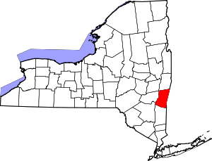 | |
| Towns | ||
| Villages | ||
| CDPs | ||
| Other hamlets | ||
| Footnotes | ‡This populated place also has portions in an adjacent county or counties | |