Harrisburg, Arkansas
| Harrisburg, Arkansas | |
|---|---|
| Village | |
 | |
 Location in Poinsett County and the state of Arkansas | |
| Coordinates: 35°33′51″N 90°43′20″W / 35.56417°N 90.72222°WCoordinates: 35°33′51″N 90°43′20″W / 35.56417°N 90.72222°W | |
| Country | United States |
| State | Arkansas |
| County | Poinsett |
| Area | |
| • Total | 2.1 sq mi (5.4 km2) |
| • Land | 2.1 sq mi (5.4 km2) |
| • Water | 0 sq mi (0 km2) |
| Elevation | 312 ft (95 m) |
| Population (2000) | |
| • Total | 2,192 |
| • Density | 1,043.8/sq mi (405.9/km2) |
| Time zone | Central (CST) (UTC-6) |
| • Summer (DST) | CDT (UTC-5) |
| ZIP code | 72432 |
| Area code(s) | 870 |
| FIPS code | 05-30400 |
| GNIS feature ID | 0077132 |
Harrisburg is a city in Poinsett County, Arkansas, United States. The population was 2,192 at the 2000 census. It is included in the Jonesboro, Arkansas Metropolitan Statistical Area. The city is the county seat of Poinsett County.[1]
Geography
Harrisburg is located at 35°33′51″N 90°43′20″W / 35.56417°N 90.72222°W (35.564123, -90.722152)[2] on Crowley's Ridge.
According to the United States Census Bureau, the city has a total area of 2.1 square miles (5.4 km2), all land.
Demographics
| Historical population | |||
|---|---|---|---|
| Census | Pop. | %± | |
| 1890 | 482 | — | |
| 1900 | 462 | −4.1% | |
| 1910 | 942 | 103.9% | |
| 1920 | 1,315 | 39.6% | |
| 1930 | 1,111 | −15.5% | |
| 1940 | 1,193 | 7.4% | |
| 1950 | 1,498 | 25.6% | |
| 1960 | 1,481 | −1.1% | |
| 1970 | 1,931 | 30.4% | |
| 1980 | 1,921 | −0.5% | |
| 1990 | 1,943 | 1.1% | |
| 2000 | 2,192 | 12.8% | |
| 2010 | 2,288 | 4.4% | |
| Est. 2015 | 2,302 | [3] | 0.6% |

As of the census[5] of 2000, there were 2,192 people, 855 households, and 582 families residing in the city. The population density was 1,050.4 people per square mile (404.9/km²). There were 928 housing units at an average density of 444.7/sq mi (171.4/km²). The racial makeup of the city was 96.66% White, 1.24% Black or African American, 0.09% Native American, 0.27% Asian, 0.05% Pacific Islander, 0.87% from other races, and 0.82% from two or more races. 1.51% of the population were Hispanic or Latino of any race and 00.01% Other.
There were 855 households out of which 29.0% had children under the age of 18 living with them, 49.8% were married couples living together, 15.4% had a female householder with no husband present, and 31.9% were non-families. 29.5% of all households were made up of individuals and 15.2% had someone living alone who was 65 years of age or older. The average household size was 2.33 and the average family size was 2.84.
In the city the population was spread out with 25.1% under the age of 18, 9.9% from 18 to 24, 24.9% from 25 to 44, 22.6% from 45 to 64, and 17.5% who were 65 years of age or older. The median age was 37 years. For every 100 females there were 90.4 males. For every 100 females age 18 and over, there were 83.8 males.
The median income for a household in the city was $19,862, and the median income for a family was $24,274. Males had a median income of $20,767 versus $18,461 for females. The per capita income for the city was $13,813. About 42.6% of families and 42.6% of the population were below the poverty line, including 26.5% of those under age 18 and 25.6% of those age 65 or over.
Education

Public education for elementary and secondary school students is available from the Harrisburg School District, which leads to graduation from Harrisburg High School.
Notable residents
- John K. Hutchison, Republican member of the Arkansas House of Representatives from District 52 from 2013 to 2015, resident of Harrisburg; unseated by Dwight Tosh of Jonesboro
References
- ↑ "Find a County". National Association of Counties. Retrieved 2011-06-07.
- ↑ "US Gazetteer files: 2010, 2000, and 1990". United States Census Bureau. 2011-02-12. Retrieved 2011-04-23.
- ↑ "Annual Estimates of the Resident Population for Incorporated Places: April 1, 2010 to July 1, 2015". Retrieved July 2, 2016.
- ↑ "Census of Population and Housing". Census.gov. Retrieved June 4, 2015.
- ↑ "American FactFinder". United States Census Bureau. Retrieved 2008-01-31.
Municipalities and communities of Poinsett County, Arkansas, United States | ||
|---|---|---|
| Cities | 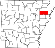 | |
| Town | ||
| Unincorporated communities | ||
