Grade II* listed buildings in Mid Suffolk

There are over 20,000 Grade II* listed buildings in England. This page is a list of these buildings in the district of Mid Suffolk in Suffolk.

Mid Suffolk

Name Location Type Completed [note 1]Date designated Grid ref.[note 2]
Geo-coordinates
Entry number [note 3]Image
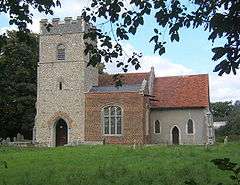
Church of St Mary Akenham, Mid Suffolk Church Norman 9 December 1955 TM1479048834
52°05′46″N 1°08′04″E / 52.096134°N 1.134341°E / 52.096134; 1.134341 (Church of St Mary)
1352028
Ashbocking Hall Ashbocking House c.1630 9 December 1955 TM1701154570
52°08′48″N 1°10′13″E / 52.146759°N 1.170367°E / 52.146759; 1.170367 (Ashbocking Hall)
1033081
Aspall Hall Aspall Hall Late 16th century 29 July 1955 TM1720365353
52°14′37″N 1°10′48″E / 52.243478°N 1.180075°E / 52.243478; 1.180075 (Aspall Hall)
1032403
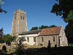
Church of St Mary of Grace Aspall Parish Church Medieval 29 July 1955 TM1672364930
52°14′24″N 1°10′22″E / 52.23987°N 1.172785°E / 52.23987; 1.172785 (Church of St Mary of Grace)
1213437
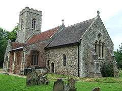
Church of St Peter Athelington Parish Church Medieval 29 July 1955 TM2103070982
52°17′33″N 1°14′23″E / 52.292481°N 1.23972°E / 52.292481; 1.23972 (Church of St Peter)
1032562
Fords Green Bacton House 18th century 29 July 1955 TM0615666144
52°15′17″N 1°01′08″E / 52.254825°N 1.018996°E / 52.254825; 1.018996 (Fords Green)
1032724
Manor House Christian Rest Home Bacton Farmhouse 19th century 29 July 1955 TM0499067153
52°15′52″N 1°00′09″E / 52.264319°N 1.00255°E / 52.264319; 1.00255 (Manor House Christian Rest Home)
1032752
Badley Hall Badley Farmhouse 16th century or Early 17th century 9 December 1955 TM0602855840
52°09′45″N 1°00′39″E / 52.162364°N 1.010858°E / 52.162364; 1.010858 (Badley Hall)
1231083
Barn 100 Metres South East of Badley Hall Badley Barn 17th century 9 December 1955 TM0608655809
52°09′43″N 1°00′42″E / 52.162064°N 1.011686°E / 52.162064; 1.011686 (Barn 100 Metres South East of Badley Hall)
1231085
Dovecote 60 Metres East of Badley Hall Badley Dovecote 16th century 9 December 1955 TM0609655840
52°09′44″N 1°00′43″E / 52.162339°N 1.011851°E / 52.162339; 1.011851 (Dovecote 60 Metres East of Badley Hall)
1231084
Badwell Ash Hall Badwell Ash Farmhouse Early 16th century 15 November 1954 TM0054269074
52°17′00″N 0°56′19″E / 52.283205°N 0.938603°E / 52.283205; 0.938603 (Badwell Ash Hall)
1032204
The Wurlie Badwell Ash House 16th century 15 November 1954 TL9907969175
52°17′05″N 0°55′02″E / 52.284643°N 0.917245°E / 52.284643; 0.917245 (The Wurlie)
1181813
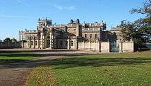
Shrubland Hall, including attached Screen Walling on East Side, and Terraces and Balustrading on South and West Sides Shrubland Park, Barham Country House 1770-1772 9 December 1955 TM1263152505
52°07′48″N 1°06′19″E / 52.129923°N 1.105163°E / 52.129923; 1.105163 (Shrubland Hall, including attached Screen Walling on East Side, and Terraces and Balustrading on South and West Sides)
1033252
Grand Stairs and Grotto, 50 Metres West of Shrubland Hall Shrubland Park, Barham Grotto c.1850 9 December 1955 TM1256152523
52°07′48″N 1°06′15″E / 52.130112°N 1.104153°E / 52.130112; 1.104153 (Grand Stairs and Grotto, 50 Metres West of Shrubland Hall)
1279509
Terrace known As the Balcony Garden, Including Balustrading and Pavilion, Shrubland Hall Shrubland Park, Barham Balustrade 1849-1850 9 December 1955 TM1258652560
52°07′50″N 1°06′16″E / 52.130434°N 1.10454°E / 52.130434; 1.10454 (Terrace known As the Balcony Garden, Including Balustrading and Pavilion, Shrubland Hall)
1352051
Upper Gun Terrace, 10 Metres West of Shrubland Hall Shrubland Park, Barham Wall 1849-1850 9 December 1955 TM1259752514
52°07′48″N 1°06′17″E / 52.130017°N 1.104672°E / 52.130017; 1.104672 (Upper Gun Terrace, 10 Metres West of Shrubland Hall)
1207906
Baylham Hall Baylham Hall Early 17th century 9 December 1955 TM0917351664
52°07′25″N 1°03′15″E / 52.123691°N 1.054202°E / 52.123691; 1.054202 (Baylham Hall)
1293336
Stable Range, 30 Metres South East of Baylham Hall Baylham Granary C20 9 December 1955 TM0922951646
52°07′25″N 1°03′18″E / 52.123509°N 1.055008°E / 52.123509; 1.055008 (Stable Range, 30 Metres South East of Baylham Hall)
1208099
Baylham Watermill and Mill House Baylham Mill House Mid 19th century 9 December 1955 TM1124252709
52°07′56″N 1°05′06″E / 52.132287°N 1.085028°E / 52.132287; 1.085028 (Baylham Watermill and Mill House)
1033260
Church of St Peter Baylham Tower Late 14th century 9 December 1955 TM1022851547
52°07′20″N 1°04′10″E / 52.122241°N 1.069518°E / 52.122241; 1.069518 (Church of St Peter)
1033258
Bedfield Hall Bedfield House 19th century 29 July 1955 TM2275966442
52°15′04″N 1°15′43″E / 52.251034°N 1.262033°E / 52.251034; 1.262033 (Bedfield Hall)
1198745
Bedingfield Hall Bedingfield Aisled House Early 14th century 29 July 1955 TM1990267756
52°15′50″N 1°13′16″E / 52.263977°N 1.221105°E / 52.263977; 1.221105 (Bedingfield Hall)
1213518
Fleming's Hall Bedingfield House C20 29 July 1955 TM1924967788
52°15′52″N 1°12′42″E / 52.264524°N 1.211573°E / 52.264524; 1.211573 (Fleming's Hall)
1032413
Church of All Saints Beyton Parish Church Medieval 15 November 1954 TL9339562776
52°13′45″N 0°49′49″E / 52.229212°N 0.830362°E / 52.229212; 0.830362 (Church of All Saints)
1032500
Chapel of St Botolph Crown Hill, Botesdale Grammar School/Chapel of Ease 1576 29 July 1955 TM0487775890
52°20′34″N 1°00′22″E / 52.3428°N 1.006209°E / 52.3428; 1.006209 (Chapel of St Botolph)
1352340
St Catherines Botesdale House Early-Mid 17th century 16 March 1988 TM0471275754
52°20′30″N 1°00′13″E / 52.341641°N 1.003707°E / 52.341641; 1.003707 (St Catherines)
1277591
Street Farmhouse with Attached Outbuilding Botesdale Farmhouse Early 15th century 16 March 1988 TM0491475943
52°20′36″N 1°00′24″E / 52.343262°N 1.006783°E / 52.343262; 1.006783 (Street Farmhouse with Attached Outbuilding)
1352339
The Priory with attached Outbuildings and Garden Walls Botesdale House Early 17th century 29 July 1955 TM0489175918
52°20′35″N 1°00′23″E / 52.343046°N 1.006431°E / 52.343046; 1.006431 (The Priory with attached Outbuildings and Garden Walls)
1032608
Former Church of St Mary Braiseworth Parish Church (ruin) 12th century 29 July 1955 TM1379271322
52°17′54″N 1°08′02″E / 52.298395°N 1.133974°E / 52.298395; 1.133974 (Former Church of St Mary)
1032276
Bramford House Bramford House c.1693 9 December 1955 TM1266846413
52°04′31″N 1°06′07″E / 52.075219°N 1.101903°E / 52.075219; 1.101903 (Bramford House)
1250919
Church of St Mary Brome, Brome and Oakley Parish Church Medieval 29 July 1955 TM1450976464
52°20′39″N 1°08′52″E / 52.344274°N 1.147748°E / 52.344274; 1.147748 (Church of St Mary)
1352379
Church of St Nicholas Oakley, Brome and Oakley Parish Church Medieval 29 July 1955 TM1571977366
52°21′07″N 1°09′58″E / 52.351896°N 1.166062°E / 52.351896; 1.166062 (Church of St Nicholas)
1181612
Park Farmhouse Brome and Oakley Farmhouse Mid 16th century 14 April 1988 TM1418476556
52°20′43″N 1°08′35″E / 52.345226°N 1.143043°E / 52.345226; 1.143043 (Park Farmhouse)
1032524
Poplar Farmhouse Lower Oakley, Brome and Oakley Farmhouse Late 16th century 29 July 1955 TM1613277949
52°21′25″N 1°10′21″E / 52.356967°N 1.172491°E / 52.356967; 1.172491 (Poplar Farmhouse)
1284932
Brundish Manor Brundish Farmhouse Early-mid 16th century 29 July 1955 TM2639271222
52°17′33″N 1°19′06″E / 52.292454°N 1.318367°E / 52.292454; 1.318367 (Brundish Manor)
1032864
Church of St Mary Burgate Parish Church Mid to Late 14th century 29 July 1955 TM0824275599
52°20′20″N 1°03′19″E / 52.338922°N 1.055352°E / 52.338922; 1.055352 (Church of St Mary)
1032797
Hall Farm House Burgate Farmhouse c.1400 29 July 1955 TM0800675525
52°20′18″N 1°03′07″E / 52.338347°N 1.051847°E / 52.338347; 1.051847 (Hall Farm House)
1352234
Maypole Farmhouse Buxhall Farmhouse c.1530 9 December 1955 TM0038757779
52°10′55″N 0°55′47″E / 52.181848°N 0.929645°E / 52.181848; 0.929645 (Maypole Farmhouse)
1033033
Mockbeggars Hall Claydon House 1621 9 December 1955 TM1311348664
52°05′43″N 1°06′35″E / 52.095256°N 1.109791°E / 52.095256; 1.109791 (Mockbeggars Hall)
1263022
Grand Stairs and Grotto 50 Metres West of Shrubland Hall Shrubland Park, Coddenham Grotto c.1850 26 March 1987 TM1251852534
52°07′49″N 1°06′13″E / 52.130227°N 1.103532°E / 52.130227; 1.103532 (Grand Stairs and Grotto 50 Metres West of Shrubland Hall)
1033241
Lower Loggia and attached Balustrading and Steps 150 Metres West of Shrubland Hall Shrubland Park, Coddenham Balustrade c.1850 26 March 1987 TM1245952548
52°07′49″N 1°06′10″E / 52.130375°N 1.10268°E / 52.130375; 1.10268 (Lower Loggia and attached Balustrading and Steps 150 Metres West of Shrubland Hall)
1284720
The Old Lodge and the Post Office Coddenham Jettied House Early-Mid 16th century 9 December 1955 TM1342354260
52°08′43″N 1°07′04″E / 52.145373°N 1.117816°E / 52.145373; 1.117816 (The Old Lodge and the Post Office)
1181646
Ponderosa & Post Office Cottage Combs Farmhouse Late 14th century or c1400 9 December 1955 TM0432656412
52°10′05″N 0°59′11″E / 52.168132°N 0.986355°E / 52.168132; 0.986355 (Ponderosa & Post Office Cottage)
1284144
Church of St Mary Creeting St. Mary Parish Church Medieval 9 December 1955 TM0938256703
52°10′08″N 1°03′37″E / 52.168851°N 1.060353°E / 52.168851; 1.060353 (Church of St Mary)
1033245
Barn 30 Metres North West of Roydon Hall Creeting St Peter or West Creeting Barn C18-C19 9 December 1955 TM0846458506
52°11′07″N 1°02′53″E / 52.185385°N 1.048057°E / 52.185385; 1.048057 (Barn 30 Metres North West of Roydon Hall)
1284584
Creeting Hall Creeting St Peter or West Creeting Cross Wing House Mid 16th century 9 December 1955 TM0788856850
52°10′15″N 1°02′19″E / 52.170735°N 1.03863°E / 52.170735; 1.03863 (Creeting Hall)
1352073
Roydon Hall Creeting St. Peter or West Creeting Farmhouse Mid or Late 16th century 9 December 1955 TM0849358483
52°11′07″N 1°02′54″E / 52.185167°N 1.048466°E / 52.185167; 1.048466 (Roydon Hall)
1033215
Church of All Saints Crowfield Parish Church Early 15th century 9 December 1955 TM1423257780
52°10′36″N 1°07′55″E / 52.176659°N 1.13184°E / 52.176659; 1.13184 (Church of All Saints)
1181164
Ancient House 3, Gracechurch St, Debenham Cross Passage House c.1540 9 December 1955 TM1736563241
52°13′28″N 1°10′52″E / 52.224456°N 1.181087°E / 52.224456; 1.181087 (Ancient House)
1032319
Crows Hall (including Bridge over Moat and Walling Lining Inner Side of Moat to West and South) Debenham House 19th century 9 December 1955 TM1923462827
52°13′12″N 1°12′29″E / 52.219999°N 1.208138°E / 52.219999; 1.208138 (Crows Hall (including Bridge over Moat and Walling Lining Inner Side of Moat to West and South))
1352472
Lanchester Antiques & Old House & the Gables 21-25, High St, Debenham Shop and House Mid 16th century 9 December 1955 TM1739863276
52°13′29″N 1°10′54″E / 52.224757°N 1.181592°E / 52.224757; 1.181592 (Lanchester Antiques & Old House & the Gables)
1352462
Swiss Farm Butchers & the Debenham Gallery 1-3, High St, Debenham House Early-Mid 16th century 9 December 1955 TM1737163361
52°13′32″N 1°10′53″E / 52.225531°N 1.181252°E / 52.225531; 1.181252 (Swiss Farm Butchers & the Debenham Gallery)
1032322
Sycamores 27, High St, Debenham House 19th century 9 December 1955 TM1740063256
52°13′28″N 1°10′54″E / 52.224577°N 1.181608°E / 52.224577; 1.181608 (Sycamores)
1199486
The Guildhall 2 Gracechurch st, Debenham Fire Station Post 1621 9 December 1955 TM1737463265
52°13′29″N 1°10′52″E / 52.224668°N 1.181234°E / 52.224668; 1.181234 (The Guildhall)
1199276
31–37 High Street Debenham House Post 16th century (later) 9 December 1955 TM1740963228
52°13′28″N 1°10′54″E / 52.224322°N 1.181722°E / 52.224322; 1.181722 (31–37 High Street)
1199502
Church of St John the Baptist Denham Parish Church Medieval 29 July 1955 TM1883474784
52°19′39″N 1°12′36″E / 52.327487°N 1.210043°E / 52.327487; 1.210043 (Church of St John the Baptist)
1032530
Church of All Saints Drinkstone Parish Church 1330-50 15 November 1954 TL9597261605
52°13′04″N 0°52′03″E / 52.217787°N 0.867367°E / 52.217787; 0.867367 (Church of All Saints)
1352345
The Old Rectory Drinkstone Vicarage c.1760 15 November 1954 TL9598461853
52°13′12″N 0°52′04″E / 52.22001°N 0.867686°E / 52.22001; 0.867686 (The Old Rectory)
1032622
Church of St John Elmsell Parish Church Medieval 15 November 1954 TL9820263599
52°14′06″N 0°54′04″E / 52.234894°N 0.901134°E / 52.234894; 0.901134 (Church of St John)
1032468
Barn at Moor Hall Farm (Moor Hall Farm not included) Eye Barn 18th century 12 February 1998 TM1430873161
52°18′53″N 1°08′34″E / 52.314702°N 1.142698°E / 52.314702; 1.142698 (Barn at Moor Hall Farm (Moor Hall Farm not included))
1334397
Cookley Farmhouse Eye Farmhouse c.1550 15 June 1951 TM1660274155
52°19′22″N 1°10′37″E / 52.322725°N 1.176937°E / 52.322725; 1.176937 (Cookley Farmhouse)
1316625
Cranley Hall Eye Farmhouse Mid 15th century 15 June 1951 TM1524072835
52°18′41″N 1°09′22″E / 52.311412°N 1.156141°E / 52.311412; 1.156141 (Cranley Hall)
1316627
Stayer House Eye Kitchen World War II 15 June 1951 TM1481373716
52°19′10″N 1°09′02″E / 52.319487°N 1.150449°E / 52.319487; 1.150449 (Stayer House)
1316595
The Cottage & White House Eye House Early 18th century 15 June 1951 TM1483173851
52°19′14″N 1°09′03″E / 52.320692°N 1.150799°E / 52.320692; 1.150799 (The Cottage & White House)
1316616
Town Hall Eye Town Hall 1857 20 October 1971 TM1451273886
52°19′16″N 1°08′46″E / 52.321131°N 1.146148°E / 52.321131; 1.146148 (Town Hall)
1316536
5 Broad Street Eye House c.1480 15 June 1951 TM1454573868
52°19′15″N 1°08′48″E / 52.320956°N 1.14662°E / 52.320956; 1.14662 (5 Broad Street)
1316524
Church of St Peter Felsham Parish Church Medieval 15 November 1954 TL9468157005
52°10′37″N 0°50′45″E / 52.17694°N 0.845853°E / 52.17694; 0.845853 (Church of St Peter)
1032627
Church Farmhouse Gislingham Rd, Finningham House Late 15th century 14 June 1987 TM0683869380
52°17′01″N 1°01′51″E / 52.283621°N 1.030955°E / 52.283621; 1.030955 (Church Farmhouse)
1033145
Yew Tree House and Amberley Church Lane, Finningham House Mid 16th century 29 July 1955 TM0664869475
52°17′04″N 1°01′42″E / 52.284545°N 1.028232°E / 52.284545; 1.028232 (Yew Tree House and Amberley)
1033143
Barn 70 Metres South of Framsden Hall Framsden Outbuilding 19th century 9 December 1955 TM2059360002
52°11′39″N 1°13′34″E / 52.1941°N 1.22616°E / 52.1941; 1.22616 (Barn 70 Metres South of Framsden Hall)
1181297
Boundary Farmhouse Framsden Farmhouse Mid 16th century 9 December 1955 TM1867860782
52°12′07″N 1°11′55″E / 52.201864°N 1.198692°E / 52.201864; 1.198692 (Boundary Farmhouse)
1033058
Post Mill Framsden Flour Mill c.1740 9 December 1955 TM1918159753
52°11′33″N 1°12′19″E / 52.192427°N 1.205375°E / 52.192427; 1.205375 (Post Mill)
1352134
Stable, 50 Metres South of Boundary Farmhouse Framsden Stable Early or Mid 17th century 9 December 1955 TM1866260735
52°12′05″N 1°11′54″E / 52.201448°N 1.198428°E / 52.201448; 1.198428 (Stable, 50 Metres South of Boundary Farmhouse)
1033059
Barn Approximately 50 Metres West South West of Church Farm Stable Fressingfield Aisled Barn Late C13-Early 14th century 3 June 1997 TM2601777580
52°20′59″N 1°19′02″E / 52.349672°N 1.317146°E / 52.349672; 1.317146 (Barn Approximately 50 Metres West South West of Church Farm Stable)
1245363
Fressingfield Hall Fressingfield Farmhouse Early 17th century 29 July 1955 TM2665777657
52°21′00″N 1°19′36″E / 52.350099°N 1.326578°E / 52.350099; 1.326578 (Fressingfield Hall)
1352192
The Fox and Goose Fressingfield Inn 19th century 29 July 1955 TM2611477453
52°20′55″N 1°19′07″E / 52.348493°N 1.318483°E / 52.348493; 1.318483 (The Fox and Goose)
1032967
Tithe Farmhouse Fressingfield Farmhouse Mid 14th century 21 October 1987 TM2680777038
52°20′40″N 1°19′42″E / 52.344482°N 1.328359°E / 52.344482; 1.328359 (Tithe Farmhouse)
1032927
Ufford Hall Fressingfield Farmhouse Late 16th century 29 July 1955 TM2727574605
52°19′21″N 1°20′01″E / 52.322452°N 1.333573°E / 52.322452; 1.333573 (Ufford Hall)
1032930
Gedding Hall with Bridge attached to South Side of Gatehouse Gedding House Early 16th century 15 November 1954 TL9538758565
52°11′27″N 0°51′25″E / 52.190698°N 0.857063°E / 52.190698; 0.857063 (Gedding Hall with Bridge attached to South Side of Gatehouse)
1032593
Gipping Lone Gipping House c.1600 9 December 1955 TM0721864152
52°14′12″N 1°02′00″E / 52.236542°N 1.033311°E / 52.236542; 1.033311 (Gipping Lone)
1180773
Ivy House Farmhouse Gislingham House Late 15th century 29 July 1955 TM0768471880
52°18′21″N 1°02′42″E / 52.305746°N 1.044879°E / 52.305746; 1.044879 (Ivy House Farmhouse)
1180705
Manor House Gislingham House Late 15th century 29 July 1955 TM0649572064
52°18′28″N 1°01′39″E / 52.307846°N 1.027578°E / 52.307846; 1.027578 (Manor House)
1033163
The Old Guildhall Gislingham House Late 15th century 29 July 1955 TM0738571812
52°18′19″N 1°02′26″E / 52.305248°N 1.040458°E / 52.305248; 1.040458 (The Old Guildhall)
1180771
Church of St Mary Gosbeck Parish Church Possibly 10th century or 11th century 9 December 1955 TM1506255622
52°09′25″N 1°08′33″E / 52.156964°N 1.142593°E / 52.156964; 1.142593 (Church of St Mary)
1181491
Butterfly Farmhouse Great Finborough Farmhouse c.1570 22 January 1988 TM0036456361
52°10′09″N 0°55′43″E / 52.169125°N 0.928473°E / 52.169125; 0.928473 (Butterfly Farmhouse)
1197984
New Bells Farmhouse Haughley Green, Haughley Farmhouse c.1530 9 December 1955 TM0352964072
52°14′14″N 0°58′46″E / 52.237199°N 0.979317°E / 52.237199; 0.979317 (New Bells Farmhouse)
1032705
Elm Farmhouse Helmingham Farmhouse Early 17th century 22 September 1987 TM1967856948
52°10′01″N 1°12′39″E / 52.167051°N 1.210819°E / 52.167051; 1.210819 (Elm Farmhouse)
1033040
Old Hall Farmhouse Hemingstone Farmhouse Early 17th century 22 September 1987 TM1523953089
52°08′03″N 1°08′37″E / 52.134157°N 1.143574°E / 52.134157; 1.143574 (Old Hall Farmhouse)
1182665
Stonewall Farmhouse Hemingstone Farmhouse c.1600 9 December 1955 TM1516754249
52°08′41″N 1°08′36″E / 52.144598°N 1.143257°E / 52.144598; 1.143257 (Stonewall Farmhouse)
1352152
Walnut Tree Farmhouse Henley Farmhouse Mid 15th century to Mid 16th century 24 January 1986 TM1558251808
52°07′21″N 1°08′52″E / 52.122524°N 1.147766°E / 52.122524; 1.147766 (Walnut Tree Farmhouse)
1251354
Church of St Mary Horham Parish Church Medieval 29 July 1955 TM2103372446
52°18′20″N 1°14′27″E / 52.305621°N 1.240723°E / 52.305621; 1.240723 (Church of St Mary)
1032540
Abbey Farmhouse Hoxne Farmhouse Early 17th century 29 July 1955 TM1831576400
52°20′32″N 1°12′13″E / 52.342199°N 1.203488°E / 52.342199; 1.203488 (Abbey Farmhouse)
1032502
Chickering Corner Farmhouse Hoxne Farmhouse C16-C17 29 July 1955 TM2055176409
52°20′29″N 1°14′11″E / 52.341386°N 1.236262°E / 52.341386; 1.236262 (Chickering Corner Farmhouse)
1181159
Haywards Farm Cottage Chickering, Hoxne Farmhouse 16th century 29 July 1955 TM2056076418
52°20′29″N 1°14′11″E / 52.341463°N 1.2364°E / 52.341463; 1.2364 (Haywards Farm Cottage)
1032543
Red House Farmhouse South Green, Hoxne Farmhouse Early 16th century 29 July 1955 TM1733675003
52°19′48″N 1°11′18″E / 52.330047°N 1.188238°E / 52.330047; 1.188238 (Red House Farmhouse)
1374915
The Swan (including attached Outbuildings) Hoxne Jettied House Early 16th century 29 July 1955 TM1797677190
52°20′58″N 1°11′57″E / 52.349425°N 1.199032°E / 52.349425; 1.199032 (The Swan (including attached Outbuildings))
1352375
Thorpe Hall Hoxne House Late 16th century 29 July 1955 TM2118073783
52°19′03″N 1°14′38″E / 52.317562°N 1.243754°E / 52.317562; 1.243754 (Thorpe Hall)
1352386
Church of St Michael Hunston Parish Church Medieval 9 May 1988 TL9758568048
52°16′30″N 0°53′41″E / 52.275062°N 0.894712°E / 52.275062; 0.894712 (Church of St Michael)
1182395
Church of All Saints Kenton Parish Church Medieval 29 July 1955 TM1913965913
52°14′52″N 1°12′31″E / 52.247738°N 1.208748°E / 52.247738; 1.208748 (Church of All Saints)
1283114
Church of St Mary Langham Parish Church 14th century 15 November 1954 TL9805669024
52°17′01″N 0°54′08″E / 52.283656°N 0.902179°E / 52.283656; 0.902179 (Church of St Mary)
1352527
Langham Hall Langham Manor House Early 18th century 15 November 1954 TL9786269030
52°17′02″N 0°53′58″E / 52.28378°N 0.899343°E / 52.28378; 0.899343 (Langham Hall)
1181875
Aldridge's Farmhouse Laxfield Farmhouse First half of 14th century 18 December 1987 TM2737173463
52°18′44″N 1°20′03″E / 52.312163°N 1.334208°E / 52.312163; 1.334208 (Aldridge's Farmhouse)
1180914
Old Guildhall Laxfield Guildhall/Museum c.1520 29 July 1955 TM2962272380
52°18′05″N 1°21′59″E / 52.301508°N 1.366432°E / 52.301508; 1.366432 (Old Guildhall)
1180990
Waterloo House Laxfield House Early-mid 16th century 29 July 1955 TM2973172473
52°18′08″N 1°22′05″E / 52.302297°N 1.368091°E / 52.302297; 1.368091 (Waterloo House)
1180816
White House Farmhouse Laxfield Farmhouse Early 15th century 18 December 1987 TM2740973150
52°18′34″N 1°20′04″E / 52.309338°N 1.334553°E / 52.309338; 1.334553 (White House Farmhouse)
1285326
Church of St Mary Little Finborough Parish Church Medieval 9 December 1955 TM0185854963
52°09′22″N 0°56′58″E / 52.156029°N 0.949457°E / 52.156029; 0.949457 (Church of St Mary)
1032984
Church of St Mary the Virgin Mellis Parish Church Early 14th century 29 July 1955 TM0948474321
52°19′37″N 1°04′22″E / 52.326976°N 1.072759°E / 52.326976; 1.072759 (Church of St Mary the Virgin)
1181735
Elm Tree Farmhouse Mellis House Late 16th century 29 July 1955 TM1042574767
52°19′50″N 1°05′13″E / 52.33062°N 1.086825°E / 52.33062; 1.086825 (Elm Tree Farmhouse)
1181795
Mendham Lodge Mendham Farmhouse 16th century 29 July 1955 TM2721381875
52°23′16″N 1°20′15″E / 52.387726°N 1.337582°E / 52.387726; 1.337582 (Mendham Lodge)
1284665
Middleton Hall Mendham Farmhouse Early 16th century 29 July 1955 TM2870383550
52°24′08″N 1°21′38″E / 52.402138°N 1.36058°E / 52.402138; 1.36058 (Middleton Hall)
1032939
Elms Farmhouse Mendlesham Farmhouse Late 15th century 29 July 1955 TM1031265353
52°14′46″N 1°04′45″E / 52.246152°N 1.079299°E / 52.246152; 1.079299 (Elms Farmhouse)
1352508
Read Hall Mickfield Farmhouse Early 15th century 26 July 1979 TM1266962673
52°13′16″N 1°06′44″E / 52.221188°N 1.112086°E / 52.221188; 1.112086 (Read Hall)
1183190
The Ancient House 1 & 3, King William St, Needham Market House Early or Mid 16th century 9 December 1955 TM0879755250
52°09′22″N 1°03′03″E / 52.156028°N 1.050919°E / 52.156028; 1.050919 (The Ancient House)
1254336
The Bull Inn Needham Market Jettied House Early 16th century 9 December 1955 TM0881355135
52°09′18″N 1°03′04″E / 52.154989°N 1.051082°E / 52.154989; 1.051082 (The Bull Inn)
1277416
The Limes Hotel Needham Market Steps 1986 9 December 1955 TM0877255121
52°09′18″N 1°03′02″E / 52.154879°N 1.050475°E / 52.154879; 1.050475 (The Limes Hotel)
1253662
Tudor House 11, High St, Needham Market House 16th century 9 December 1955 TM0873855167
52°09′19″N 1°03′00″E / 52.155305°N 1.050007°E / 52.155305; 1.050007 (Tudor House)
1253664
93 High Street Needham Market House Early 18th century 9 December 1955 TM0878255092
52°09′17″N 1°03′02″E / 52.154615°N 1.050603°E / 52.154615; 1.050603 (93 High Street)
1253661
High Hall Nettlestead House 1620-1630 9 December 1955 TM0860650248
52°06′40″N 1°02′42″E / 52.111193°N 1.045065°E / 52.111193; 1.045065 (High Hall)
1250944
Tudor Grange Somersham, Nettlestead Farmhouse Mid 16th century 9 December 1955 TM0829148995
52°06′00″N 1°02′23″E / 52.100062°N 1.039706°E / 52.100062; 1.039706 (Tudor Grange)
1263029
Barn 200 Metres West of Halls Farmhouse Norton Barn 18th century 9 May 1988 TL9579666730
52°15′50″N 0°52′04″E / 52.263868°N 0.867761°E / 52.263868; 0.867761 (Barn 200 Metres West of Halls Farmhouse)
1352406
Church of St Andrew Norton Parish Church Medieval 15 November 1954 TL9622366320
52°15′36″N 0°52′26″E / 52.260034°N 0.873772°E / 52.260034; 0.873772 (Church of St Andrew)
1352404
Little Haugh Hall Norton Manor House c.1730 15 November 1954 TL9521766647
52°15′48″N 0°51′33″E / 52.263328°N 0.85924°E / 52.263328; 0.85924 (Little Haugh Hall)
1352425
Manor Farmhouse Norton Little Green, Norton Farmhouse Medieval 15 November 1954 TL9753866429
52°15′38″N 0°53′35″E / 52.260543°N 0.893077°E / 52.260543; 0.893077 (Manor Farmhouse)
1284431
Church of St Michael Occold Parish Church Medieval 29 July 1955 TM1557870863
52°17′37″N 1°09′35″E / 52.293577°N 1.15983°E / 52.293577; 1.15983 (Church of St Michael)
1352447
Old Newton Hall Old Newton with Dagworth Farmhouse 19th century 9 December 1955 TM0673761841
52°12′58″N 1°01′30″E / 52.215975°N 1.024866°E / 52.215975; 1.024866 (Old Newton Hall)
1181768
Ward Green Farmhouse Ward Green, Old Newton with Dagworth Farmhouse Early 15th century 9 December 1955 TM0507564009
52°14′10″N 1°00′07″E / 52.23606°N 1.001887°E / 52.23606; 1.001887 (Ward Green Farmhouse)
1032689
Brackendale Palgrave House C20 29 July 1955 TM1156478397
52°21′46″N 1°06′21″E / 52.362769°N 1.1058°E / 52.362769; 1.1058 (Brackendale)
1032778
Church of St Catherine Pettaugh Parish Church Medieval 9 December 1955 TM1678759617
52°11′32″N 1°10′13″E / 52.192152°N 1.17032°E / 52.192152; 1.17032 (Church of St Catherine)
1182764
Church Cottage Rattlesden Open Hall House Pre 1800 15 November 1954 TL9784759027
52°11′38″N 0°53′36″E / 52.19397°N 0.893272°E / 52.19397; 0.893272 (Church Cottage)
1352360
Folly Lodge known as Dove House Redgrave Park, Redgrave Lodge 1765-70 29 July 1955 TM0629476724
52°20′59″N 1°01′39″E / 52.349757°N 1.027491°E / 52.349757; 1.027491 (Folly Lodge known as Dove House)
1261272
The Pink House Redgrave House 17th century 29 July 1955 TM0421978161
52°21′48″N 0°59′53″E / 52.363434°N 0.997944°E / 52.363434; 0.997944 (The Pink House)
1261273
Broomhills Rickinghall Inferior House 19th century 15 November 1954 TM0408776410
52°20′52″N 0°59′42″E / 52.347763°N 0.994944°E / 52.347763; 0.994944 (Broomhills)
1064775
Hamblyn House Rickinghall Inferior Timber Framed House Mid 17th century 29 July 1955 TM0463675714
52°20′29″N 1°00′09″E / 52.34131°N 1.002569°E / 52.34131; 1.002569 (Hamblyn House)
1359125
Barn, 80 Metres South West of Ringshall Hall Ringshall House 1993 9 December 1955 TM0427952736
52°08′07″N 0°59′00″E / 52.135145°N 0.98346°E / 52.135145; 0.98346 (Barn, 80 Metres South West of Ringshall Hall)
1352190
Buck's Hall Rishangles Farmhouse Mid 14th century 23 June 1988 TM1670267347
52°15′42″N 1°10′26″E / 52.261574°N 1.174027°E / 52.261574; 1.174027 (Buck's Hall)
1352451
The Old Church Rishangles, Mid Suffolk Parish Church/House c.1200 29 July 1955 TM1605268646
52°16′25″N 1°09′55″E / 52.27349°N 1.165349°E / 52.27349; 1.165349 (The Old Church)
1032380
Church of King Charles the Martyr Shelland Green, Shelland Parish Church Medieval 9 December 1955 TM0035260228
52°12′14″N 0°55′50″E / 52.20385°N 0.930581°E / 52.20385; 0.930581 (Church of King Charles the Martyr)
1352321
Church of St Margaret Southolt Parish Church 15th century 29 July 1955 TM1934168870
52°16′27″N 1°12′49″E / 52.2742°N 1.213622°E / 52.2742; 1.213622 (Church of St Margaret)
1288635
Church of All Saints Stoke Ash Parish Church Medieval 29 July 1955 TM1149970423
52°17′28″N 1°05′59″E / 52.291211°N 1.099835°E / 52.291211; 1.099835 (Church of All Saints)
1181895
East End Manor Stonham Aspal Farmhouse Mid 15th century 9 December 1955 TM1530259871
52°11′42″N 1°08′56″E / 52.195014°N 1.148791°E / 52.195014; 1.148791 (East End Manor)
1033171
Yewtree House Forward Green, Stonham Earl House 16th century 9 December 1955 TM0981559922
52°11′51″N 1°04′07″E / 52.197585°N 1.068665°E / 52.197585; 1.068665 (Yewtree House)
1033226
Clock House Stonham Parva Farmhouse Mid or Late 15th century 9 December 1955 TM1149161189
52°12′30″N 1°05′38″E / 52.208319°N 1.093941°E / 52.208319; 1.093941 (Clock House)
1284270
Abbot's Hall Crowe St, Stowmarket House 1709 28 July 1950 TM0485458523
52°11′13″N 0°59′43″E / 52.186889°N 0.995338°E / 52.186889; 0.995338 (Abbot's Hall)
1195859
Edgar's Farmhouse Museum of East Anglian Life Stowmarket Farmhouse 1972 28 July 1950 TM0455458376
52°11′08″N 0°59′27″E / 52.18568°N 0.990867°E / 52.18568; 0.990867 (Edgar's Farmhouse Museum of East Anglian Life)
1297921
3, Station Road Stowmarket House Early 15th century 19 April 1972 TM0488958704
52°11′19″N 0°59′45″E / 52.188501°N 0.995958°E / 52.188501; 0.995958 (3, Station Road)
1297869
Lynton House 10, Station Rd, Stowmarket House Mid 18th century 28 July 1950 TM0498658732
52°11′19″N 0°59′51″E / 52.188716°N 0.997392°E / 52.188716; 0.997392 (Lynton House)
1209660
Museum of East Anglian Life Tithe Barn Stowmarket Grange 15th century 28 July 1950 TM0471958506
52°11′12″N 0°59′36″E / 52.186786°N 0.993356°E / 52.186786; 0.993356 (Museum of East Anglian Life Tithe Barn)
1195880
The Cedars Hotel Needham Rd, Stowmarket House Early 17th century 28 July 1950 TM0584557485
52°10′38″N 1°00′33″E / 52.177201°N 1.009184°E / 52.177201; 1.009184 (The Cedars Hotel)
1209561
The Meadlands Public House Needham Rd, Stowmarket House Late C20 19 April 1972 TM0571357725
52°10′46″N 1°00′27″E / 52.179405°N 1.007401°E / 52.179405; 1.007401 (The Meadlands Public House)
1195875
The Rookery 15 & 15a, Tavern St, Stowmarket House 1770 28 July 1950 TM0475058681
52°11′18″N 0°59′38″E / 52.188346°N 0.993914°E / 52.188346; 0.993914 (The Rookery)
1297873
The Stricklands Stricklands Rd, Stowmarket House Late 18th century 28 July 1950 TM0493358396
52°11′09″N 0°59′47″E / 52.185719°N 0.996415°E / 52.185719; 0.996415 (The Stricklands)
1209708
Valley Farmhouse Stowmarket Farmhouse Late 15th century 28 July 1950 TM0437757917
52°10′54″N 0°59′17″E / 52.181625°N 0.988005°E / 52.181625; 0.988005 (Valley Farmhouse)
1195896
Columbine Hall Stowupland, Mid Suffolk Farmhouse 18th century and 19th century 15 March 1988 TM0675660848
52°12′25″N 1°01′28″E / 52.207053°N 1.024538°E / 52.207053; 1.024538 (Columbine Hall)
1352322
Broad End Farmhouse Stradbroke, Mid Suffolk Farmhouse Second half of 14th century 29 July 1955 TM2626074357
52°19′14″N 1°19′07″E / 52.320646°N 1.31854°E / 52.320646; 1.31854 (Broad End Farmhouse)
1032844
Church of All Saints Stradbroke Parish Church Medieval 29 July 1955 TM2319173980
52°19′07″N 1°16′24″E / 52.318517°N 1.273338°E / 52.318517; 1.273338 (Church of All Saints)
1032854
Hill House Farmhouse Battlesea Green, Stradbroke Farmhouse 16th century 29 July 1955 TM2258275410
52°19′54″N 1°15′55″E / 52.331599°N 1.265364°E / 52.331599; 1.265364 (Hill House Farmhouse)
1181184
Church of All Saints Stuston Parish Church 12th century or 13th century 29 July 1955 TM1346177857
52°21′26″N 1°08′00″E / 52.357187°N 1.133273°E / 52.357187; 1.133273 (Church of All Saints)
1032794
Church of St Mary Syleham Parish Church C11/C12 29 July 1955 TM2049278952
52°21′51″N 1°14′13″E / 52.364235°N 1.237066°E / 52.364235; 1.237066 (Church of St Mary)
1032919
Gatehouse Farmhouse Syleham Farmhouse Mid 16th century 29 July 1955 TM1922477386
52°21′02″N 1°13′03″E / 52.350687°N 1.217453°E / 52.350687; 1.217453 (Gatehouse Farmhouse)
1182408
Monks Hall Syleham Farmhouse c.1600 29 July 1955 TM2016178470
52°21′36″N 1°13′55″E / 52.360041°N 1.231897°E / 52.360041; 1.231897 (Monks Hall)
1032921
Tannington Hall Tannington House 19th century 29 July 1955 TM2479068729
52°16′15″N 1°17′36″E / 52.270736°N 1.293257°E / 52.270736; 1.293257 (Tannington Hall)
1215204
Church of All Saints Thorndon Parish Church Early 13th century 29 July 1955 TM1419669661
52°17′00″N 1°08′20″E / 52.283327°N 1.138834°E / 52.283327; 1.138834 (Church of All Saints)
1215792
Shorts Farmhouse Thorndon Farmhouse Mid 16th century 23 June 1988 TM1425768018
52°16′07″N 1°08′19″E / 52.268555°N 1.138684°E / 52.268555; 1.138684 (Shorts Farmhouse)
1032390
Church of St Mary Magdalene Thornham Magna Parish Church 14th century 29 July 1955 TM1039171427
52°18′02″N 1°05′03″E / 52.30065°N 1.08424°E / 52.30065; 1.08424 (Church of St Mary Magdalene)
1033129
The Four Horseshoes Public House Thornham Magna House Mid - Late 15th century 29 July 1955 TM1042270729
52°17′40″N 1°05′03″E / 52.294372°N 1.084258°E / 52.294372; 1.084258 (The Four Horseshoes Public House)
1033134
The Manor House Thrandeston House C20 17 November 1987 TM1121076393
52°20′42″N 1°05′58″E / 52.344916°N 1.099349°E / 52.344916; 1.099349 (The Manor House)
1182711
Manor Farm House Thurston Farmhouse 1876 11 January 1991 TL9272265642
52°15′19″N 0°49′20″E / 52.255183°N 0.822154°E / 52.255183; 0.822154 (Manor Farm House)
1032401
Church of St George Thwaite Church (redundant) Medieval 29 July 1955 TM1135868153
52°16′15″N 1°05′47″E / 52.270888°N 1.096349°E / 52.270888; 1.096349 (Church of St George)
1032261
Church of St Margaret Wattisfield Church Early 14th century 15 November 1954 TM0103074191
52°19′44″N 0°56′56″E / 52.328969°N 0.9488°E / 52.328969; 0.9488 (Church of St Margaret)
1182475
Wattisfield Hall, Garden Walls and Gate Piers Wattisfield Farmhouse Early 17th century 15 November 1954 TM0083473872
52°19′34″N 0°56′45″E / 52.326176°N 0.945738°E / 52.326176; 0.945738 (Wattisfield Hall, Garden Walls and Gate Piers)
1352541
Rookery Farmhouse Westhorpe House 16th century 29 July 1955 TM0440769170
52°16′58″N 0°59′43″E / 52.282644°N 0.995241°E / 52.282644; 0.995241 (Rookery Farmhouse)
1352097
Rookyard Farmhouse Base Green, Wetherden Farmhouse Late 15th century or Early 16th century 15 March 1988 TM0151863380
52°13′54″N 0°56′58″E / 52.231725°N 0.949496°E / 52.231725; 0.949496 (Rookyard Farmhouse)
1032668
Church of St Andrew Weybread Parish Church Medieval 29 July 1955 TM2410280117
52°22′24″N 1°17′27″E / 52.373228°N 1.290772°E / 52.373228; 1.290772 (Church of St Andrew)
1284449
Street Farmhouse Wickham Skeith Farmhouse 16th century 29 July 1955 TM0887569728
52°17′10″N 1°03′40″E / 52.285975°N 1.060988°E / 52.285975; 1.060988 (Street Farmhouse)
1352524
Chesnut Lodge Wilby Green, Wilby Farmhouse 16th century 29 July 1955 TM2410770842
52°17′24″N 1°17′05″E / 52.289979°N 1.284667°E / 52.289979; 1.284667 (Chesnut Lodge)
1181729
White House Wingfield House Early 17th century 21 October 1987 TM2372276549
52°20′29″N 1°16′58″E / 52.341359°N 1.282823°E / 52.341359; 1.282823 (White House)
1032893
Wingfield College Wingfield College/House Post 1362 29 July 1955 TM2301576762
52°20′37″N 1°16′21″E / 52.343559°N 1.272604°E / 52.343559; 1.272604 (Wingfield College)
1284374
Church of St Andrew Winston Parish Church Probably Early 15th century 9 December 1955 TM1802561635
52°12′35″N 1°11′23″E / 52.209779°N 1.189701°E / 52.209779; 1.189701 (Church of St Andrew)
1182799
The Lanes Woolpit House 19th century 18 April 1988 TL9848961644
52°13′02″N 0°54′15″E / 52.217237°N 0.904185°E / 52.217237; 0.904185 (The Lanes)
1032557
Worlingworth Hall Worlingworth Manor House Late 13th century 23 June 1988 TM2359368960
52°16′24″N 1°16′33″E / 52.273297°N 1.275897°E / 52.273297; 1.275897 (Worlingworth Hall)
1032363
The Manor House Wortham House 18th century 29 July 1955 TM0782379749
52°22′35″N 1°03′06″E / 52.376337°N 1.051778°E / 52.376337; 1.051778 (The Manor House)
1032738
Grange Farm House Wyverstone House 15th century 29 July 1955 TM0311968070
52°16′24″N 0°58′33″E / 52.273245°N 0.975724°E / 52.273245; 0.975724 (Grange Farm House)
1284925
Bull's Hall and attached Outbuildings Yaxley House 19th century 14 June 1987 TM1171473068
52°18′54″N 1°06′17″E / 52.314873°N 1.104644°E / 52.314873; 1.104644 (Bull's Hall and attached Outbuildings)
1033119
Guildhall Cottage Yaxley Guildhall Early 16th century 29 July 1955 TM1210174096
52°19′26″N 1°06′39″E / 52.323952°N 1.110961°E / 52.323952; 1.110961 (Guildhall Cottage)
1033115
Yaxley Hall Yaxley Country House c.1580 14 June 1987 TM1247273594
52°19′09″N 1°06′58″E / 52.319302°N 1.116079°E / 52.319302; 1.116079 (Yaxley Hall)
1284876
Yaxley Manor House Yaxley Farmhouse c.1520 29 July 1955 TM1082274475
52°19′40″N 1°05′33″E / 52.327847°N 1.09246°E / 52.327847; 1.09246 (Yaxley Manor House)
1352106

Notes

  1. The date given is the date used by Historic England as significant for the initial building or that of an important part in the structure's description.
  2. Sometimes known as OSGB36, the grid reference is based on the British national grid reference system used by the Ordnance Survey.
  3. The "List Entry Number" is a unique number assigned to each listed building and scheduled monument by Historic England.

Media related to Grade II* listed buildings in Suffolk at Wikimedia Commons


This article is issued from Wikipedia - version of the 11/16/2016. The text is available under the Creative Commons Attribution/Share Alike but additional terms may apply for the media files.