Grade II* listed buildings in Taunton Deane

Taunton Deane shown within the county of Somerset

Taunton Deane is a local government district with borough status in the English county of Somerset. In the United Kingdom, the term listed building refers to a building or other structure officially designated as being of special architectural, historical or cultural significance; Grade II* structures are those considered to be "particularly significant buildings of more than local interest".[1] Listing was begun by a provision in the Town and Country Planning Act 1947. Once listed, severe restrictions are imposed on the modifications allowed to a building's structure or its fittings. In England, the authority for listing under the Planning (Listed Buildings and Conservation Areas) Act 1990 rests with Historic England, a non-departmental public body sponsored by the Department for Culture, Media and Sport; local authorities have a responsibility to regulate and enforce the planning regulations.[2]

The district of Taunton Deane Area covers a population of approximately 100,000 in an area of 462 square kilometres (178 sq mi).[3][4] It is centered on the town of Taunton, where around 60,000 of the population live and the council are based, and includes surrounding suburbs and villages.[3]

There are 118 Grade II* listed buildings in Taunton Deane.
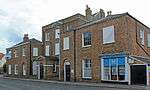
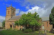
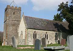
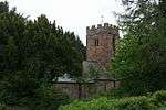
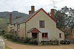
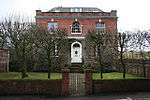
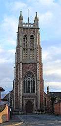
Buildings

Name Location Type Completed [note 1] Grid ref.[note 2]
Geo-coordinates
Entry number [note 3]ImageRef.
1–6, Cheapside Taunton Shop Early 19th century ST2284224454
51°00′51″N 3°06′05″W / 51.014268°N 3.101287°W / 51.014268; -3.101287 (1–6, Cheapside)
1060078
[5]
1–11, The Crescent Taunton Terrace 1807 ST2254224324
51°00′47″N 3°06′20″W / 51.013059°N 3.105535°W / 51.013059; -3.105535 (1–11, The Crescent)
1344699
[6]
4, 5–8, Hammet Street Taunton Terrace 1788–90 ST2280924585
51°00′56″N 3°06′06″W / 51.015441°N 3.101785°W / 51.015441; -3.101785 (4, 5–8, Hammet Street)
1276877 [7]
5 and 7, The Square Wiveliscombe House 1881 ST0810327847
51°02′33″N 3°18′44″W / 51.042601°N 3.312203°W / 51.042601; -3.312203 (5 and 7, The Square)
1307465
[8]
9–12, Hammet Street Taunton Terrace 1788-90 ST2282324568
51°00′55″N 3°06′06″W / 51.01529°N 3.101582°W / 51.01529; -3.101582 (9–12, Hammet Street)
1060037 [9]
12, Middle Street Taunton House c. 1700 ST2283724720
51°01′00″N 3°06′05″W / 51.016659°N 3.101415°W / 51.016659; -3.101415 (12, Middle Street)
1344725
[10]
13–17, Hammet Street Taunton Terrace 1788–90 ST2278624551
51°00′54″N 3°06′08″W / 51.015132°N 3.102106°W / 51.015132; -3.102106 (13–17, Hammet Street)
1344735 [11]
15, 16–20, The Crescent Taunton Terrace 1807 ST2255624271
51°00′45″N 3°06′19″W / 51.012584°N 3.105324°W / 51.012584; -3.105324 (15, 16–20, The Crescent)
1060043
[12]
16–20, Park Street Taunton Terrace Mid Victorian ST2221324374
51°00′48″N 3°06′37″W / 51.013464°N 3.110235°W / 51.013464; -3.110235 (16–20, Park Street)
1059993
[13]
18, Fore Street Taunton House 16th or early 17th century ST2267224462
51°00′52″N 3°06′13″W / 51.014317°N 3.103712°W / 51.014317; -3.103712 (18, Fore Street)
1232670
[14]
24–28, Silver Street Taunton House Probably very early 19th century ST2313124401
51°00′50″N 3°05′50″W / 51.01383°N 3.097157°W / 51.01383; -3.097157 (24–28, Silver Street)
1276486
[15]
48, East Street Taunton House Mid 18th century ST2304624501
51°00′53″N 3°05′54″W / 51.014718°N 3.098389°W / 51.014718; -3.098389 (48, East Street)
1060057
[16]
115 and 117, Galmington Road, 2, Galmington Lane Taunton Cross Passage House Medieval ST2122623832
51°00′30″N 3°07′27″W / 51.008456°N 3.124184°W / 51.008456; -3.124184 (115 and 117, Galmington Road, 2, Galmington Lane)
1276934 [17]
Almshouses Staple Fitzpaine Flats 1643 ST2640018291
50°57′34″N 3°02′58″W / 50.959325°N 3.049325°W / 50.959325; -3.049325 (Almshouses)
1060273 [18]
Bagborough House West Bagborough Country House c. 1730 ST1687733702
51°05′48″N 3°11′18″W / 51.096577°N 3.188428°W / 51.096577; -3.188428 (Bagborough House)
1060526
[19]
Blagrove's Farmhouse
(and adjoining walls to the north west and south west)
Oake Kitchen Late 17th century ST1453525641
51°01′26″N 3°13′12″W / 51.023763°N 3.219959°W / 51.023763; -3.219959 (Blagrove's Farmhouse
(and adjoining walls to the north west and south west)
)
1344563
[20]
Bradford Bridge Bradford on Tone Road Bridge 15th century ST1719222997
51°00′01″N 3°10′53″W / 51.000382°N 3.181479°W / 51.000382; -3.181479 (Bradford Bridge)
1060375
[21]
Buckland Farmhouse West Buckland Farmhouse Late 16th century ST1818119395
50°58′05″N 3°10′00″W / 50.96814°N 3.166576°W / 50.96814; -3.166576 (Buckland Farmhouse)
1180164 [22]
Bulford House Wellington House 18th century ST1411820319
50°58′33″N 3°13′29″W / 50.975855°N 3.224642°W / 50.975855; -3.224642 (Bulford House)
1059874 [23]
Chilliswood Farmhouse
(with horse-engine house and barn)
Trull House Medieval ST1988722017
50°59′31″N 3°08′34″W / 50.991954°N 3.142864°W / 50.991954; -3.142864 (Chilliswood Farmhouse
(with horse-engine house and barn)
)
1060445
[24]
Church of All Saints Chipstable Parish Church 15th century ST0426727140
51°02′08″N 3°22′00″W / 51.035618°N 3.366717°W / 51.035618; -3.366717 (Church of All Saints)
1344603
[25]
Church of All Saints Norton Fitzwarren Parish Church Late 13th or early 14th century ST1967925969
51°01′39″N 3°08′48″W / 51.027455°N 3.146703°W / 51.027455; -3.146703 (Church of All Saints)
1060468
[26]
Church of St Andrew Wiveliscombe Church 1827–29 ST0827227675
51°02′28″N 3°18′35″W / 51.041082°N 3.30975°W / 51.041082; -3.30975 (Church of St Andrew)
1177072
[27]
Church of St Bartholomew Oake Parish Church 13th–14th century ST1525525179
51°01′11″N 3°12′35″W / 51.019716°N 3.209587°W / 51.019716; -3.209587 (Church of St Bartholomew)
1307395
[28]
Church of St George Taunton Church Saxon ST2247023902
51°00′33″N 3°06′23″W / 51.009255°N 3.106471°W / 51.009255; -3.106471 (Church of St George)
1060018
[29]
Church of St Giles Bradford on Tone Parish Church c. 1300 ST1730222979
51°00′01″N 3°10′48″W / 51.000236°N 3.179908°W / 51.000236; -3.179908 (Church of St Giles)
1060376
[30]
Church of St James Taunton Church Medieval ST2285524843
51°01′04″N 3°06′04″W / 51.017767°N 3.101185°W / 51.017767; -3.101185 (Church of St James)
1059956
[31]
Church of St James the Great Fitzhead Sculpture 15th century ST1197428391
51°02′53″N 3°15′26″W / 51.048099°N 3.257134°W / 51.048099; -3.257134 (Church of St James the Great)
1175726
[32]
Church of St John the Baptist Ashbrittle Church 15th century ST0520221358
50°59′02″N 3°21′07″W / 50.983795°N 3.351874°W / 50.983795; -3.351874 (Church of St John the Baptist)
1059880
[33]
Church of St Leonard Otterford Parish Church 14th century ST2223914328
50°55′23″N 3°06′28″W / 50.923148°N 3.107713°W / 50.923148; -3.107713 (Church of St Leonard)
1344635
[34]
Church of St Margaret Wellington Without Parish Church 15th century ST0986321094
50°58′56″N 3°17′08″W / 50.982171°N 3.285425°W / 50.982171; -3.285425 (Church of St Margaret)
1180128
[35]
Church of St Mary Cheddon Fitzpaine Parish Church Late 13th century ST2428827596
51°02′34″N 3°04′53″W / 51.042709°N 3.081335°W / 51.042709; -3.081335 (Church of St Mary)
1060508
[36]
Church of St Mary Stoke St Mary Parish Church 13th century ST2658122337
50°59′45″N 3°02′51″W / 50.995725°N 3.047567°W / 50.995725; -3.047567 (Church of St Mary)
1177216
[37]
Church of St Michael Orchard Portman Parish Church Norman ST2437221650
50°59′21″N 3°04′44″W / 50.989262°N 3.078895°W / 50.989262; -3.078895 (Church of St Michael)
1060391
[38]
Church of St Michael Pitminster Parish Church 14th century ST1990618701
50°57′44″N 3°08′31″W / 50.962144°N 3.141862°W / 50.962144; -3.141862 (Church of St Michael)
1177574
[39]
Church of St Nicholas Corfe Parish Church Norman ST2324719689
50°58′17″N 3°05′40″W / 50.971482°N 3.094506°W / 50.971482; -3.094506 (Church of St Nicholas)
1060345
[40]
Church of St Nicholas Stawley Church c. 1500 ST0781922329
50°59′35″N 3°18′53″W / 50.99295°N 3.314849°W / 50.99295; -3.314849 (Church of St Nicholas)
1176263 [41]
Church of St Pancras West Bagborough Sundial 1643 ST1684833704
51°05′48″N 3°11′20″W / 51.096591°N 3.188843°W / 51.096591; -3.188843 (Church of St Pancras)
1344480
[42]
Church of St Peter Langford Budville Parish Church 15th century ST1189521877
50°59′22″N 3°15′24″W / 50.989525°N 3.256676°W / 50.989525; -3.256676 (Church of St Peter)
1060352
[43]
Church of St Peter and St Paul Bishop's Hull Boiler House Mid 20th century ST2048224757
51°01′00″N 3°08′06″W / 51.01667°N 3.134989°W / 51.01667; -3.134989 (Church of St Peter and St Paul)
1060537
[44]
Church of the Holy Cross Oake Parish Church 14th century ST1674824638
51°00′54″N 3°11′17″W / 51.015071°N 3.188182°W / 51.015071; -3.188182 (Church of the Holy Cross)
1060326
[45]
Church of the Holy Trinity Ash Priors Church 15th century ST1517829482
51°03′30″N 3°12′42″W / 51.05839°N 3.211694°W / 51.05839; -3.211694 (Church of the Holy Trinity)
1344823
[46]
Churchyard cross,
Church of St Andrew
Wiveliscombe Cross 14th century ST0829227693
51°02′28″N 3°18′34″W / 51.041247°N 3.309469°W / 51.041247; -3.309469 (Churchyard cross,
Church of St Andrew
)
1177103 [47]
Churchyard cross,
Church of St James the Great
Fitzhead Sculpture 14th century ST1197228374
51°02′53″N 3°15′26″W / 51.047945°N 3.257158°W / 51.047945; -3.257158 (Churchyard cross,
Church of St James the Great
)
1059198
[48]
Churchyard cross,
Church of St John the Baptist
Heathfield Cross Late 13th century ST1600426457
51°01′53″N 3°11′57″W / 51.031316°N 3.199208°W / 51.031316; -3.199208 (Churchyard cross,
Church of St John the Baptist
)
1307462
[49]
Churchyard cross,
Church of St Mary
Bishops Lydeard Steps 14th century ST1676229732
51°03′39″N 3°11′21″W / 51.060869°N 3.189154°W / 51.060869; -3.189154 (Churchyard cross,
Church of St Mary
)
1175069
[50]
Churchyard cross,
Church of St Peter and St Paul
Combe Florey Cross 15th century ST1506231156
51°04′24″N 3°12′49″W / 51.073422°N 3.213742°W / 51.073422; -3.213742 (Churchyard cross,
Church of St Peter and St Paul
)
1059225
[51]
Churchyard cross,
Church of St Peter and St Paul
North Curry Cross 15th century ST3195625487
51°01′29″N 2°58′18″W / 51.024708°N 2.971579°W / 51.024708; -2.971579 (Churchyard cross,
Church of St Peter and St Paul
)
1060411 [52]
Cloth Finishing Works at Tone Mills
(North range including dye-house and reservoirs)
Wellington Reservoir c. 1830 ST1277621242
50°59′02″N 3°14′38″W / 50.983951°N 3.243974°W / 50.983951; -3.243974 (Cloth Finishing Works at Tone Mills
(North range including dye-house and reservoirs)
)
1271246
[53]
Coalharbour Creech St Michael House 16th century ST2889625332
51°01′23″N 3°00′55″W / 51.022943°N 3.015173°W / 51.022943; -3.015173 (Coalharbour)
1344519 [54]
Conservative Club Taunton House 1805 ST2283624615
51°00′57″N 3°06′05″W / 51.015715°N 3.101407°W / 51.015715; -3.101407 (Conservative Club)
1231461
[55][56]
Cothelstone Manor Cothelstone Manor House Mid 16th century ST1814531800
51°04′47″N 3°10′12″W / 51.07966°N 3.169893°W / 51.07966; -3.169893 (Cothelstone Manor)
1344838
[57]
County Hotel Taunton House Early 19th century ST2288624452
51°00′51″N 3°06′02″W / 51.014256°N 3.100659°W / 51.014256; -3.100659 (County Hotel)
1060016
[58]
Fairhouse Farmhouse Churchstanton Farmhouse Late Medieval ST2191612308
50°54′18″N 3°06′43″W / 50.904943°N 3.111875°W / 50.904943; -3.111875 (Fairhouse Farmhouse)
1177497 [59]
Fitzhead Court and The Manor Fitzhead House Late 16th century ST1219328493
51°02′57″N 3°15′15″W / 51.049049°N 3.254035°W / 51.049049; -3.254035 (Fitzhead Court and The Manor)
1059202
[60]
Garden House Pitminster Garden House 17th century ST2220720201
50°58′33″N 3°06′34″W / 50.975945°N 3.109425°W / 50.975945; -3.109425 (Garden House)
1344593 [61]
Gatehouse, Cothay Manor
(and wall linking gatehouse to manor)
Stawley Wall Late 15th century ST0852921297
50°59′02″N 3°18′16″W / 50.983785°N 3.304475°W / 50.983785; -3.304475 (Gatehouse, Cothay Manor
(and wall linking gatehouse to manor)
)
1344803 [62]
Gatehouse, Combe Florey House Combe Florey Privy house 1591 ST1511231154
51°04′24″N 3°12′47″W / 51.073411°N 3.213028°W / 51.073411; -3.213028 (Gatehouse, Combe Florey House)
1059226
[63]
Gaulden Manor Tolland House 16th century ST1108431359
51°04′29″N 3°16′14″W / 51.074643°N 3.270557°W / 51.074643; -3.270557 (Gaulden Manor)
1307623 [64]
Gazebo, Cothelstone Manor
(and adjoining walls)
Cothelstone Wall Late 16th century ST1822131827
51°04′48″N 3°10′08″W / 51.079914°N 3.168814°W / 51.079914; -3.168814 (Gazebo, Cothelstone Manor
(and adjoining walls)
)
1059193 [65]
Gerbestone Manor West Buckland Cross Passage House Late 16th century ST1618319378
50°58′04″N 3°11′42″W / 50.9677°N 3.195019°W / 50.9677; -3.195019 (Gerbestone Manor)
1344582
[66]
Giffords Farmhouse and Barn Norton Fitzwarren Farmhouse 16th century ST1997327003
51°02′12″N 3°08′34″W / 51.036792°N 3.14274°W / 51.036792; -3.14274 (Giffords Farmhouse and Barn)
1060466 [67]
Hamwood Farmhouse
(and walls with gate-piers and gate)
Trull Farmhouse 17th century ST1970621102
50°59′01″N 3°08′43″W / 50.983702°N 3.14524°W / 50.983702; -3.14524 (Hamwood Farmhouse
(and walls with gate-piers and gate)
)
1344504 [68]
Henlade House Ruishton Country House 1805–15 ST2729323055
51°00′08″N 3°02′15″W / 51.002271°N 3.037567°W / 51.002271; -3.037567 (Henlade House)
1060397
[69]
Hestercombe House Cheddon Fitzpaine Country house 16th century ST2415028723
51°03′10″N 3°05′01″W / 51.052823°N 3.08354°W / 51.052823; -3.08354 (Hestercombe House)
1060513
[70]
Hill Farmhouse Stawley Farmhouse Late 16th century ST0616021852
50°59′18″N 3°20′18″W / 50.988393°N 3.338358°W / 50.988393; -3.338358 (Hill Farmhouse)
1176991 [71]
Homedale Milverton House 16th–17th century ST1218025843
51°01′31″N 3°15′13″W / 51.025224°N 3.253577°W / 51.025224; -3.253577 (Homedale)
1060553 [72]
Kittisford Barton Stawley House Late 15th century ST0768323193
51°00′03″N 3°19′01″W / 51.000695°N 3.317006°W / 51.000695; -3.317006 (Kittisford Barton)
1307955 [73]
Langford Court Langford Budville House 17th century ST1089723023
50°59′59″N 3°16′16″W / 50.999674°N 3.271173°W / 50.999674; -3.271173 (Langford Court)
1060351 [74]
Little Court West Bagborough House Late 20th century ST1672433488
51°05′41″N 3°11′26″W / 51.094631°N 3.190563°W / 51.094631; -3.190563 (Little Court)
1176957 [75]
Lodge Farmhouse Durston Farmhouse 15th century ST2909228178
51°02′55″N 3°00′47″W / 51.048555°N 3.012937°W / 51.048555; -3.012937 (Lodge Farmhouse)
1060491 [76]
Lower Stoford Farmhouse
(and wall, gate-piers)
Halse Farmhouse Late 15th or early 16th century ST1446328780
51°03′07″N 3°13′18″W / 51.051972°N 3.221727°W / 51.051972; -3.221727 (Lower Stoford Farmhouse
(and wall, gate-piers)
)
1308046 [77]
Lower Terhill Farmhouse Bishops Lydeard Farmhouse 16th century ST1769632681
51°05′15″N 3°10′35″W / 51.087516°N 3.176502°W / 51.087516; -3.176502 (Lower Terhill Farmhouse)
1344853
[78]
Lydeard House
(and attached stables and walls)
Bishops Lydeard Country House Early–Mid 18th century ST1668029889
51°03′44″N 3°11′25″W / 51.062269°N 3.190361°W / 51.062269; -3.190361 (Lydeard House
(and attached stables and walls)
)
1295371
[79]
Manor Farmhouse North Curry Farmhouse 1570 ST3221525248
51°01′21″N 2°58′04″W / 51.02259°N 2.967842°W / 51.02259; -2.967842 (Manor Farmhouse)
1176349 [80]
Manor Farmhouse North Curry Farmhouse Late Medieval ST3050725570
51°01′31″N 2°59′32″W / 51.025281°N 2.992253°W / 51.025281; -2.992253 (Manor Farmhouse)
1176652 [81]
Manor House Bishop's Hull Manor house 1586 ST2056124813
51°01′02″N 3°08′02″W / 51.017184°N 3.133875°W / 51.017184; -3.133875 (Manor House)
1060535
[82]
Market House Taunton House 1770–72 ST2273424490
51°00′52″N 3°06′10″W / 51.014577°N 3.102834°W / 51.014577; -3.102834 (Market House)
1059989
[83]
Masonic Hall Taunton Steps 1812 ST2256824250
51°00′45″N 3°06′19″W / 51.012397°N 3.105149°W / 51.012397; -3.105149 (Masonic Hall)
1060044
[84]
Mausoleum, Hestercombe House West Monkton Garden Temple Late 18th century ST2435028906
51°03′16″N 3°04′51″W / 51.054495°N 3.080725°W / 51.054495; -3.080725 (Mausoleum, Hestercombe House)
1060461
[85]
Municipal Buildings
(incorporating the Old Grammar School)
Taunton Local Government Office c. 1480 ST2262324522
51°00′53″N 3°06′16″W / 51.01485°N 3.104423°W / 51.01485; -3.104423 (Municipal Buildings
(incorporating the Old Grammar School)
)
1060041
[86]
Musgrave Farmhouse Ruishton Kitchen Mid 19th century ST2691423580
51°00′25″N 3°02′35″W / 51.006943°N 3.043074°W / 51.006943; -3.043074 (Musgrave Farmhouse)
1177045 [87]
Netherfield Milverton House c. 1766 ST1198025675
51°01′25″N 3°15′23″W / 51.023683°N 3.256388°W / 51.023683; -3.256388 (Netherfield)
1176748
[88]
North Lodge Bishops Lydeard Carriageway Early 18th century ST1556230337
51°03′58″N 3°12′23″W / 51.066133°N 3.206415°W / 51.066133; -3.206415 (North Lodge)
1059222 [89]
Nynehead Court
(and adjoining wall)
Nynehead Kitchen Late Medieval ST1373522744
50°59′51″N 3°13′50″W / 50.997599°N 3.230673°W / 50.997599; -3.230673 (Nynehead Court
(and adjoining wall)
)
1307540
[90]
Old Court Wellington House 16th century ST1372920468
50°58′38″N 3°13′49″W / 50.977136°N 3.230217°W / 50.977136; -3.230217 (Old Court)
1059899 [91]
Outbuilding with wall, Haydon House Stoke St Mary Wash House Late 17th century ST2555823575
51°00′24″N 3°03′45″W / 51.006724°N 3.062396°W / 51.006724; -3.062396 (Outbuilding with wall, Haydon House)
1177118 [92]
Poundisford Lodge Pitminster Country House 17th century ST2225920771
50°58′52″N 3°06′32″W / 50.981077°N 3.108806°W / 50.981077; -3.108806 (Poundisford Lodge)
1344592
[93]
Priory Barn Taunton Augustinian Monastery 1220 ST2301124965
51°01′08″N 3°05′56″W / 51.018885°N 3.098987°W / 51.018885; -3.098987 (Priory Barn)
1344774
[94]
Pyleigh Manor Lydeard St Lawrence Farmhouse 16th century ST1280930874
51°04′14″N 3°14′45″W / 51.070548°N 3.245824°W / 51.070548; -3.245824 (Pyleigh Manor)
1344481 [95]
Pyrland Hall Cheddon Fitzpaine Country House c. 1760 ST2272027623
51°02′34″N 3°06′13″W / 51.042742°N 3.103702°W / 51.042742; -3.103702 (Pyrland Hall)
1176079 [96]
Queens College Comeytrowe Further Education College 1874 ST2170623142
51°00′08″N 3°07′02″W / 51.002319°N 3.117194°W / 51.002319; -3.117194 (Queens College)
1276273
[97]
Remains of Churchyard cross,
Church of St George
Ruishton Cross Early 15th century ST2636425099
51°01′14″N 3°03′04″W / 51.020529°N 3.05122°W / 51.020529; -3.05122 (Remains of Churchyard cross,
Church of St George
)
1060396 [98]
Remains of Churchyard cross,
Church of All Saints
Nynehead Cross 15th century ST1378422732
50°59′51″N 3°13′48″W / 50.997498°N 3.229972°W / 50.997498; -3.229972 (Remains of Churchyard cross,
Church of All Saints
)
1344597 [99]
Risdons Bradford on Tone Farmhouse 16th century ST1730522655
50°59′50″N 3°10′47″W / 50.997324°N 3.179791°W / 50.997324; -3.179791 (Risdons)
1060337 [100]
Roman Catholic Church of St George Taunton Church 1861 ST2303824292
51°00′46″N 3°05′54″W / 51.012838°N 3.098459°W / 51.012838; -3.098459 (Roman Catholic Church of St George)
1231201
[101]
Sandhill Park Hospital Bishops Lydeard Country House c. 1720 ST1562429861
51°03′43″N 3°12′20″W / 51.061863°N 3.20542°W / 51.061863; -3.20542 (Sandhill Park Hospital)
1295317
[102]
Sherford House Taunton House 1679 ST2267223317
51°00′14″N 3°06′12″W / 51.004023°N 3.103467°W / 51.004023; -3.103467 (Sherford House)
1233681 [103]
Slough Farmhouse Stoke St Gregory Double Ended Hall House Late Medieval ST3478027703
51°02′42″N 2°55′54″W / 51.04496°N 2.931719°W / 51.04496; -2.931719 (Slough Farmhouse)
1344637 [104]
St Joseph's Convent Taunton House Early 19th century ST2323324139
51°00′41″N 3°05′44″W / 51.011488°N 3.095647°W / 51.011488; -3.095647 (St Joseph's Convent)
1276422
[105]
St Margaret's Leper Hospital Taunton Almshouse Early 16th century ST2384624810
51°01′03″N 3°05′13″W / 51.017603°N 3.087052°W / 51.017603; -3.087052 (St Margaret's Leper Hospital)
1232831
[106]
Summerhouse at Language Centre Taunton Summerhouse Late 19th century ST2214625113
51°01′12″N 3°06′41″W / 51.020099°N 3.111348°W / 51.020099; -3.111348 (Summerhouse at Language Centre)
1059936 [107]
Tetton House
(and terrace to garden)
Kingston St Mary Country House c. 1790 ST2079130456
51°04′05″N 3°07′55″W / 51.067949°N 3.131833°W / 51.067949; -3.131833 (Tetton House
(and terrace to garden)
)
1307958
[108]
Temple, Hestercombe House West Monkton Garden Temple Late 18th century ST2432528941
51°03′17″N 3°04′52″W / 51.054806°N 3.081089°W / 51.054806; -3.081089 (Temple, Hestercombe House)
1390976 [109]
The Manor House Kingston St Mary Cross Passage House c. 1560 ST2209929753
51°03′43″N 3°06′47″W / 51.061808°N 3.113018°W / 51.061808; -3.113018 (The Manor House)
1060501 [110]
The Old House Milverton House Late 15th or early 16th century ST1222725880
51°01′32″N 3°15′10″W / 51.025563°N 3.252916°W / 51.025563; -3.252916 (The Old House)
1060552 [111]
The Old Manor House Combe Florey House 17th century ST1534231224
51°04′27″N 3°12′35″W / 51.074075°N 3.209762°W / 51.074075; -3.209762 (The Old Manor House)
1059230 [112]
Tonedale Mills
(East complex)
Wellington Carpenters Workshop Late 19th century ST1282721337
50°59′05″N 3°14′36″W / 50.984813°N 3.243271°W / 50.984813; -3.243271 (Tonedale Mills
(East complex)
)
1176514 [113]
Tonedale Mills
(West complex)
Wellington Industrial Estate Late 20th century ST1270021300
50°59′04″N 3°14′42″W / 50.984461°N 3.245071°W / 50.984461; -3.245071 (Tonedale Mills
(West complex)
)
1051987
[114]
Trowell Farmhouse Chipstable Farmhouse 17th century ST0483526049
51°01′33″N 3°21′30″W / 51.025905°N 3.358332°W / 51.025905; -3.358332 (Trowell Farmhouse)
1177577 [115]
Unidentified chest tomb in Churchyard,
Church of St Augustine
West Monkton Chest Tomb Late 17th century ST2630428440
51°03′02″N 3°03′10″W / 51.050559°N 3.052756°W / 51.050559; -3.052756 (Unidentified chest tomb in Churchyard,
Church of St Augustine
)
1307458 [116]
Unitarian Chapel Taunton Unitarian Chapel 1721 ST2277824228
51°00′44″N 3°06′08″W / 51.012227°N 3.102151°W / 51.012227; -3.102151 (Unitarian Chapel)
1060009
[117]
Walford House West Monkton Apartment c. 1965 ST2720528202
51°02′55″N 3°02′23″W / 51.048535°N 3.039856°W / 51.048535; -3.039856 (Walford House)
1060421
[118]
Washer's Farmhouse Fitzhead Farmhouse Early 17th century ST1154928651
51°03′01″N 3°15′48″W / 51.050371°N 3.263259°W / 51.050371; -3.263259 (Washer's Farmhouse)
1059205 [119]
Wellington Monument Wellington Without Obelisk 1817–18 ST1373817229
50°56′53″N 3°13′46″W / 50.948018°N 3.22932°W / 50.948018; -3.22932 (Wellington Monument)
1060281
[120]
Wheatleigh House Taunton House Early to mid 19th century ST2207823783
51°00′29″N 3°06′43″W / 51.008132°N 3.112032°W / 51.008132; -3.112032 (Wheatleigh House)
1039998
[121]
Yarde Farmhouse Staplegrove Farmhouse Early 17th century ST2014827375
51°02′25″N 3°08′25″W / 51.040161°N 3.140327°W / 51.040161; -3.140327 (Yarde Farmhouse)
1344515 [122]

See also

Notes

  1. The date given is the date used by Historic England as significant for the initial building or that of an important part in the structure's description.
  2. Sometimes known as OSGB36, the grid reference is based on the British national grid reference system used by the Ordnance Survey.
  3. The "List Entry Number" is a unique number assigned to each listed building and scheduled monument by Historic England.

References

  1. "What is a listed building?". Manchester City Council. Retrieved 8 December 2007.
  2. "Planning (Listed Buildings and Conservation Areas) Act 1990 (c. 9)". Ministry of Justice. Retrieved 17 December 2007.
  3. 1 2 "Demographics". Taunton Deane Borough Council. Retrieved 25 April 2009.
  4. "Area: Taunton Deane (Local Authority): Key Figures for Physical Environment". Neighbourhood Statistics. Office for National Statistics. Retrieved 25 April 2009.
  5. "1–6, Cheapside". National heritage list for England. English Heritage. Retrieved 14 July 2013.
  6. "1–5, The Crescent". National heritage list for England. English Heritage. Retrieved 14 July 2013.
  7. Historic England. "4, Hammet Street (1276877)". National Heritage List for England. Retrieved 3 April 2015.
  8. Historic England. "5 And 7, The Square (1307465)". National Heritage List for England. Retrieved 3 April 2015.
  9. Historic England. "9-12, Hammet Street (1060037)". National Heritage List for England. Retrieved 3 April 2015.
  10. Historic England. "12, Middle Street (1344725)". National Heritage List for England. Retrieved 3 April 2015.
  11. "13–17, Hammet Street". National heritage list for England. English Heritage. Retrieved 14 July 2013.
  12. Historic England. "15, The Crescent (1060043)". National Heritage List for England. Retrieved 3 April 2015.
  13. "16–20, Park Street". National heritage list for England. English Heritage. Retrieved 14 July 2013.
  14. Historic England. "18, Fore Street (1232670)". National Heritage List for England. Retrieved 3 April 2015.
  15. "24–28, Silver Street". National heritage list for England. English Heritage. Retrieved 14 July 2013.
  16. Historic England. "48, East Street (1060057)". National Heritage List for England. Retrieved 3 April 2015.
  17. Historic England. "115 And 117, Galmington Road (1276934)". National Heritage List for England. Retrieved 3 April 2015.
  18. Historic England. "Almshouses (1060273)". National Heritage List for England. Retrieved 3 April 2015.
  19. Historic England. "Bagborough House (1060526)". National Heritage List for England. Retrieved 3 April 2015.
  20. Historic England. "Balgrove's Farmhouse and Adjoining Walls to North West and South West (1344563)". National Heritage List for England. Retrieved 7 July 2015.
  21. Historic England. "Bradford Bridge At Ngr St 1719 2299 (1060375)". National Heritage List for England. Retrieved 3 April 2015.
  22. Historic England. "Buckland Farmhouse (1180164)". National Heritage List for England. Retrieved 3 April 2015.
  23. Historic England. "Bulford House (1059874)". National Heritage List for England. Retrieved 3 April 2015.
  24. Historic England. "Chilliswood Farmhouse with horse-engine house and barn (1060445)". National Heritage List for England. Retrieved 3 April 2015.
  25. Historic England. "Church Of All Saints (1344603)". National Heritage List for England. Retrieved 3 April 2015.
  26. Historic England. "Church Of All Saints (1060468)". National Heritage List for England. Retrieved 3 April 2015.
  27. Historic England. "Church Of St Andrew (1177072)". National Heritage List for England. Retrieved 3 April 2015.
  28. Historic England. "Church Of St Bartholomew (1307395)". National Heritage List for England. Retrieved 3 April 2015.
  29. Historic England. "St George's Church (1060018)". National Heritage List for England. Retrieved 7 July 2015.
  30. Historic England. "Church Of St Giles (1060376)". National Heritage List for England. Retrieved 3 April 2015.
  31. Historic England. "St James Church (1059956)". National Heritage List for England. Retrieved 3 April 2015.
  32. Historic England. "Church Of St James The Great (1175726)". National Heritage List for England. Retrieved 3 April 2015.
  33. Historic England. "Church Of St John The Baptist (1059880)". National Heritage List for England. Retrieved 3 April 2015.
  34. Historic England. "Church Of St Leonard (1344635)". National Heritage List for England. Retrieved 3 April 2015.
  35. Historic England. "Church Of St Margaret (1180128)". National Heritage List for England. Retrieved 3 April 2015.
  36. Historic England. "Church Of St Mary (1060508)". National Heritage List for England. Retrieved 3 April 2015.
  37. Historic England. "Church Of St Mary (1177216)". National Heritage List for England. Retrieved 3 April 2015.
  38. Historic England. "Church Of St Michael (1060391)". National Heritage List for England. Retrieved 3 April 2015.
  39. Historic England. "Church Of St Michael (1177574)". National Heritage List for England. Retrieved 3 April 2015.
  40. Historic England. "Church Of St Nicholas (1060345)". National Heritage List for England. Retrieved 3 April 2015.
  41. Historic England. "Church Of St Nicholas (1176263)". National Heritage List for England. Retrieved 3 April 2015.
  42. Historic England. "Church Of St Pancras (1344480)". National Heritage List for England. Retrieved 3 April 2015.
  43. Historic England. "Church Of St Peter (1060352)". National Heritage List for England. Retrieved 3 April 2015.
  44. Historic England. "Church Of St Peter And St Paul (1060537)". National Heritage List for England. Retrieved 3 April 2015.
  45. Historic England. "Church Of The Holy Cross (1060326)". National Heritage List for England. Retrieved 3 April 2015.
  46. Historic England. "Church Of The Holy Trinity (1344823)". National Heritage List for England. Retrieved 3 April 2015.
  47. Historic England. "Churchyard Cross, Church Of St Andrew (1177103)". National Heritage List for England. Retrieved 3 April 2015.
  48. Historic England. "Cross In Churchyard, Church Of St James The Great Cross In St James Churchyard (1059198)". National Heritage List for England. Retrieved 3 April 2015.
  49. Historic England. "Churchyard Cross About 10 Metres South East Of Chancel, Church Of St John The Baptist (1307462)". National Heritage List for England. Retrieved 3 April 2015.
  50. Historic England. "Cross In Churchyard, Church Of St Mary (1175069)". National Heritage List for England. Retrieved 3 April 2015.
  51. Historic England. "Cross, 3 Metres South East Of Porch, Church Of St Peter And St Paul (1059225)". National Heritage List for England. Retrieved 3 April 2015.
  52. Historic England. "Churchyard Cross In Churchyard About 80 Metres South Of Chancel Church Of St Peter And St Paul (1060411)". National Heritage List for England. Retrieved 3 April 2015.
  53. Historic England. "Cloth Finishing Works At Tone Mills North Range Including Dyehouse And Reservoirs (1271246)". National Heritage List for England. Retrieved 3 April 2015.
  54. Historic England. "Coalharbour (1344519)". National Heritage List for England. Retrieved 3 April 2015.
  55. Historic England. "Conservative Club (1231461)". National Heritage List for England. Retrieved 3 April 2015.
  56. "Nos 1 and 2 (Conservative Club) (formerly listed as No 1), Church Square (North side), Taunton". Somerset Historic Environment Record. Somerset County Council. Retrieved 16 July 2013.
  57. Historic England. "Cothelstone Manor (1344838)". National Heritage List for England. Retrieved 3 April 2015.
  58. Historic England. "County Hotel (1060016)". National Heritage List for England. Retrieved 3 April 2015.
  59. Historic England. "Fairhouse Farmhouse (1177497)". National Heritage List for England. Retrieved 3 April 2015.
  60. Historic England. "Fitzhead Court The Manor (1059202)". National Heritage List for England. Retrieved 3 April 2015.
  61. Historic England. "Garden House, About 50 Metres West Of Poundisford Park (1344593)". National Heritage List for England. Retrieved 3 April 2015.
  62. Historic England. "Gatehouse And Wall Linking Gatehouse To Manor On South East Side, Cothay Manor (1344803)". National Heritage List for England. Retrieved 3 April 2015.
  63. Historic England. "Gatehouse at Combe Florey House (1059226)". National Heritage List for England. Retrieved 3 April 2015.
  64. Historic England. "Gaulden Manor (1307623)". National Heritage List for England. Retrieved 3 April 2015.
  65. Historic England. "Gazebo And Adjoining Walls, 50 Metres East North East Of Cothelstone Manor (1059193)". National Heritage List for England. Retrieved 3 April 2015.
  66. Historic England. "Gerbestone Manor (1344582)". National Heritage List for England. Retrieved 3 April 2015.
  67. Historic England. "Giffords Farmhouse And Barn (1060466)". National Heritage List for England. Retrieved 3 April 2015.
  68. Historic England. "Hamwood Farmhouse And Wall Abutting North Corner With Gatepiers And Gate (1344504)". National Heritage List for England. Retrieved 3 April 2015.
  69. Historic England. "Henlade House (1060397)". National Heritage List for England. Retrieved 3 April 2015.
  70. Historic England. "Hestercombe House (1060513)". National Heritage List for England. Retrieved 3 April 2015.
  71. Historic England. "Hill Farmhouse (1176991)". National Heritage List for England. Retrieved 3 April 2015.
  72. Historic England. "Homedale, And Landing Linking Property To Flight Of Steps From Churchyard (1060553)". National Heritage List for England. Retrieved 3 April 2015.
  73. Historic England. "Kittisford Barton (1307955)". National Heritage List for England. Retrieved 3 April 2015.
  74. Historic England. "Langford Court (1060351)". National Heritage List for England. Retrieved 3 April 2015.
  75. Historic England. "Little Court (1176957)". National Heritage List for England. Retrieved 3 April 2015.
  76. Historic England. "Lodge Farmhouse (1060491)". National Heritage List for England. Retrieved 3 April 2015.
  77. Historic England. "Lower Stoford Farmhouse, Wall, Gate-Piers And Boundary Wall Running North-South To The Refectory (1308046)". National Heritage List for England. Retrieved 3 April 2015.
  78. Historic England. "Lower Terhill Farmhouse (1344853)". National Heritage List for England. Retrieved 3 April 2015.
  79. Historic England. "Lydeard House, Attached Stables And Walls Abutting Entrance To The Latter (1295371)". National Heritage List for England. Retrieved 3 April 2015.
  80. Historic England. "Manor Farmhouse (1176349)". National Heritage List for England. Retrieved 3 April 2015.
  81. Historic England. "Manor Farmhouse (1176652)". National Heritage List for England. Retrieved 3 April 2015.
  82. Historic England. "Manor House (1060535)". National Heritage List for England. Retrieved 3 April 2015.
  83. Historic England. "The Market House (1059989)". National Heritage List for England. Retrieved 3 April 2015.
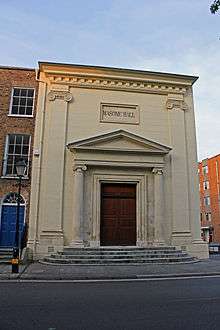
  84. Historic England. "Masonic Hall (1060044)". National Heritage List for England. Retrieved 3 April 2015.
  85. Historic England. "The Mausoleum In The Grounds Of Hestercombe House (1060461)". National Heritage List for England. Retrieved 3 April 2015.
  86. Historic England. "Municipal Building (West End) Municipal Buildings (East End) (Incorporating The Old Grammar School) (1060041)". National Heritage List for England. Retrieved 3 April 2015.
  87. Historic England. "Musgrave Farmhouse (1177045)". National Heritage List for England. Retrieved 3 April 2015.
  88. Historic England. "Netherfield (1176748)". National Heritage List for England. Retrieved 3 April 2015.
  89. Historic England. "North Lodge (1059222)". National Heritage List for England. Retrieved 3 April 2015.
  90. Historic England. "Nynehead Court And Wall Adjoining On North Side Of Forecourt (1307540)". National Heritage List for England. Retrieved 3 April 2015.
  91. Historic England. "Old Court (1059899)". National Heritage List for England. Retrieved 3 April 2015.
  92. Historic England. "Outbuilding With Wall Adjoining South East Corner Of Haydon House (1177118)". National Heritage List for England. Retrieved 3 April 2015.
  93. Historic England. "Poundisford Lodge (1344592)". National Heritage List for England. Retrieved 3 April 2015.
  94. Historic England. "Poundisford Lodge (1344774)". National Heritage List for England. Retrieved 3 April 2015.
  95. Historic England. "Pyleigh Manor (1344481)". National Heritage List for England. Retrieved 3 April 2015.
  96. Historic England. "Pyrland Hall (1176079)". National Heritage List for England. Retrieved 3 April 2015.
  97. Historic England. "Queens College (1276273)". National Heritage List for England. Retrieved 3 April 2015.
  98. Historic England. "Remains Of Churchyard Cross In Churchyard About 7 Metres South Of Porch Church Of St George (1060396)". National Heritage List for England. Retrieved 3 April 2015.
  99. Historic England. "Remains Of Churchyard Cross, About 2 Metres North Of Sandford Chapel, Church Of All Saints (1344597)". National Heritage List for England. Retrieved 3 April 2015.
  100. Historic England. "Risdons (1060337)". National Heritage List for England. Retrieved 3 April 2015.
  101. Historic England. "The Roman Catholic Church Of St George (1231201)". National Heritage List for England. Retrieved 3 April 2015.
  102. Historic England. "Sandhill Park Hospital (1295317)". National Heritage List for England. Retrieved 3 April 2015.
  103. Historic England. "Sherford House (1233681)". National Heritage List for England. Retrieved 3 April 2015.
  104. Historic England. "Slough Farmhouse (1344637)". National Heritage List for England. Retrieved 3 April 2015.
  105. Historic England. "St Joseph's Convent (1276422)". National Heritage List for England. Retrieved 7 July 2015.
  106. Historic England. "St Margaret's Leper Hospital (1232831)". National Heritage List for England. Retrieved 7 July 2015.
  107. Historic England. "Summerhouse At Language Centre (1059936)". National Heritage List for England. Retrieved 3 April 2015.
  108. Historic England. "Tetton House And Terrace To Garden On South Front (1307958)". National Heritage List for England. Retrieved 3 April 2015.
  109. Historic England. "The Temple North North East Of Hestercombe House (1390976)". National Heritage List for England. Retrieved 3 April 2015.
  110. Historic England. "The Manor House (1060501)". National Heritage List for England. Retrieved 3 April 2015.
  111. Historic England. "The Old House (1060552)". National Heritage List for England. Retrieved 3 April 2015.
  112. Historic England. "The Old Manor House (1059230)". National Heritage List for England. Retrieved 3 April 2015.
  113. Historic England. "Tonedale Mills (East Complex) (1176514)". National Heritage List for England. Retrieved 3 April 2015.
  114. Historic England. "Tonedale Mills (West Complex) (1051987)". National Heritage List for England. Retrieved 3 April 2015.
  115. Historic England. "Trowell Farmhouse (1177577)". National Heritage List for England. Retrieved 3 April 2015.
  116. Historic England. "Unidentified Chest Tomb In Churchyard, About 3 Metres South Of Porch, Church Of St Auguistine (1307458)". National Heritage List for England. Retrieved 3 April 2015.
  117. Historic England. "Unitarian Chapel (1060009)". National Heritage List for England. Retrieved 3 April 2015.
  118. Historic England. "Walford House (1060421)". National Heritage List for England. Retrieved 3 April 2015.
  119. Historic England. "Washer's Farmhouse (1059205)". National Heritage List for England. Retrieved 7 July 2015.
  120. Historic England. "Wellington Monument (1060281)". National Heritage List for England. Retrieved 3 April 2015.
  121. Historic England. "Wheatleigh House (1039998)". National Heritage List for England. Retrieved 3 April 2015.
  122. Historic England. "Yarde Farmhouse (1344515)". National Heritage List for England. Retrieved 3 April 2015.

External links

Media related to Grade II* listed buildings in Somerset at Wikimedia Commons

This article is issued from Wikipedia - version of the 12/2/2016. The text is available under the Creative Commons Attribution/Share Alike but additional terms may apply for the media files.