Glenmore Park, New South Wales
| Glenmore Park Sydney, New South Wales | |||||||||||||
|---|---|---|---|---|---|---|---|---|---|---|---|---|---|
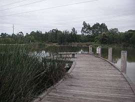 Blue Hills Wetland | |||||||||||||
| Population | 20,273 (2011 census)[1] | ||||||||||||
| • Density | 2,443/km2 (6,330/sq mi) | ||||||||||||
| Established | 1824 | ||||||||||||
| Postcode(s) | 2745 | ||||||||||||
| Area | 8.3 km2 (3.2 sq mi) | ||||||||||||
| Location | 59 km (37 mi) W of Sydney CBD | ||||||||||||
| LGA(s) | Penrith City Council | ||||||||||||
| State electorate(s) | Mulgoa | ||||||||||||
| Federal Division(s) | Lindsay | ||||||||||||
| |||||||||||||
Glenmore Park is a suburb of Sydney, in the state of New South Wales, Australia. Glenmore Park is located 59 kilometres (37 mi) west of the Sydney central business district, in the local government area of the City of Penrith and is part of the Greater Western Sydney region.
Glenmore Park is south of Jamisontown and South Penrith with its boundary being the M4 Motorway. The suburbs of Regentville and Mulgoa are located to its west and south, while Orchard Hills runs along its eastern boundary with the Northern Road as its dividing line. Glenmore Park is one of Penrith City's largest and most rapidly developing housing estates. Its development has been carefully planned to cater for the social, economic and recreational needs of its residents.
History
Aboriginal culture
Prior to European settlement, what is now Glenmore Park was home to the Mulgoa people who spoke the Darug language. They lived a hunter-gatherer lifestyle governed by traditional laws, which had their origins in the Dreamtime. Their homes were bark huts called 'gunyahs'. They hunted kangaroos and emus for meat, and gathered yams, berries and other native plants.[2]
European settlement
Following the arrival of British settlers, the colonial government granted land in the area to one of New South Wales' leading private citizens, Sir John Jamison (1776–1844), who arrived in Sydney in 1814. Sir John acquired further parcels of land adjoining his original property, thus establishing a magnificent agricultural estate which he called Regentville. In 1824, Sir John constructed a lavish mansion on the Regentville estate. Sadly, however, the mansion burned down in the 1860s due to arson.
Henry Cox, another prominent local landowner, (the son of William Cox) also built a residence in the area. He called it Glenmore.[3] Built in 1825, Cox's residence has since lent its name to the modern locality.
The area's land stayed largely rural until the 1970s, when the first residential sub-divisions commenced. Initially, the locality was known as "Peachtree" but Penrith Council later adopted the more historical-sounding Glenmore Park.[4]
Transport
Glenmore Parkway is the main road in the suburb. It connects with the Northern Road which in turn provides connection with both Penrith and the M4 Western Motorway. The M4 provides quick connection to greater Sydney and the Blue Mountains. Busways provides three bus services in the area which connect Glenmore Park with Penrith. The 797 bus travels via Mulgoa Road and Floribunda Avenue, before arriving at Glenmore Park Shops and then looping around Surveyors Creek Road and The Lakes Drive,[5] while the 799 bus travels via Mulgoa Road and Alison Drive, before arriving at Glenmore Park Shops, followed by a short trip around Shearwater Drive and Ridgetop Drive to St Andrews Drive, before returning the same way.[6] A 2008 report in the Sydney Morning Herald described the suburb as "designed without consideration of public transport".[7] According to the 2006 census, only 193 people in the suburb (less than two percent) used the bus for part or all of their trip to work. The vast majority (more than 70%) travelled by car only.[8]
Education
Glenmore Park has four primary schools and two high schools.
- Primary Schools
- Glenmore Park Public School
- Surveyors Creek Public School
- Bethany Catholic Primary School
- Regentville Public School
- High Schools
- Glenmore Park High School
- Caroline Chisholm Catholic Girls High School.
Bethany and Caroline Chisholm are however not owned by the government.
People
Demographics
The recorded population of Glenmore Park in the 2011 census was 20,273. The residents are primarily young families living in detached houses. The median age of people in the suburb was only 31, a little younger than the national median of 37. 60.9% were couples with children compared to the national average of 44.6%. The majority of houses in the area were detached (91.2%) and most of them were being paid off (58.4%) rather than owned outright (19.2%) or rented (21.1%). The median household income ($1,930 per week) was substantially higher than the national median ($1,223).[1]
As such, the population is typically local families, many of whom are home-owners or aspiring home-owners. Suburbs like Glenmore Park are often considered part of the mortgage belt of Western Sydney. There are some units and semi-detached houses in the shopping centre area, though the majority are detached with reasonable size house blocks, well kept gardens and abundant mature native trees.
Governance
Local Government
Glenmore Park is located in South Ward of Penrith City Council. Following council elections in 2008; Jim Aitken OAM (Ind), Robert Ardill (Lib), Mark Davies (Lib), Prue Guillaume (ALP) & Karen McKeown (ALP) were elected to represent South Ward.
State Government
Glenmore Park is located in the electorate of Mulgoa. The current member is Tanya Davies MP (Lib). As of March 2011, she has been the member for Mulgoa.
Federal Government
Glenmore Park is located in the electorate of Lindsay. The current member is Fiona Scott MP (Lib). She was elected in 2013, following the 2013 Federal Election.
Sport
Rugby League
Glenmore Park's rugby league club is the Glenmore Park Brumbies. They play home games at Ched Towns Reserve (Like all other Glenmore Park-based sports clubs), and play in the colours white, maroon and gold. Their logo is based on an old Brisbane Broncos logo.
Football (Soccer)
Glenmore Park's football club is Glenmore Park FC.[9] They play in purple, yellow and white. They are the largest football club in the Nepean district as administered by the Nepean Football Association.
Cricket
Glenmore Park's cricket club is the Glenmore Park Cricket Club. Like all cricket clubs, they play in plain white, but their logo includes red and black.
References
- 1 2 Australian Bureau of Statistics (31 October 2012). "Glenmore Park (State Suburb)". 2011 Census QuickStats. Retrieved 5 May 2013.
- ↑ "Dharug Aboriginal History". Christopher Tobin. Archived from the original on 29 September 2007. Retrieved 2007-07-26.
- ↑ "William Cox, Builder". Retrieved 25 November 2011.
- ↑ "Penrith Local Suburb Profiles - Glenmore Park". Penrith City Council. Retrieved 2007-07-31.
- ↑ "797 Bus Timetable" (PDF). CDCBus. Retrieved 2009-10-11.
- ↑ "Route 799 Bus Timetable" (PDF). CDCBus. Retrieved 2009-10-11.
- ↑ "The build a suburb then find the buses don't fit". Fairfax. 2008-06-16. Retrieved 2008-06-15.
- ↑ "20680-Method of Travel to Work (full classification list) by Sex - Glenmore Park". Australian Bureau of Statistics. Retrieved 2008-06-15.
- ↑ http://www.glenmoreparkfootball.com.au/
