Georgia State Route 181
| ||||
|---|---|---|---|---|
| Smith McGee Highway | ||||
 | ||||
| Route information | ||||
| Maintained by GDOT | ||||
| Length: | 2.95 mi[1][2] (4.75 km) | |||
| Major junctions | ||||
| West end: |
| |||
| East end: |
| |||
| Location | ||||
| Counties: | Hart | |||
| Highway system | ||||
| ||||

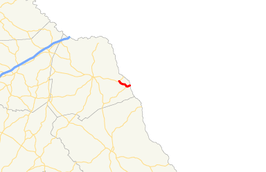
State Route 181 (SR 181) is a state highway in the northeastern part of the U.S. state of Georgia. It runs west–east through portions of Hart county.
Route description
The route begins at an intersection with US 29/SR 8 south of Lake Hartwell. It heads southeast, and then curves northeast until it meets its eastern terminus at the South Carolina state line southeast of Lake Hartwell. When SR 181 reaches the state line at the Savannah River, the roadway continues east as South Carolina Highway 181.
Major intersections
The entire route is in Hart County.
| Location | mi[2] | km | Destinations | Notes | |
|---|---|---|---|---|---|
| | 0.0 | 0.0 | Western terminus | ||
| | 2.7 | 4.3 | Eastern terminus of SR 77 Spur | ||
| Savannah River | 2.9 | 4.7 | Eastern terminus; roadway continues into South Carolina as SC 181. | ||
| 1.000 mi = 1.609 km; 1.000 km = 0.621 mi | |||||
See also
-
.svg.png) Georgia (U.S. state) portal
Georgia (U.S. state) portal -
 U.S. Roads portal
References
- ↑ Office of Information Services (December 31, 2002). "State Highway System Mileage in Each County Classified by State Route Number and Federal-Aid System" (PDF). Georgia Department of Transportation. Archived from the original (PDF) on September 26, 2007. Retrieved January 7, 2013.
- 1 2 Google (June 9, 2013). "Route of SR 181" (Map). Google Maps. Google. Retrieved June 9, 2013.
External links
This article is issued from Wikipedia - version of the 9/14/2016. The text is available under the Creative Commons Attribution/Share Alike but additional terms may apply for the media files.