Franconia, Virginia
| Franconia, Virginia | |
|---|---|
| Census-designated place | |
|
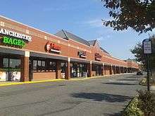
Nall's Produce in Franconia | |
 Location of Franconia in Fairfax County, Virginia | |
 Franconia, Virginia  Franconia, Virginia  Franconia, Virginia Location of Franconia in Fairfax County, Virginia | |
| Coordinates: 38°45′48″N 77°9′1″W / 38.76333°N 77.15028°WCoordinates: 38°45′48″N 77°9′1″W / 38.76333°N 77.15028°W | |
| Country | United States |
| State | Virginia |
| County | Fairfax |
| Area | |
| • Total | 3.48 sq mi (9.01 km2) |
| • Land | 3.47 sq mi (8.99 km2) |
| • Water | 0.008 sq mi (0.02 km2) |
| Elevation | 249 ft (76 m) |
| Population (2010) | |
| • Total | 18,245 |
| • Density | 5,254/sq mi (2,028.5/km2) |
| Time zone | Eastern (EST) (UTC-5) |
| • Summer (DST) | EDT (UTC-4) |
| ZIP codes | 22310, 22315 |
| Area code(s) | 703, 571 |
| FIPS code | 51-29552[1] |
| GNIS feature ID | 1492975[2] |

Franconia is a census-designated place (CDP) in Fairfax County, Virginia, United States. The population was 18,245 at the 2010 census,[3] down from 31,907 in 2000 due to the splitting off of part of it to form the Kingstowne CDP.
Located just southwest of Alexandria, Franconia has existed as a community since the 1870s, when a station by that name opened on the RF&P Railroad; however, like most of the surrounding area, it only began to develop into its present, suburban form in the 1950s. The CDP extends south to just north of the border of Fort Belvoir, encompassing neighborhoods such as Manchester Lakes and Windsor Estates. Street addresses have Alexandria ZIP codes 22310 and 22315. It is near the Springfield Mall shopping area and the Franconia–Springfield Washington Metro station.
Geography
Franconia is located in southeastern Fairfax County at 38°45′48″N 77°09′01″W / 38.763351°N 77.150328°W (38.763351, −77.150328).[4] It is bordered to the west by Springfield, to the north by Lincolnia, to the northeast by Rose Hill, to the east by Kingstowne, and to the south by Newington. It is 13 miles (21 km) southwest of Washington, D.C.
According to the United States Census Bureau, the Franconia CDP has a total area of 3.5 square miles (9.0 km2), of which 0.01 square miles (0.02 km2), or 0.18%, is water.[3]
Demographics
As of the census[1] of 2000, there were 31,907 people, 13,284 households, and 8,182 families residing in the CDP. The population density was 4,465.3 people per square mile (1,723.0/km2). There were 13,509 housing units at an average density of 1,890.6/sq mi (729.5/km2). The racial makeup of the CDP was 69.26% White, 13.57% African American, 0.30% Native American, 10.72% Asian, 0.11% Pacific Islander, 2.28% from other races, and 3.77% from two or more races. Hispanic or Latino of any race were 7.32% of the population.
There were 13,284 households out of which 29.6% had children under the age of 18 living with them, 50.4% were married couples living together, 8.5% had a female householder with no husband present, and 38.4% were non-families. 28.5% of all households were made up of individuals and 2.5% had someone living alone who was 65 years of age or older. The average household size was 2.40 and the average family size was 3.01.
In the CDP the population was spread out with 21.9% under the age of 18, 6.2% from 18 to 24, 43.4% from 25 to 44, 23.8% from 45 to 64, and 4.7% who were 65 years of age or older. The median age was 35 years. For every 100 females there were 92.6 males. For every 100 females age 18 and over, there were 88.8 males.
According to a 2007 estimate, the median income for a household in the CDP was $100,161, and the median income for a family was $106,998. Males had a median income of $56,890 versus $46,138 for females. The per capita income for the CDP was $37,134. About 1.8% of families and 2.8% of the population were below the poverty line, including 3.2% of those under age 18 and 2.2% of those age 65 or over.
Notable residents
- Mark D. Sickles, member of the Virginia House of Delegates
References
- 1 2 "American FactFinder". United States Census Bureau. Retrieved 2008-01-31.
- ↑ "US Board on Geographic Names". United States Geological Survey. 2007-10-25. Retrieved 2008-01-31.
- 1 2 "Geographic Identifiers: 2010 Demographic Profile Data (G001): Franconia CDP, Virginia". U.S. Census Bureau, American Factfinder. Retrieved October 4, 2016.
- ↑ "US Gazetteer files: 2010, 2000, and 1990". United States Census Bureau. 2011-02-12. Retrieved 2011-04-23.