Lake Barcroft, Virginia
| Lake Barcroft, Virginia | |
|---|---|
| Census-designated place | |
|
View over Lake Barcroft from Beach 4 | |
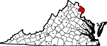
 Location of Lake Barcroft in Fairfax County, Virginia | |
 Lake Barcroft, Virginia  Lake Barcroft, Virginia  Lake Barcroft, Virginia Location of Lake Barcroft in Fairfax County, Virginia | |
| Coordinates: 38°51′5″N 77°9′20″W / 38.85139°N 77.15556°WCoordinates: 38°51′5″N 77°9′20″W / 38.85139°N 77.15556°W | |
| Country | United States |
| State | Virginia |
| County | Fairfax |
| Area | |
| • Total | 2.7 sq mi (6.9 km2) |
| • Land | 2.4 sq mi (6.3 km2) |
| • Water | 0.2 sq mi (0.6 km2) |
| Elevation | 262 ft (80 m) |
| Population (2010) | |
| • Total | 9,558 |
| • Density | 3,918/sq mi (1,512.8/km2) |
| Time zone | Eastern (EST) (UTC-5) |
| • Summer (DST) | EDT (UTC-4) |
| FIPS code | 51-43352[1] |
| GNIS feature ID | 1492515[2] |

Lake Barcroft is a census-designated place (CDP) in Fairfax County, Virginia, United States. The population was 9,558 at the 2010 census.[3] It is also the name of the privately owned lake—part of the Cameron Run Watershed—around which this population is located. The lake is named for Dr. John W. Barcroft, who owned and operated a mill on Holmes Run during the mid-19th century.[4]
History
In 1913, the Alexandria Water Company began construction of the Lake Barcroft Dam to create a drinking water reservoir for the city of Alexandria. Construction of the dam was completed in 1915, putting a 620 million-gallon reservoir into service. In 1942, the company installed 24 gates at the top of the dam to raise the spillway elevation five feet, increasing the reservoir size to 800 million gallons.[5]
In 1949, the City of Alexandria began to draw its drinking water from the Occoquan Reservoir. A year later, Colonel Joseph Barger and Associates purchased the reservoir, dam, and 680 adjacent acres of land for $1 million from the Alexandria Water Company. A year later, Barger and Associates began developing the 680 acres (2.8 km2) into a residential community. During the early 1950s, residents formed a homeowners association called the Lake Barcroft Community Association (LABARCA). In 1970, community residents purchased the lake, dam, and common grounds for $300,000, and established the Barcroft Lake Management Association (BARLAMA).
In 1972, Hurricane Agnes passed over the area. The hurricane caused so much rain that the lake level rose above the top of the dam by 3 feet (0.91 m). This resulted in the lake overflowing, and eroding the western, earthen shoulder of the dam. The rush of water deepened the washout, but the slow erosion protected downstream interests from the wall of water that would have resulted from a total dam collapse. In order to restore the dam and lake, residents voted to establish the Lake Barcroft Watershed Improvement District (LBWID) in order to set up a taxing authority to fund repairs. The LBWID is a quasi-governmental entity headed by three state-appointed trustees who are residents of Lake Barcroft. The lake was dry for two years during the early 1970s while the damaged dam was rebuilt. A new gate improved the operation of the dam and is now fully automatic. The dam meets all Commonwealth dam safety requirements.
The Lake Barcroft Association (LBA) came into being in 1992 when LABARCA and BARLAMA joined up into one private entity. Lake Barcroft has excellent fishing. Largemouth bass, catfish, sunfish and a rare (non-stinging) fresh water jellyfish all inhabit Lake Barcroft. Ospreys, fishing birds of prey, are now on the lake as well.
Geography
Lake Barcroft is located in eastern Fairfax County at 38°51′5″N 77°9′20″W / 38.85139°N 77.15556°W (38.851412, −77.155654).[6] It is bordered to the northeast by Seven Corners, to the east by Bailey's Crossroads, to the south by Lincolnia, to the southwest by Annandale, and to the northwest by West Falls Church. Downtown Washington, D.C. is 9 miles (14 km) to the northeast.
According to the United States Census Bureau, the Lake Barcroft CDP has a total area of 2.7 square miles (6.9 km2), of which 2.4 square miles (6.3 km2) is land and 0.2 square miles (0.6 km2), or 8.34%, is water.[3]
The local high school is J.E.B. Stuart.
Demographics
As of the census[1] of 2000, there were 8,906 people, 3,589 households, and 2,415 families residing in the CDP. The population density was 3,602.5 people per square mile (1,392.2/km2). There were 3,673 housing units at an average density of 1,485.7/sq mi (574.2/km2). The racial makeup of the CDP was 75.98% White, 9.59% Asian, 4.92% African American, 4.84% from other races, 4.35% from two or more races, 0.26% Native American, and 0.07% Pacific Islander.
Hispanics or Latinos (who may be of any race) were 14.72% of the population.
There were 3,589 households out of which 26.9% had children under the age of 18 living with them, 56.9% were married couples living together, 7.1% had a female householder with no husband present, and 32.7% were non-families. 26.0% of all households were made up of individuals and 9.1% had someone living alone who was 65 years of age or older. The average household size was 2.48 and the average family size was 2.97.
In the CDP the population was spread out with 20.5% under the age of 18, 5.3% from 18 to 24, 29.8% from 25 to 44, 28.2% from 45 to 64, and 16.1% who were 65 years of age or older. The median age was 42 years. For every 100 females there were 95.1 males. For every 100 females age 18 and over, there were 92.7 males.
The median income for a household in the CDP was $83,593, and the median income for a family was $101,562. Males had a median income of $62,882 versus $52,284 for females. The per capita income for the CDP was $46,293. About 2.7% of families and 3.4% of the population were below the poverty line, including 2.3% of those under age 18 and 0.8% of those age 65 or over.
Management of the lake
Lake Barcroft is privately owned, and managed by a homeowners' association. Property owners on the lake and the immediate areas are bound by a restrictive covenant that also gives them rights to use the lake. For homeowners who do not own riparian land, there are several private beaches that are open to people who live within the boundaries of the association.
The residents organize occasional aquatic festivals, most notably Independence Day fireworks every July 4. Fireworks are fired from one of the beaches, and residents crowd the water in their electric-powered or paddled boats to watch.
Gas and diesel engines are prohibited on the lake to prevent noise and pollution. Only the lifeguards have access to gas-powered motorboats. Most residents own a small sailboat, canoe, or an electrically powered boat.
Ecology of the lake
Lake Barcroft is home to many freshwater species of fish and invertebrate. Largemouth bass were introduced to the lake decades ago, and now the population is self-sustaining. Catfish and bluegill also live in the lake in large numbers. Semi-aquatic species such as muskrat, ducks, Canada geese and kingfishers are also common.
As part of the Cameron Run Watershed, the lake receives large amounts of runoff from adjacent parts of suburban Fairfax County. These cause occasional algal blooms. The microbiology of the lake is monitored, and it is considered safe for fishing and swimming.
References
- 1 2 "American FactFinder". United States Census Bureau. Retrieved 2008-01-31.
- ↑ "US Board on Geographic Names". United States Geological Survey. 2007-10-25. Retrieved 2008-01-31.
- 1 2 "Geographic Identifiers: 2010 Demographic Profile Data (G001): Lake Barcroft CDP, Virginia". U.S. Census Bureau, American Factfinder. Retrieved October 11, 2016.
- ↑ "Cameron Run / Holmes Run Watershed Feasibility Study e-Newsletter". Northern Virginia Regional Commission. July–August 2007.
- ↑ Bracken, L. Anthony; Finley, Robert (2001). Lake Barcroft History (PDF). ISBN 0-615-11978-6.
- ↑ "US Gazetteer files: 2010, 2000, and 1990". United States Census Bureau. 2011-02-12. Retrieved 2011-04-23.