Erle, California
Coordinates: 39°06′03″N 121°23′45″W / 39.10083°N 121.39583°W
| Erle | |
|---|---|
| Former settlement | |
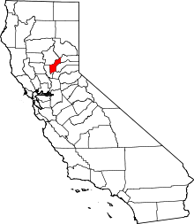
 Erle Location in California | |
| Coordinates: 39°06′03″N 121°23′45″W / 39.10083°N 121.39583°W | |
| Country | United States |
| State | California |
| County | Yuba County |
| Elevation[1] | 115 ft (35 m) |
Erle is a former settlement in Yuba County, California. It was located 6.25 miles (10.1 km) north-northeast of Wheatland,[2] at an elevation of 115 feet (35 m). Erle still appeared on maps as of 1910; the former settlement is now part of Beale Air Force Base.
A post office operated at Erle from 1892 to 1909.[2] The name is in honor of a pioneer family.[2]
References
This article is issued from Wikipedia - version of the 1/26/2011. The text is available under the Creative Commons Attribution/Share Alike but additional terms may apply for the media files.
