Eagle, Nebraska
| Eagle, Nebraska | |
|---|---|
| Village | |
|
Downtown Eagle: Fourth Street | |
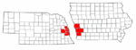
 Location of Eagle, Nebraska | |
| Coordinates: 40°48′58″N 96°25′52″W / 40.81611°N 96.43111°WCoordinates: 40°48′58″N 96°25′52″W / 40.81611°N 96.43111°W | |
| Country | United States |
| State | Nebraska |
| County | Cass |
| Area[1] | |
| • Total | 0.35 sq mi (0.91 km2) |
| • Land | 0.35 sq mi (0.91 km2) |
| • Water | 0 sq mi (0 km2) |
| Elevation | 1,352 ft (412 m) |
| Population (2010)[2] | |
| • Total | 1,024 |
| • Estimate (2012[3]) | 1,023 |
| • Density | 2,925.7/sq mi (1,129.6/km2) |
| Time zone | Central (CST) (UTC-6) |
| • Summer (DST) | CDT (UTC-5) |
| ZIP code | 68347 |
| Area code(s) | 402 |
| FIPS code | 31-14100[4] |
| GNIS feature ID | 0828917[5] |

Eagle is a village in Cass County, Nebraska, in the United States. As of the 2010 census, the village population was 1,024.
History
Eagle was platted in 1886 when the Missouri Pacific Railroad was extended to that point.[6] The community was likely named for the wild eagles observed by the first settlers.[7]
Geography
Eagle is located at 40°48′58″N 96°25′52″W / 40.81611°N 96.43111°W (40.816129, -96.431195).[8]
According to the United States Census Bureau, the village has a total area of 0.35 square miles (0.91 km2), all of it land.[1]
Demographics
| Historical population | |||
|---|---|---|---|
| Census | Pop. | %± | |
| 1900 | 297 | — | |
| 1910 | 360 | 21.2% | |
| 1920 | 368 | 2.2% | |
| 1930 | 309 | −16.0% | |
| 1940 | 289 | −6.5% | |
| 1950 | 255 | −11.8% | |
| 1960 | 302 | 18.4% | |
| 1970 | 441 | 46.0% | |
| 1980 | 832 | 88.7% | |
| 1990 | 1,047 | 25.8% | |
| 2000 | 1,105 | 5.5% | |
| 2010 | 1,024 | −7.3% | |
| Est. 2015 | 1,047 | [9] | 2.2% |
2010 census
As of the census[2] of 2010, there were 1,024 people, 384 households, and 295 families residing in the village. The population density was 2,925.7 inhabitants per square mile (1,129.6/km2). There were 418 housing units at an average density of 1,194.3 per square mile (461.1/km2). The racial makeup of the village was 98.2% White, 0.2% African American, 0.1% Native American, 0.3% Asian, 0.1% from other races, and 1.1% from two or more races. Hispanic or Latino of any race were 1.9% of the population.
There were 384 households of which 44.0% had children under the age of 18 living with them, 60.7% were married couples living together, 9.6% had a female householder with no husband present, 6.5% had a male householder with no wife present, and 23.2% were non-families. 18.8% of all households were made up of individuals and 4.4% had someone living alone who was 65 years of age or older. The average household size was 2.67 and the average family size was 3.03.
The median age in the village was 32.7 years. 28.6% of residents were under the age of 18; 6.8% were between the ages of 18 and 24; 31.6% were from 25 to 44; 25.5% were from 45 to 64; and 7.8% were 65 years of age or older. The gender makeup of the village was 52.4% male and 47.6% female.
2000 census
As of the census[4] of 2000, there were 1,105 people, 401 households, and 305 families residing in the village. The population density was 3,427.1 people per square mile (1,333.3/km²). There were 413 housing units at an average density of 1,280.9 per square mile (498.3/km²). The racial makeup of the village was 98.37% White, 0.45% Native American, 0.09% from other races, and 1.09% from two or more races. Hispanic or Latino of any race were 1.45% of the population.
There were 401 households out of which 45.4% had children under the age of 18 living with them, 60.1% were married couples living together, 10.5% had a female householder with no husband present, and 23.9% were non-families. 20.4% of all households were made up of individuals and 6.5% had someone living alone who was 65 years of age or older. The average household size was 2.76 and the average family size was 3.20.
In the village the population was spread out with 31.6% under the age of 18, 8.1% from 18 to 24, 34.9% from 25 to 44, 18.8% from 45 to 64, and 6.6% who were 65 years of age or older. The median age was 32 years. For every 100 females there were 105.0 males. For every 100 females age 18 and over, there were 105.4 males.
The median income for a household in the village was $45,750, and the median income for a family was $48,947. Males had a median income of $33,250 versus $22,788 for females. The per capita income for the village was $17,154. About 2.5% of families and 2.9% of the population were below the poverty line, including 2.6% of those under age 18 and 2.9% of those age 65 or over.
Sports and Leisure
The Eagle Raceway dirt track is located two miles east of Eagle on U.S. Highway 34. The track consistently features winged sprints and modifieds in their weekly shows from April to September.
Eagle is a popular stop for riders of the MoPac Trail as it is exactly 10 miles from the 84th Street trailhead in Lincoln.
References
- 1 2 "US Gazetteer files 2010". United States Census Bureau. Retrieved 2012-06-24.
- 1 2 "American FactFinder". United States Census Bureau. Retrieved 2012-06-24.
- ↑ "Population Estimates". United States Census Bureau. Retrieved 2013-05-29.
- 1 2 "American FactFinder". United States Census Bureau. Retrieved 2008-01-31.
- ↑ "US Board on Geographic Names". United States Geological Survey. 2007-10-25. Retrieved 2008-01-31.
- ↑ "Eagle, Cass County". Center for Advanced Land Management Information Technologies. University of Nebraska. Retrieved 31 July 2014.
- ↑ Fitzpatrick, Lillian L. (1960). Nebraska Place-Names. University of Nebraska Press. p. 31.
- ↑ "US Gazetteer files: 2010, 2000, and 1990". United States Census Bureau. 2011-02-12. Retrieved 2011-04-23.
- ↑ "Annual Estimates of the Resident Population for Incorporated Places: April 1, 2010 to July 1, 2015". Retrieved July 2, 2016.
- ↑ "Census of Population and Housing". Census.gov. Retrieved June 4, 2015.
Municipalities and communities of Cass County, Nebraska, United States | ||
|---|---|---|
| Cities | ||
| Villages | ||
| Unincorporated communities | ||
| Ghost towns | ||
Metropolitan area of Omaha–Council Bluffs | ||||||||
|---|---|---|---|---|---|---|---|---|
| Primary Cities |
|  | ||||||
| Cities over 10,000 (per 2010 Census) |
| |||||||
| Cities of 5,000 to 10,000 (per 2010 Census) |
| |||||||
| Cities of 1,000 to 5,000 (per 2010 Census) |
| |||||||
| Census-designated places |
| |||||||
| Cities and villages of fewer than 1,000 (per 2010 Census) |
| |||||||
| Counties |
| |||||||