Dunnellon, Florida
| Dunnellon, Florida | |
|---|---|
| City | |
|
The former Atlantic Coast Line Railroad depot in Dunnellon, Florida. | |
 Location in Marion County and the state of Florida | |
| Coordinates: 29°3′N 82°27′W / 29.050°N 82.450°WCoordinates: 29°3′N 82°27′W / 29.050°N 82.450°W | |
| Country |
|
| State |
|
| County | Marion |
| Area | |
| • Total | 7.4 sq mi (19.3 km2) |
| • Land | 7 sq mi (18.3 km2) |
| • Water | 0.4 sq mi (1 km2) |
| Elevation | 49 ft (15 m) |
| Population (2000) | |
| • Total | 1,898 |
| • Density | 256.5/sq mi (98.3/km2) |
| Time zone | Eastern (EST) (UTC-5) |
| • Summer (DST) | EDT (UTC-4) |
| ZIP codes | 34430-34432 |
| Area code(s) | 352 |
| FIPS code | 12-18675[1] |
| GNIS feature ID | 0281879[2] |

Dunnellon is a city in Marion County, Florida, United States. The population was 1,733 at the 2010 census. It is part of the Ocala Metropolitan Statistical Area.
Geography
Dunnellon is located at 29°3'N 82°27'W (29.0500, -82.4555), 76 miles (122 km) due north of Tampa.
According to the United States Census Bureau, the city has a total area of 7.4 square miles (19 km2). 7.1 square miles (18 km2) of it is land and 0.4 square miles (1.0 km2) of it (5.11%) is water.
Demographics
| Historical population | |||
|---|---|---|---|
| Census | Pop. | %± | |
| 1890 | 532 | — | |
| 1900 | 700 | 31.6% | |
| 1910 | 1,227 | 75.3% | |
| 1920 | 1,185 | −3.4% | |
| 1930 | 1,194 | 0.8% | |
| 1940 | 1,066 | −10.7% | |
| 1950 | 1,110 | 4.1% | |
| 1960 | 1,079 | −2.8% | |
| 1970 | 1,146 | 6.2% | |
| 1980 | 1,427 | 24.5% | |
| 1990 | 1,624 | 13.8% | |
| 2000 | 1,898 | 16.9% | |
| 2010 | 1,733 | −8.7% | |
| Est. 2015 | 1,777 | [3] | 2.5% |
As of the census[1] of 2000, there were 1,898 people, 950 households, and 555 families residing in the city. The population density was 269.3 inhabitants per square mile (103.9/km²). There were 1,128 housing units at an average density of 160.0 per square mile (61.8/km²). The racial makeup of the city was 85.72% White, 11.85% African American, 0.11% Native American, 0.53% Asian, 0.05% Pacific Islander, 0.47% from other races, and 1.26% from two or more races. Hispanic or Latino of any race were 1.79% of the population.
There were 950 households out of which 18.5% had children under the age of 18 living with them, 44.6% were married couples living together, 11.4% had a female householder with no husband present, and 41.5% were non-families. 37.3% of all households were made up of individuals and 24.4% had someone living alone who was 65 years of age or older. The average household size was 2.00 and the average family size was 2.59.
In the city the population was spread out with 17.2% under the age of 18, 5.1% from 18 to 24, 17.7% from 25 to 44, 24.6% from 45 to 64, and 35.5% who were 65 years of age or older. The median age was 53 years. For every 100 females there were 80.9 males. For every 100 females age 18 and over, there were 75.8 males.
The median income for a household in the city was $27,386, and the median income for a family was $35,313. Males had a median income of $29,605 versus $22,045 for females. The per capita income for the city was $17,905. About 10.4% of families and 15.5% of the population were below the poverty line, including 26.7% of those under age 18 and 11.3% of those age 65 or over.
History

Dunnellon was founded in 1887. In 1889, phosphate was discovered in the area, leading to an expansion of the area until the early 1910s.[5] The original mining took place in and around the Rainbow River (formerly called 'Blue Run'), using the river's natural flow to transport phosphates. What is now the 'Blue Cove' subdivision, was one of the original mining pits.
Areas in and around Dunnellon served as filming locations for the 2001 horror film Jeepers Creepers, with a great deal of location work on Tiger Trail (a.k.a. High School Road), the road to Dunnellon High School, officially known as SW 180th Avenue Rd., just outside Rainbow Springs State Park.
Transportation
Major roads

 The main road through Dunnellon is US 41 a major south-to-north highway that spans from Miami to the Michigan Upper Peninisula. County Roads include County Roads 40, 336, and 484, all three of which run along Pennsylvania Avenue.
 County Road 40 is a bi-county road that begins along the Gulf of Mexico in Yankeetown in Levy County, and merges with CR 336 before entering the city limits and turning north onto US 41 as hidden State Road 40 where it branches off on its own in Rainbow Lakes Estates north of the city.
 County Road 336 is another bi-county road, but this one spans southeast from western Levy County, and merges with CR 40 west of the city limits before terminating at US 41, where CR 40 turns north and Pennsylvania Avenue becomes CR 484.
 County Road 484, is a major county road in southern Marion County which begins at the terminus of CR 336 and its multiplex with CR 40. It leads to Marion Oaks, and spans as far east as US 27-441 in Summerfield.
Other transportation
Dunnellon has had three railroad lines in the past; Two owned by the Atlantic Coast Line Railroad and one owned by the Seaboard Air Line Railroad. Today only one ACL line exists, and is used by the Florida Northern Railroad for freight to the Crystal River Energy Complex in Red Level in Citrus County. A boat launching area exists along the Withlacoochee River. Just outside the city, the Dunnellon/Marion County Airport can be found along CR 484.
Notable people
- Terry Plumeri American musician, classical composer, orchestra conductor, double bassist, lecturer, teacher, producer, and film score composer
- Lerentee McCray outside linebacker/defensive end for the Denver Broncos. Attended the University of Florida.
- Terrence Brooks, American football safety for the Baltimore Ravens
- Max Lanier, baseball player.[6]
See also
References
- 1 2 "American FactFinder". United States Census Bureau. Retrieved 2008-01-31.
- ↑ "US Board on Geographic Names". United States Geological Survey. 2007-10-25. Retrieved 2008-01-31.
- ↑ "Annual Estimates of the Resident Population for Incorporated Places: April 1, 2010 to July 1, 2015". Retrieved July 2, 2016.
- ↑ "Census of Population and Housing". Census.gov. Retrieved June 4, 2015.
- ↑ Dinkins, J. Lester (1969). Dunnellon: Boomtown of the 1890s. Great Outdoors Publishing Co. p. 72. ISBN 0-8200-1016-2.
- ↑ Max Lanier at SABR Baseball Biography Project
External links
| Wikimedia Commons has media related to Dunnellon, Florida. |
Municipalities and communities of Marion County, Florida, United States | ||
|---|---|---|
| Cities | 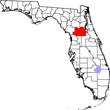 | |
| Towns | ||
| CDPs | ||
| Unincorporated communities |
| |
| Footnotes | ‡This populated place also has portions in an adjacent county or counties | |
